❌

Normal view

There are new articles available, click to refresh the page.
Before yesterdayMain stream

W6/ND-169 Red Mountain

By: Jeff
16 November 2023 at 18:51

This was the final peak I was able to do on my 2023 desert trip. The trailhead is in the aptly named town of Red Mountain, along 395. Turn north onto Trona Road, then an immediate right onto the dirt road with the big pullout. Google calls this Steamwells Road. I was only able to drive about a quarter mile down the road in a sedan, but real OHVs could get much farther.

Summit on the right.

The roads in this area all had signs. I followed road 108. This winds its way to the base of the mountain, then goes up to a col north of the peak. The road was pretty rough in places; no problem for someone on foot, but could require some skill to drive. The climb to the col seemed easier than I expected. At the col there is another road that heads south up to the crest of the ridge.
Ridge near the summit.

After a very steep climb, the road levels out and ends at a dry pond. It seemed like an area that people camp at for fun. I found bits of a trail that lead higher, but nothing formal. The ridge crest is fairly rocky, but it was not hard to find a way up the next steep section. On top was a wide, gently sloped part of the ridge. It was easy walking, and I enjoyed the views. After going over a sub-peak, you drop a short distance down, then climb up a rocky area to the summit. From a distance it looks like there are some cliffs, but they are not bad to traverse.
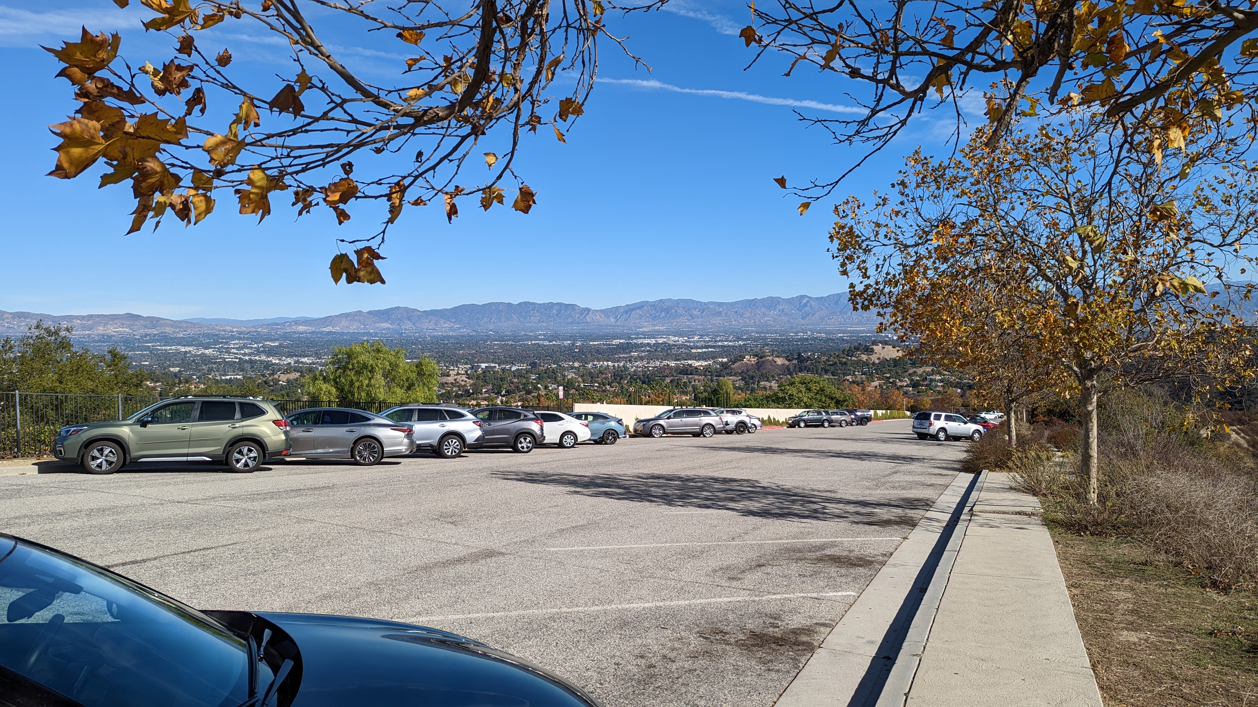
Desert views.

There was a lot of debris at the summit. I put up my antenna and got busy making contacts. Cell service was good on top. The bands cooperated, and I had no problem getting my contacts. There was a rock with some graffiti scratched in. One was dated 1907. I wonder if it was real, or just some prankster.
Really from 1907?

I retraced my steps to get down. The creosote really hid the car, so I had to pay attention at the bottom to make sure I ended up back where I wanted to. But I did it, and headed back to town for lunch.

Trailhead:Β Pullout on Trona Road, or as far up 108 as you can drive.
Website:Β SOTA Site.
Route:Β Follow road 108 up to the col, then the spur road to the dry pond bed. Cross country up to the summit along the ridge.
Red Tape:Β None.
Video:Β Coming Soon!

W6/SD-472

By: Jeff
14 November 2023 at 19:16

Ridgecrest is a strangely named city. The name implies it is on top of a hill, but it is actually in a basin, near a dry lake bed. Nowhere near the crest of a ridge. This peak, however, is on the crest of the ridge south of town. I drove up 395 to the starting point for this unnamed peak. Boundry Road heads off to the east from the highway. I only had a sedan, so I was able to drive about half a mile up the sandy road. With a jeep or similar you could drive to the summit.

Decisions....

The hike is pretty straightforward. Just follow Boundary Road until you get to the summit. As simple as this sounds, however, I still managed to make some wrong turns. Some of the junctions are not signed, and didn't appear on the map I had. I did walk past some benches and art set up in the middle of the desert. Not sure if this is a rest area or a campground or something like that. I didn't stop.Β 

Some benches at a campsite?

The relief is fairly low in this area, and there are a lot of small hills that look like they could be the summit. You have to walk past a few, and over the sides of some. The highest point is pretty rocky, and there is a turn around area for vehicles. Like most places in the desert, there is plenty of space. I found a nice rock to sit on off to the side of the road, and put up my antenna.Β 
Summit area with Ridgecrest below.

I had a nice view of Ridgecrest as I operated, and very good cell service. The bands were decent, and I had no problems getting my contacts. Not sure if there are many hams in Ridgecrest, but it would be a good place to get them on 2m. Once I was done, I packed up and retraced my steps back to the car. This time, however, I did a better job following Boundary Road, and had a slightly shorter hike back.Β 
Watch out for the cholla.


Trailhead:Β As far along Boundary Road as you want to or can drive.
Website:Β SOTA Site.
Route:Β Walk along Boundary Road until you get to the summit. There are plenty of other OHV trails if you want to make a loop or get some variety.
Red Tape:Β None. If driving, follow the signs about where you can and can't drive.
Video:Β Coming Soon!

W6/SD-152 Bell Mountain

By: Jeff
7 November 2023 at 21:31

This was the third peak of the Victorville Threesome I hiked. After Catholic Hill andΒ Little Bell MountainΒ was Bell Mountain. This was the hardest of the three peaks. The trailhead for this peak is south of the summit. From Dale Evans Parkway head west on a dirt road. Google calls it Falchion Road, but I can't find this name on other maps. At the intersection with what Google calls Vega Road turn right and head north as far as you can. In a sedan I could get about a quarter mile down this final road. There was a nice place to turn around and park out of the way, so I decided to not risk getting stuck.

Bell Mountain from the trailhead.

I then walked up the road a bit to a sheltered area. In the satellite view I was able to see a trail, but I couldn't find it on the ground, so I just started going up the hill. It was steep. When I got to the ridge, I crossed the trail. It was a good place to find it, since above me on the ridge were some cliffs and the trail nicely routed around them. With the trail, it was easy to find my way up to the summit. There is a flagpole with a flag, and, appropriately, a bell. I signed the register and got on the air.
Its a steep hike to the summit.

There was good cell service, but no chasers. I called for a while on 20m, but didn't get anyone. Maybe it was too late in the day to get east coast people. Down on 40m I called, and barely got four contacts. Not the best activation, but it was successful. And I didn't get blown away in the strong wind.
On the way down I followed the trail all the way to the base. There were some nice switchbacks lower down, and it was much more pleasant.
Looking back at the two other summits I did.

Back at the car I headed back to the pavement for the long drive to Ridgecrest. Along 395 there was an accident, with multiple campers in pieces on the side of the road with a crane lifting one onto something. Glad I missed the big jam I'm sure that caused. Be careful driving!

Trailhead:Β South of the summit, at the corner of Vega and Falchion Roads. Or as far up as you can drive.
Website:Β SOTA Site.
Route:Β Find the trail, and follow it to the summit. It is not obvious from the OHV roads where the trail is.
Red Tape:Β None.
Video:Β Coming Soon!

W6/SD-181, Little Bell Mountain

By: Jeff
7 November 2023 at 21:12
The middle peak of the Victorville Threesome, Little Bell Mountain. After hiking Catholic HillΒ I drove a few minutes down the road to the base of this one. There is an access point for some OHV trails along Corwin Road, just across from Waalew Road. Since I only had a sedan, I pulled into the wide area just off the road and parked. A jeep or similar could get much closer.Β 
The peak is in the middle of the frame.

From here, a sub-peak is closer, then the peak. I followed the OHV roads to the base of the col between the two peaks. From here it looked a bit better to go up the ridge on the right (north) to the main ridge, but going up the reentrant would probably have been fine.
Plenty of interesting desert plants out there.

It did not take me too long to climb up to the ridge. From here I just had to follow it along until I got to the high point. There was a small false summit on the way. This peak was much better for playing radio than Catholic Hill. Much more space on top, and no ants to attack. I was still pining after the KH1, but not as badly. There were also more chasers, or maybe I just wasn't so impatient. Cell service was excellent on top.
Looking down my route up and down the hill.

I took the same route back down. At the base I had to be careful, since there were so many paths to take and the car was hidden in the big creosote bushes. But my trusty GPS watch led me back without problems. Now I had done two summits, it was time to get number three, Bell Mountain.

Trailhead:Β Across from Waalew Road, as far as you're willing to drive.
Website:Β SOTA Site.
Route:Β Find your way to below the col, then head up to the main ridge. Turn right and follow it to the summit.
Red Tape:Β None.
Video:Β Coming Soon!

W6/SD-186, Catholic Hill

By: Jeff
7 November 2023 at 20:54

This peak is one of three that I call the Victorville Threesome, three peaks along the same ridge, more or less. Catholic Hill was the first I did this day, and the easiest. I parked near the corner of Sylvan and Roanoke Roads in Apple Valley. There is a paved and gated road that leads up to a big water tank on the side of the hill.

At the start of the hike.

I walked up the pavement to the tank, then along the fence. On the other side there was a break in the small cliff that I could scramble up. From here, I just followed the ridge up to the summit. The terrain is covered in big rocks, so a bit of care is needed to find a way through, but it wasn't difficult.
Almost at the top.

There is a large cross on top, along with some solar garden lights. I suppose they like to have it lit up at night. Either way, it was a convenient support for my antenna pole. The radio gods must've heard my prayers, since I quickly got five contacts. I did, however, pick a bad place to sit. One crawling with red ants. After the first bite I hurried up a bit. It was also the day after Pacificon, where the Elecraft KH1 was announced, so I was really sad I didn't have one. It would've been the perfect summit for it.
Views of Apple Valley

I mostly took the same way down, but I cut down to the road at one of the small cols, before I got back to the water tank. This saved a little distance, but was a bit steep. Probably wouldn't have been fun to go up. Back I the car I headed a minute down the road to the base of Little Bell Mountain, the second of the threesome.

Trailhead:Β Apple Valley, corner of Sylvan and Roanoke Roads.
Website:Β SOTA Site.
Route:Β Walk up the paved road to the water tank, then follow the ridge to the summit.
Red Tape:Β None. Don't block the gate.
Video:Β Coming Soon!

W6/CT-241 Pedley Hills

By: Jeff
6 November 2023 at 19:14

This is not the most interesting summit I've done. It is, however, a short and easy hike. Drive up to the end of Lakeside Drive, and find a place to park in the neighborhood. At the end of the pavement, the dirt starts and it is a quarter mile up to the summit.

The summit is visible from the trailhead.

You can see where you want to go, so just walk on up. The eroded jeep trails are an easy walk, but would require some serios OHV capability to drive. The top is rocky, but it wouldn't be too hard to set up an HF antenna. I was short on time, so I did VHF only. It took about 15 minutes to get four contacts, and I was worried I'd have to leave before I got number four.Β 
Views of the Jurupa Hills, and the San Gabriel Mountains.

Talking with locals later, it sounds like that area is just not very good for VHF. Too low and far away from the chasers in LA, and not that many hams in the inland empire. Oh well, next time I'll leave more time for HF.
Back at the car it was a short drive over to the airport for my flight home.Β 

Trailhead:Β End of Lakeside Dr.
Website:Β SOTA Site.
Route:Β Walk up to the summit. You can see it from the end of the road.
Red Tape:Β None that I'm aware of.
Video:Β Coming Soon!

W6/ND-232 El Paso Peaks

By: Jeff
2 November 2023 at 16:41

After driving up Government Peak, I headed north on 395 to get this peak. Motorcross road goes towards this summit. It heads west across from Searles Station Cutoff road. Motorcross Road is paved, I suppose. There is pavement, but there are also potholes big enough to swallow a small car. In the Jeep I had, it was easy enough to go around, but a sedan might have a bit of trouble navigating the poor road.

View of the peak from the parking spot.

The road doesn't really get rougher, but there is less asphalt as you get farther along. At the turnoff for Laurel Mountain there are lots of signs warning you not to get too close to the government stuff on top. Probably something to do with the base at China Lake just to the north, but I am curious what the golf ball is for. The rough road then climbs up to a sub-peak with a bunch of towers. This is where I parked, as the road gets significantly rougher past here. It was only three quarters of a mile or so to the summit from here.
El Paso Peaks

I walked along the road to the base of the peak. There is a relatively steep climb that looks like dirt bikes have driven up and down. Probably fun on one of those. Up on the summit ridge is was a quick walk over to the high point. The wind had died down a bit from earlier, so it was pleasant to sit on the summit and operate. The cell service was good. It was getting to be lunch time, so I didn't linger too long. Back at the car I drove down the hill to find some food in Ridgecrest.

Trailhead:Β Subpeak with all the towers.
Website:Β SOTA Site.
Route:Β From the towers, follow the road to below the summit, then follow the motorcycle trail to the summit ridge, then cross country to the top.
Red Tape:Β None.
Video:Β Coming Soon!

W6/ND-224 Government Peak

By: Jeff
2 November 2023 at 16:15

This desert peak south of Ridgecrest is either really easy or a long slog, depending on your vehicle. I had a Jeep, so it was really easy. Don't follow Google Maps, it tried to take me down closed roads, and didn't know about roads that were easy to drive on. Someone on peakbagger posted a GPS track of the route described here,Β https://peakbagger.com/climber/ascent.aspx?aid=1133044, if you like pictures more.

From the south end of the small town of Red Mountain, head west on Osdick Road. This curves to the south and becomes Butte Ave. A short distance down Butte, turn right onto Randsburg Mojave Road. All of these roads are dirt, but would be passable in a sedan.Β 

Next, turn right onto R20, which is also called R16. From here the roads get rougher, and sedans may not be able to make it. Finally, turn north onto R85 or R83, depending on the map or sign, and follow that to the col below the summit. I parked at the col to get some walking in, but you could drive all the way to the summit.

Looking over at Fremont Peak

It is less than half a mile to the summit. I set up just below the road, to get away from the towers a little. There was good cell service, and I quickly got plenty of HF contacts. The wind was blowing, but it was reasonably warm, so a light windbreaker was enough. I drove down the same way I went up. The tire tracks were fresh enough in the dirt I could follow those when I got to intersections. Back on the highway I drove a few miles down the road to get El Paso Peaks.

Trailhead:Β Col below the summit.
Website:Β SOTA Site.
Route:Β See post for driving description.
Red Tape:Β None.
Video:Β Coming Soon!

W6/ND-231 Fremont Peak

By: Jeff
31 October 2023 at 21:03

I had just climbed Frankish Peak, and the rental company had given me a Jeep, so I drove over to the desert to try it out on some dirt roads. My goal was Fremont Peak. This pointy mountain is easy to see as you drive 395, probably on your way to or from the Sierra.Β 

Looking up at the summit.

The peak is at the end of a long dirt road, aptly called Fremont Peak Road. The turnoff from 395 is not marked, so be careful not to miss it. The flat part of the road was in decent shape, and a sedan could likely drive a few miles in before the road got too rough. It was super easy in the jeep.

Looking at one of the many dry lake beds in the Mojave.

Eventually the road begins bearing right and going up the hill. It becomes much rougher here as well. I drove up, parked, and started to walk, then realized it wasn't so bad. So I got back in the car and drove up to the end of the road. There were some abandoned structures here, just below a col, and the path from here got much steeper. On a dirt bike you could get a lot farther up. Or maybe if you were a better off road driver than I am.
Summit area.

I followed the dirt bike trail up to its high point, about 200 feet below the summit. From here I just went straight up. It was steep and rocky, but I was able to easily find ways around any big rocks. No climbing required. The summit area is flat and open, and bigger than I expected. There was a small antenna and solar panel from some unknown organization, and a register. I signed it and put up my antenna.Β 
Enjoying desert views while I operate.

I had good cell service, so spotting wasn't a problem. Twenty meters was open to Europe. While I was on 40m, the UTC rollover happened, so I worked a bunch of chasers twice. Always nice to be able to give out extra points. I took the same route back down, more or less. I just picked what looked like the best way through the rocks until I got to the open desert slope below. From the path it was a quick jog back to the car. It seemed like a long drive back to 395, but I was just glad I didn't have to walk it.

Trailhead:Β As far up Fremont Peak Road as you can/will drive.
Website:Β SOTA Site.
Route:Β Follow the road/bike trail up as high as it goes, then go straight up to the summit.
Red Tape:Β None.
Video:Β Coming Soon!

W6/CT-151 Frankish Peak

By: Jeff
31 October 2023 at 20:29

Β Frankish Peak is one of those peaks that doesn't look too bad on the map. Real life, however, is different. The trailhead for this peak is easily accessible, a large dirt pullout on N Mountain Ave. This is across the street from what appears to be a large dam. Probably to prevent floods when it rains and snows in the mountains. From here there is an unmaintained trail that heads up the hill.

Steep and dry.

The trail up to the ridge is steep. Very steep. Most of it is just regular steep hiking, but there were a few sections that were class 2 or even class 3. Not the most fun hike I've ever done, but I made it up.
Enjoying views of the San Gabriel Mountains.

The views do get better as you climb. There are a few short sections along jeep trails, but mostly it is narrow, overgrown single track. The final road section is just below the summit. On the summit ridge, the closer peak is a little lower, but the trail continues across to the high point. This is marked with a sign and a large open area covered in broken glass. I'd like to know how all that glass got up there.
QRV!

I did not have cell service on top, at least where I was sitting. I may have been able to find it by walking around, but RBNhole does a good job putting up spots, so I didn't try. I worked people on 20m, but surprisingly no one on 40m. On VHF I got a few people as I expected, looking down a such a large populated area.
The hike down was nearly as bad as the way up. Steep and loose in places. Badly defined trail. I nearly went down the wrong ridge, but caught myself before I got too far. That would've been bad, since hiking up in the dense chaparral would have been terrible. Back at the car I had a drink and headed across the mountains into the desert to my next goal, Fremont Peak.

Trailhead:Β Side of N Mountain Ave, across from the reservoir.
Website:Β SOTA Site.
Route:Β Take the extremely steep use trail up the ridge. Be careful, both of the steepness and of going the wrong way!
Red Tape:Β None, hike is in Angeles or San Bernardino NF.
Video:Β Coming Soon!

W6/SS-354 Park Ridge

By: Jeff
9 August 2023 at 15:37

Β We had gone to Sequoia Kings Canyon National Parks for the weekend, and before heading home decided to grab an easy SOTA peak. The choice was the nearby Park Ridge. We packed up the campsite, then drove up to the Panoramic Point parking lot.Β 

What a nice view.

There is a short paved trail up to the viewpoint. Definitely worth the trip up. From the viewpoint, it is a pleasant walk along the ridge. The ridge has open forest along it, and there are some nice views as you hike along.Β 
Another view from Panoramic Point.

Just below the high point there is an obvious hill. The trail has a switchback or two up this last climb. On top, there is more open forest. I stuck my pole in some of the bushes, and ran out the antenna. Since I was planning a quick activation, I only extended it to the 20m link. I had a little service on top, enough to put out a spot. I quickly got some contacts, including Germany.
General Grant tree, the third largest in the world!

It was a quick hike back down to the car, with another stop to enjoy the viewpoint. Back at the car we drove down the hill and made one last stop at the Grant Grove to enjoy the giant sequoias before heading back home.Β 

Trailhead:Β Panoramic Point Parking Lot.
Website:Β SOTA Site.
Route:Β Follow the paved trail to the view point, then the regular trail to the summit.
Red Tape:Β None.
Video:Β Coming Soon!

Sunol Peak W6/NC-244

By: Jeff
8 May 2023 at 19:31

Β Some time recently Pleasanton Ridge regional park was expanded to include the southern part of Sunol Ridge. This is great news for peak baggers and SOTA enthusiasts - there is now a public trail to the summit. The trailhead is the Tyler Ranch Staging Area at the end of Foothill Road in Sunol. There is a large dirt lot with pit toilets.

Looking down at the new parking lot.

There are two trails that head up from here. The shorter paved road, or the dirt trail that rejoins the road at the end of the pavement via a long switchback. I took the switchback up and the road down for some variety. The main trail that runs up and along the ridge is called the Sunol Ridge Trail. Stay on this, and you'll be taken directly to the summit.Β 
Partway up the steep section.

The forecast was not great for the Friday I went, but I decided to risk it. It was pretty nice below the clouds, but as I climbed it got colder and windier. Around the base of the clouds it even rained a little. There were no views, sadly. Just before the summit I scared some cows out of the way, then reached the paved road that comes up from the west. I took this the last quarter mile or so to the top.
View as I approached the summit.

It was cold and windy, so I walked around the fence surrounding the many towers to try and find somewhere out of the wind. I partially succeeded, but it was a cold activation. There was some sort of HF blackout that morning, and I barely made three contacts on 20-30-40. Luckily I had thrown in my HT just before leaving, so I was able to get enough contacts for the point.
Looking over at Pleasanton Ridge on the way down.

The clouds had lifted some while I was on the summit, so I had some ok views on the way down. The high peaks were still obscured, but I enjoyed what I could see. I also was moving pretty quick, since I was cold after sitting for so long. The hike down was quick, and a real leg workout. Overall, it was a good hike, and I'm glad this new area has been opened.

Trailhead:Β Tyler Ridge Staging Area
Website:Β SOTA Site.
Route:Β Take the Sunol Ridge Trail to the summit.
Red Tape:Β None.
Video:Β Coming Soon!

W6/CC-039 Viejas Mountain

By: Jeff
4 April 2023 at 22:49


Β This was the second summit of our San Diego Trip. It was an overcast morning near downtown when we woke up. Perfect weather for an exposed hike. We drove up I-5 to Alpine, where we made our way through town to the dirt road that this trail starts from, 15S30. The Corolla we had had no trouble with the dirt road, and we made it to the pullout at the trailhead.

Parking at the trailhead.

With careful parking you could fit quite a few cars here, but maybe only when the giant puddles are dry. The trail starts heading up the hill, and keeps going up the whole way. It is a relatively constant grade, a pretty good one for hiking. We made good time going up. All those hours on the stair master must be paying off.
Looking over at El Cajon mountain.

Eventually the uphill ends and you find yourself on the long summit ridge. It appears this whole area is in the activation zone. We found a spot out of the way and got set up. There was good cell service on top, and spotting was not an issue.
Antenna ready to go.

KN6REU went first. Spots for SOTA and POTA meant she quickly had her four contacts, including France again on 10m. AA6XA did 15m CW, and got a good size pileup that took some time to clear. Since it was lunch time, we had some leftover Pizza Port pizza and cookies on top. A nice change from the sandwiches we usually take.
Looking down at the parking area and Alpine.

The hike down felt long. We passed a decent number of people heading up and down. It seems that this as a relatively popular mountain, and with excellent views of the San Diego area and easy access I can see why.Β 

Trailhead:Β Pullout on Forest Road 15S30. This is a continuation of Anderson Road in Alpine.
Website:Β SOTA Site.
Route:Β Follow the trail up to the summit.
Red Tape:Β None.Β Β 
Video: Coming Soon!

W6/SD-026

By: Jeff
4 April 2023 at 16:34


We decided to go down to San Diego for the weekend. After an early flight, we arrived and headed for the hills. Our goal was this unnamed peak near the Mt Laguna recreation area. We had a pleasant drive through the mountains to the trailhead at the Pioneer Mail picnic area. The PCT runs through this area, and we did see some thru hikers, only a few days into their hikes.

Summit from the parking lot.

The trail is across the road from the picnic area. There is a crosswalk at the top of the hill. We crossed, then took the trail that leaves to the right. This briefly parallels the road before turning away and heading up the hill. As you climb onto the base of the ridge, there is an unmarked trail junction. Turn right here and start heading up the ridge.

Summit. If it had been warmer, the pole would have been a good antenna support.

This trail is obviously unmaintained, and it sort of just ends after a while. The brush is sparse enough that it is easy to find a path up. There are even some small cairns marking tricky sections. We had no trouble getting to the summit. It was quite breezy on top, so we found a sheltered area to get set up in. There was good cell service on top. On the bands, 15m was open to Europe, and AA6XA worked Ireland and Portugal. KN6REU worked F4WBN for the first time on 10m, so that was exciting for her.

Trying to make 2m contacts.

Β It was getting cool, and also to be lunch time, so we didn't linger too long on top. We took the same route back down to the car. There are so many path options higher up, but near the trail we found the small cairns and junction. Naina was so excited to be going down, she nearly missed the turn to go back to the car. Luckily Jeff wasn't too far behind.

Brush on the way up.

The drive back to San Diego was nice, where we went to Balboa Park for some lunch and walking around. Overall, a great hike and summit.

Trailhead:Β Keys View.
Website:Β SOTA Site.
Route:Β Cross the highway, and take the trail to the right of the driveway. When you get to the spine of the ridge, turn right and take the use trail up to the summit.
Red Tape:Β None. Parking pass may be requiredΒ 
Video: Coming Soon!

January VHF Contest 2023

By: Jeff
24 January 2023 at 21:12


Β It was a beautiful day as I hiked up to Loma Alta (W6/NC-350), my usual VHF contest spot. I was worried it would be very muddy after all the recent rains, but the trail seems to have mostly dried out. The was water running in the trail, but it was in little erosion channels. The flat areas a little below the summit were more muddy, but my socks stayed dry.

Looking down Lucas Valley.

I was a bit worried it would be really busy since the parking area was totally full, but I didn't see that many people on the trail. Maybe everyone was going to Big Rock Ridge instead. It seemed like a long two miles to the summit, but I was carrying a lot of stuff.
Two of the antennas.

I brought my usual six-band setup. This includes yagis for 144, 222, 432, 920, 1296, and EDZs for 6m and 2m. Four radios, four transverters, and lots of connectors and coax. I'd bring 10GHz, but no one from the local microwave club ever seems to get on for this contest, so its not worth it. I've gotten good at setting it up, so I had some spare time before the start, which I used to make some 10m SOTA contacts.Β 
Extended Double Zepp pole.

The first hour of the contest was action packed, and I made lots of QSOs, particularly on 6m and 2m. After that it slowed down a lot. I'm not sure why activity was so slow this year. My best guess is that it was the first nice weekend of the year, and people were tired of being cooped up inside. So they went out instead of sitting at their radios.
As expected, 223 and 902 were not very active. Two meters provided the most contacts. It will be interesting to see how the scoring works out this year now that there are "all mode" and "analog only" subcategories. My guess is that single operator portable stations don't do much FT8, so the competition will be similar.
So much stuff to carry.

I took a break part way through to try out 12m. I did get a Japanese station, but there weren't many other takers. After some more calling on the VHF bands I eventually decided to pack it up. As I was taking down the 6m EDZ, on leg came off. It was nice of the antenna to break at the end of the day instead of during setup. I made it back to the car before sunset, which is unusual for me.Β 
I had plenty of time to let my mind wander since it was so slow. I definitely need to finish my Mountain Top VHF presentation and give it to the area clubs to try and drum up more activity. More QSOs means more fun for everyone! Overall, I'm claiming a score of 1,820, 63 QSOs and 20 mults.Β 
Here's hoping June will be better!Β 

W6/ND-144 Dante Benchmark

By: Jeff
9 January 2023 at 17:14

After exploring Joshua Tree National Park, we got up early and drove over to Death Valley. This huge park is a few hours drive through the desert. Our first stop was Dante's View, on the east side of the valley. Just above the parking lot is a SOTA summit, and that was our destination.
Operating from the summit.

There is a short trail that leaves from the far side of the parking lot. Watch out for cars while walking over. We were soon at the top, where we found a spot out of the wind to set up. I was worried there wouldn't be any cell service, and KN6REU wouldn't be able to get any contacts. It turns out there was decent service (Verizon) at the peak, and spotting was no problem. Naina got more contacts on 10m than she wanted, then headed back to the car. I stayed up to work a big pileup on 20m before heading back down.
Mosaic Canyon

From the viewpoint we drove down to the Furnace Creek visitor center to get a map and see if there were any souvenirs we needed, then continued around to Stovepipe Wells and Mosaic Canyon. This was a fun hike, up the canyon. We turned around before there were any difficult parts, but it is a hike we'd recommend.
Lowest people in the Western Hemisphere.

Next we made a brief stop at the Mesquite Sand Dunes on our way to Badwater Basin. This is the lowest point in the western hemisphere at -282 feet. A sign high up on the cliff above the road really drives home how low you are. A short distance back up the road we stopped again, this time at Devil's Golf Course.Β 
Only the devil could play golf here.

I think this is one of the neatest areas, with rough salt formations in the middle of the valley. Worth a stop if you're in the area. Finally, on our way out of the park we stopped at Zabrisky point for a quick sunset. The dunes and rocks in this area are excellent, and I can see why it is featured on postcards.
Sunset at Zabrisky Point.

This is one of the largest national parks in the USA, and I wish we had more time to explore. We only hit the highlights, and it feels like we barely scratched the surface.Β 

Trailhead:Β Dante's View.
Website:Β SOTA Site.
Maps:Β AA6XA SOTA Hikes map.
Route:Β Follow the trail up to the summit.Β 
Red Tape:Β None. Just the standard national park rules.Β 
Video:Β ham_bitious YouTube

W6/SD-037 Inspiration Benchmark

By: Jeff
5 January 2023 at 16:41

Since we had a 12-month national park pass, we decided to go down to the desert during Christmas break to check out Joshua Tree and Death Valley National Parks. We left San Jose early, and after a long drive down California, we reached Joshua Tree. We went straight to Keys View in the park, where we planned to activate Inspiration Benchmark, then enjoy the sunset from the viewpoint.
View across to San Jacinto.

There is no official trail up to the summit, but enough people go up that way that there is a use trail. It is hard to follow in places, but the way you should go is obvious. There are two false summits on the way to the high point.Β 
Joshua tree on the first summit.

We made good time up the hill, and were soon in the activation zone.Β  We found some comfortable rocks, and got set up. KN6REU went first on 10m, but there were no contacts. It appears that the antenna was somehow broken, so we put up the other one and tried again. She soon had a few contacts in the log, including one to Chile.
Calling on 10m.

AA6XA then worked a small pileup on 20m before we packed up and headed back. It was a quick hike down, and we were both surprised to see a dog on the trail. We both thought they weren't allowed off the pavement in the national park.
Sunset.

Back at the lot we joined the small crowd watching the sunset. It was quite spectacular, and I'd recommend going to the desert for excellent lighting. As it got dark we left the park to find some food and rest for another day of exploring the park.
Joshua Tree at sunset.

The next day we drove around and saw a lot of the sights in the park. The area is definitely worth a visit!Β 

Trailhead:Β Keys View.
Website:Β SOTA Site.
Maps:Β AA6XA SOTA Hikes map.
Route:Β Take one of the use trails up to the first peak. From there the trail becomes more defined as is drops the col then climbs up to the true summit.
Red Tape:Β None. Just the standard national park rules.Β 
Video:Β ham_bitious YouTube

W6/CT-218 Temescal Ridge

By: Jeff
29 December 2022 at 23:06


Β It was a warmer than expected day as I drove up Reseda Blvd. At the end is Topanga State Park, with Temescal Ridge my goal. At the end of the road there is paid parking, but if you're willing to walk a little farther you can park for free below. I was feeling cheap, so I used the free parking, then set off up the hill.

Top of the free parking lot.

There are a lot of trails in the park, so bring a map. I didn't see any paper ones available for taking at any of the kiosks. I took a fire road that seemed to be going in the right direction. It was, but it would've been more direct to take a single track trail at the start.

Looking back at Oat Mountain.

The fire road trail winds its way up nearly to the summit. About 3/4 of a mile before the summit the road reaches a col with a pit toilet and bench. After a quick pit stop I continued up to the top. Just before the summit a trail reaches the road. Take this single track up to the high point.

Pacific Ocean

The very top of the mountain is pretty small, so I went down a few feet to set up near some bushes. I didn't have cell service where I was sitting, but RBNhole spotted me no problem. Once I was done on HF I went to the top for some VHF and made a few more contacts.

Summit just behind my pole and antenna.

I took the same route down, mostly. I did take a little single track that went over one of the bumps. It added some variety, though there were some steep parts. Back at the car I put on some clean clothes before heading to the airport to go home.

Trailhead: End of Reseda Blvd. There is both free and paid parking.
Website:Β SOTA Site.
Maps:Β AA6XA SOTA Hikes map.
Route:Β  Take the fire road to just below the summit, then take the Backbone Trail up to the top.
Red Tape:Β None.Β 
Video:Β ham_bitious YouTube

W6/CT-032 Oat Mountain

By: Jeff
2 December 2022 at 23:31


Β It was a windy day as I arrived at the trailhead in Michael D. Antonovich park. This park is at the end of Brows Canyon Road. The road has a number of "no trespassing" signs along the way, but it seems you are allowed to drive up, since there's the park entrance. I paid my $5 and drove to the upper dirt lot.

Parking area.

The entrance to the lot is a bit rough, but I was able to get in without bottoming out the sedan I had. The path to the top is a paved road. A short distance up it passes the site of a Nike Missile base, back when the missiles were needed to defend against Soviet bombers. There isn't much left but graffiti in the area.

Views of the destination.

The road continues up at a pretty good grade. There are some flatter sections, but the climb is fairly constant. Shortly below the summit there was a signed gate. I didn't want to go through it, so here I turned and went straight up the hill. It was rather steep, but I was quickly at the top.

Summit ahead!

I tagged the summit, then set up a little below it under some trees. It was out of the wind, which was nice. I had almost lost my hat a few times. I didn't have cell service where I was sitting, but I had had it for most of the hike up. I think if I had walked around a bit I would've found somewhere that had service.

Looking over at the Santa Monica Mountains.

I had limited time, so I only did 20m and 40m, with a few calls on 2m at the end. I didn't get a lot of contacts, but there was no problem activating the summit. Once I was done I took the road back down. I didn't feel like going down the steep grass, so I took it from the summit. It probably would've been smarter to go up that way.

Trailhead: End of Browns Canyon Road in Michael D Antonovich Park
Website:Β SOTA Site.
Maps:Β AA6XA SOTA Hikes map.
Route:Β  Follow the paved road to the summit.
Red Tape:Β None.Β 
Video:Β ham_bitious Youtube


❌
❌