Normal view

There are new articles available, click to refresh the page.
Before yesterdayCopasetic Flow

Ionogram Notes about KO6BTY de JJ2JQF

 The recent pair of QSOs to Japan from Project TouCans from Great Basin National Park has me wondering about F2 layer ionospheric skip propagation again.

I got our F2 skips working for CZML. Here's a look at the skip path for JJ2JQF de KO6BTY. Notice the Earedson ionosonde is almost right in the middle


Here's the map to take a look at 


Note that the path goes for a little while underground. However, Hugyens:


Check out the mountains that can act as a knife-edge barrier creating  new source.
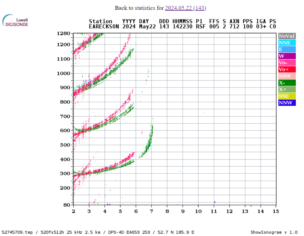

Query for JJ2JQF

select
  tx_lng,
  tx_lat,
  rx_lng,
  rx_lat,
  rm_rnb_history_pres.timestamp,
  rm_rnb_history_pres.dB,
  rm_rnb_history_pres.Spotter,
  haversine(tx_lat, tx_lng, rx_lat, rx_lng) as total_path,
  gis_partial_path_lat(tx_lat, tx_lng, rx_lat, rx_lng, 200) as el_lat,
  gis_partial_path_lng(tx_lat, tx_lng, rx_lat, rx_lng, 200) as el_lng,
  id,
  strftime('%Y%m%d', timestamp) as date,
  strftime('%H%M', timestamp) as time,
  'US-0032' as park,
  'KD0FNR' as call
from
  rm_rnb_history_pres
where
  dB > 100
  and timestamp > '2024-05-24T13:45:00'
  and timestamp < '2024-05-24T14:57:00'
order by
  rm_rnb_history_pres.timestamp desc


Query for JG0AWE

select
  tx_lng,
  tx_lat,
  rx_lng,
  rx_lat,
  rm_rnb_history_pres.timestamp,
  rm_rnb_history_pres.dB,
  rm_rnb_history_pres.Spotter,
  haversine(tx_lat, tx_lng, rx_lat, rx_lng) as total_path,
  gis_partial_path_lat(tx_lat, tx_lng, rx_lat, rx_lng, 200) as el_lat,
  gis_partial_path_lng(tx_lat, tx_lng, rx_lat, rx_lng, 200) as el_lng,
  id,
  strftime('%Y%m%d', timestamp) as date,
  strftime('%H%M', timestamp) as time,
  'US-0032' as park,
  'KD0FNR' as call
from
  rm_rnb_history_pres
where
  dB > 100
  and timestamp > '2024-05-24T13:45:00'
  and timestamp < '2024-05-24T14:57:00'
order by
  rm_rnb_history_pres.timestamp desc


And the data went away!


Notice that the table on the left isn't there. Take a look at the JJ2JQF data (two days later) for comparison


Sources of Ionosphere and specifically F2 data from around the world

New to me: Mirrion ionosonde images from NOAA. I haven't seen this page before. Not super-useful to me because it points at images, not numeric data.

Lowell Digisonde Station list: Handy map of where stations exist.

CZML and HTML style comments

Apparently, they just don't work. We had to take our comments back out.

Accessing data via URL

We use an address like this

https://lgdc.uml.edu/common/DIDBGetValues?ursiCode=PA836&charName=hF2,hmF2&fromDate

to pull in ionosonde data. To access different stations, you need different ursiCode values, (one per station.) These can be found at https://www.digisonde.com/ under the URSI column.

This URL worked great in the browser, but thanks to this issue, stumbled a few times in the czml plugin's calls to get_f2m.

References

Ionosonde Data

This was made possible with data collected by 


Japan Two Days in a Row and KO6BTY's first POTA Activation from US-0032 Great Basin National Park

 Today KO6BTY made a QSO to Japan from Great Basin National Park!!!


Not only that, but she also made her first POTA activation! She was operating from Project TouCans as KD0FNR/KO6BTY on 20 meters. Here's the QSO map, (after hitting play in the lower left corner, all the QSOs will shown for a brief moment; if you click pause you can zoom in/out and view all of them at once; continuing with 'play' will remove all QSOs and display each QSO as it happened in time during the activation):


This one Weird Trick Reduces 2 S Units of Noise

 Washi tape to the rescue again!

Tuesday morning, with Project TouCans working better that it had in days, I noticed that the ends of our stranded wire antenna had begun to fray out. I grabbed a roll of washi tape from my pocket, (who doesn't take washi tape on a radio outing?), and a few minutes later, voila


The end of our antenna was no longer frayed, and nosie was down significantly! Here's a view of our activation site from the opposite angle looking out over the Great Basin of Great Basin National Park US-0032.


Twenty meters looking pretty good this morning

 The band's looking alright to Project TouCans this morning!


The map covers the following half hour table. Project TouCans is still running five watts or less.

 spotter  spotted distance mifreqmodetypesnrspeedtimeseen
  K3PA-1  KD0FNR/61360 mi14057.4CWCQ8 dB18 wpm1244z 17 May3 minutes ago
  ND7K  KD0FNR/6385 mi14057.3CWCQ7 dB18 wpm1244z 17 May3 minutes ago
  W6YX  KD0FNR/6207 mi14057.4CWCQ13 dB17 wpm1244z 17 May4 minutes ago
  W1NT-2  KD0FNR/62601 mi14057.4CWCQ8 dB17 wpm1243z 17 May5 minutes ago
  W1UE  KD0FNR/62579 mi14057.4CWCQ4 dB18 wpm1242z 17 May6 minutes ago
  KO7SS  KD0FNR/6533 mi14057.3CWCQ6 dB18 wpm1239z 17 May8 minutes ago
  TI7W  KD0FNR/62746 mi14057.4CWCQ8 dB17 wpm1238z 17 May10 minutes ago
  AC0C-1  KD0FNR/61376 mi14057.4CWCQ4 dB17 wpm1237z 17 May10 minutes ago
  ZF9CW  KD0FNR/62633 mi14057.3CWCQ9 dB18 wpm1237z 17 May11 minutes ago
  VE6WZ  KD0FNR/61154 mi14057.2CWCQ11 dB18 wpm1236z 17 May12 minutes ago
  W6YX  KD0FNR/6207 mi14057.4CWCQ12 dB18 wpm1234z 17 May14 minutes ago
  K5TR  KD0FNR/61272 mi14057.4CWCQ5 dB17 wpm1234z 17 May14 minutes ago
  ND7K  KD0FNR/6385 mi14057.3CWCQ12 dB18 wpm1234z 17 May14 minutes ago
  K3PA-1  KD0FNR/61360 mi14057.4CWCQ10 dB17 wpm1233z 17 May14 minutes ago
  W1NT-2  KD0FNR/62601 mi14057.4CWCQ4 dB17 wpm1232z 17 May15 minutes ago
  W4KAZ  KD0FNR/62261 mi14057.3CWCQ6 dB18 wpm1232z 17 May16 minutes ago
  K6FOD  KD0FNR/6118 mi14057.4CWCQ4 dB17 wpm1231z 17 May16 minutes ago
  W3OA  KD0FNR/62145 mi14057.4CWCQ4 dB17 wpm1231z 17 May16 minutes ago
  ZF9CW  KD0FNR/62633 mi14057.4CWCQ6 dB17 wpm1230z 17 May18 minutes ago
  KA7OEI  KD0FNR/6569 mi14057.4CWCQ16 dB18 wpm1229z 17 May19 minutes ago
  KO7SS  KD0FNR/6533 mi14057.4CWCQ6 dB18 wpm1228z 17 May20 minutes ago
  VE6WZ  KD0FNR/61154 mi14057.3CWCQ12 dB17 wpm1226z 17 May22 minutes ago
  N0OI  KD0FNR/6161 mi14057.4CWCQ7 dB17 wpm1225z 17 May23 minutes ago
  W6YX  KD0FNR/6207 mi14057.4CWCQ12 dB17 wpm1224z 17 May24 minutes ago
  ND7K  KD0FNR/6385 mi14057.4CWCQ8 dB18 wpm1224z 17 May24 minutes ago
  AC0C-1  KD0FNR/61376 mi14057.4CWCQ7 dB17 wpm1223z 17 May24 minutes ago
  K3PA-1  KD0FNR/61360 mi14057.4CWCQ12 dB18 wpm1223z 17 May24 minutes ago
  WA7LNW  KD0FNR/6348 mi14057.4CWCQ6 dB17 wpm1223z 17 May25 minutes ago
  K5TR  KD0FNR/61272 mi14057.4CWCQ6 dB18 wpm1223z 17 May25 minutes ago
  TI7W  KD0FNR/62746 mi14057.4CWCQ5 dB17 wpm1223z 17 May25 minutes ago
  KA7OEI  KD0FNR/6569 mi14057.5CWCQ28 dB18 wpm1218z 17 May30 minutes ago
  W8WWV  KD0FNR/62078 mi14057.4CWCQ5 dB18 wpm1218z 17 May30 minutes ago
  VE6WZ  KD0FNR/61154 mi14057.4CWCQ11 dB21 wpm1215z 17 May33 minutes ago
  K7CO  KD0FNR/6530 mi14057.5CWCQ2 dB21 wpm1215z 17 May33 minutes ago
  W6YX  KD0FNR/6207 mi14057.5CWCQ18 dB20 wpm1213z 17 May34 minutes ago
  ND7K  KD0FNR/6385 mi14057.4CWCQ3 dB21 wpm1213z 17 May34 minutes ago
  K3PA-1  KD0FNR/61360 mi14057.5CWCQ17 dB20 wpm1213z 17 May34 minutes ago
  WA7LNW  KD0FNR/6348 mi14057.5CWCQ7 dB20 wpm1213z 17 May35 minutes ago
  AC0C-1  KD0FNR/61376 mi14057.5CWCQ13 dB20 wpm1213z 17 May35 minutes ago
  K5TR  KD0FNR/61272 mi14057.5CWCQ9 dB21 wpm1213z 17 May35 minutes ago

Project TouCans is Back!

 The rig is back up and running.

I made two QSOs last night from the home QTH with a lot of noise! They were to KA6JLT in Reno, NV and and WN1Z in Susanville, CA from here in San Francisco.

This time, we did not measure the power out of Project TouCans. I suspect our several decades old Radio Shack power meter has given up the ghost, or there's something wonky in one of the cheapo connectors from Amazon.

As a side note, the radio is much quieter and works better when the RF output leads are soldered directly to the banana binding posts at the top of the rig that the antenna attaches to.

Side, side note. KO6BTY and I need to keep a slightly cleaner workbench. The rig sparked and vaporized a stray shred of wire yesterday once when we powered it up.

Project TouCans Workbench
Project TouCans Flies Again

Amateur Radio Posts from Around the World (or at least the Bay)

 Reading up on the Tuna Topper and funding for amateur radio projects

Since we're now blowing FETs on Project TouCans, and KO6BTY and I are giving a presentation about the rig to the San Francisco Amateur Radio Club on Friday, I've been reading up on amplifier theory. I really like this article explaining how the different classes of amplifiers work except for the horribly gendered  first paragraph.


In other reading news, (it's finals week for KO6BTY and I'm getting ready for our camping trip, so mostly all I've had time to do over the last few days is read), Simon Willison pointed out that the Amateur Radio Digital Communications group has grants for advancing the usage and technology of amateur radio. Here are some examples of what's been funded.

And finally, here's a link to the article that taught me how to increase power output on the Tuna Topper by upping the bias voltage. It's an even more cool article now that I know how the calls A Tuna Topper amplifier actually works.

To wrap things up, we're hoping to get TouCans back up and running today. Here's a nighttime look at the rig from the ground. The white object is the 10 meter rig's balun.


Project TouCans and the Squizzled PA FETs

Or, how I learned to miss hard resetting RFI.


Up until about a week and a half ago, Project TouCans and the Flying Rockmite before it had never blown a final amplifier transistor. Our good fortune with transistors was caused in large part not by any particular genius in the construction or handling of the radio, but almost entirely to radio frequency interference. When too much RF energy was reflected back into the radio on key down, the Rockmite's picokeyer would reset chirping out an only slightly irritated 73 in Morse code. Hence, we couldn't use the rig, hence we changed the antenna or repaired the rig, or turned down the bias voltage on the Tuna Topper final until we could use the rig without resetting that little keyer.

Then! Then we did something that was both cool and, (we'd later find out), somewhat daunting. We removed the last of the wires that attached Project TouCans to the Earth and our RFI just went away. Which has been great for signal quality, and as it tuns out it's occasionally been hell on the amplifier.

At present count, we're three transistors down.

After the rig dropped from about 15 feet up to the ground recently, I did a quick inspection and then, (why!!!!??? why did I do that???), decided I'd measure the rig's output power since I hadn't done that in a while. The power meter reported 3 Watts. The rig nominally outputs 5 Watts. I adjusted the bias voltage on the Tuna Topper and.. still 3 Watts. I increased the voltage two more times, and? The final transistor blew out. (Eventually taking the rechargeable battery with it.) KO6BTY and I completed our debug yesterday, reattached the power meter, (which apparently no longer works since it reported 0 Watts at all bias voltages), and fairly quickly blew out the amp transistor again as I blithely upped the bias voltage.

Turns out I can't do that anymore. our keyer RFI safeguard is gone.

Interestingly, we did discover that when the bias is set to low on the amp, there's a whistling feedback tone that appears in the audio output. When the amp is biased correctly, and before it's biased too high and takes out the transistor, (i.e. in nominal operating mode), the whistling tone goes away. Audio debug lives on to a certain extent.

We'll be dropping in transistor number four tomorrow. I'll keep you posted.


Data, Debug, and Past Ham Radio POTA Activations

 It's kinda awesome to have data!

Earlier today I was working on the elevation profile project I've been writing about throughout the week. I've moved the project up to the point where an enrichment provides the elevation at the transmit location of the QSO, (my end of the path.) Looking at the results, at first I thought I must have introduced a bug at some point. The first two QSO elevations were meters and 3 meters high. That seemed awfully close to sea level, especially considering that most of my POTAs are made from the sides of various mountains. Looking at the table row for the 3 meter QSO I inspected the date: March 14th of 2024. I checked my photos to see where the gang and I were on that day and found this


So! We were at just about sea level, that being the sea just to the right-hand side of the picture.

What about the two meter high QSO? At this point it occurred to me that I didn't need to look back at pictures to see where we'd been on the 23rd of March of last year. Instead I could simply look at the QSO on the maps produced by the kml plugin for Datasette. When I did, I found this:


I was at Robert W. Crown Memorial State Beach on Alameda just south of Oakland. 


Automated elevation profiles aren't a part of the QSO logging package quite yet, but being able to easily visualize data that was easy to capture and store from over a year ago has made debug a breeze in this case! After reviewing the data above, I video from that POTA site as well.

❌
❌