Station Peak is one of the more remote peaks of the White Mountains. With Rex's SUV we were hoping to get all the way to the base, but we had bikes if the road turned out to be too rough. From the main road we turned right towards the Crooked Creek Station (road 5S01). Past the station the road got much rougher. We made it a few miles down before it was too much for the Pilot.
On the way.
A short distance after starting my bike decided it had had enough, and the rear wheel came loose. Luckily, we had the tools and strength to get it back where it belonged. Thankfully it was the last real problem I had with my (very old and cheap) bike that weekend. After riding downhill a few miles, we turned off and headed up (road 5S01B). Around the place this spur road ended, there was a small station with two guys working. They were doing something with the cattle grazing in the area.
Station Peak.
From here there was no road or trail, and it was too steep for the bikes, so we left them by a rock and walked the rest of the way. On the way up we went straight. It was a decent route, however our return route was better. On the way down we hiked to the col to the east of the summit then followed the reentrant back to the bikes. I think I would take this route up next time.
Large meadow where we left the bikes.
The summit was covered with flying ants or something like that. It was pretty bad when the breeze didn't blow. There was marginal cell service, and we were able to get a few spots out. Sadly, the bands were in terrible shape, and I barely got my contacts. We could see rain moving in, so we packed up quickly and got out. Back at the bikes we rode back to the road, then up the hill to the car. It is hard to bike at elevation. So hard.
Route: Take the road past Crooked Creek Station as far as you can or will drive. The bike or hike to the small station, the cross country up to the summit.
This peak is the easiest in the White Mountains, by far. The main road goes around the peak just below the summit. However, the only nearby parking is to the south, at the last switchback below the peak. We parked here.
Radio set up at the summit.
From the pullout, it was about a five minute walk up to the top. I was pretty out of breath despite spending the night at 8000 feet. I guess it takes more that eight hours to acclimate.
Pointing at tomorrow's goal, White Mountain Peak.
There was good cell service on top, and the bands were open. We shared a KX2 so we could eavesdrop on all the QSOs. It was a quick and easy activation.
Bristlecone Pines.
We didn't spend too long on top since we wanted to get another peak or two before heading to the end of the road. We were feeling good and hopeful, so we decided to try and get Station Peak next.
KE6MT, N6RUN, and had decided to go to the White Mountains for some peakbagging and SOTA. In order to acclimate a little, we left after work on Thursday and drove through Yosemite to spend the night on top of Lookout Mountain. I was around 11:30pm when we arrived at the turn off from 395, and with Rex's SUV we quickly made it to the top.
Trying a midnight activation.
It was a bit hard to see, but my guess is a sedan would've had a lot of trouble getting up to the summit. There were a few rough or sandy sections. We put up our tents, then quickly put up an antenna. Saurabh called CQ for a while, but only got two contacts. Since it was late, we went to bed after deciding to just get our contacts in the morning.
Sierra in the background.
In the morning I woke up first and got on the air. Since it was light across North America, it was easy to get contacts and I quickly got a dozen or so. As the other took their turns, I packed up and made breakfast. Once we all had our contacts and had finished packing up, we headed back down the hill and on to Bishop.
Despite a few trees, the views were excellent.
At the Great Basin Bakery, we met up with Adam K6ARK who was in town for his own trip. Properly fueled with tasty sandwiches, we headed into the White Mountains and our next summit, Peak 10920.
Trailhead: None, just drive to the summit. Turnoff is across from the Mammoth Scenic Drive north entrance.
This is one of three SOTA peaks in the Kaiser Wilderness above Huntington Lake. After some staring at a map, I decided the easiest approach was to drive up to Kaiser Pass, then follow the ridge. This is broadly what we did.
About to enter the wilderness.
The road gets pretty narrow and windy on the way up to the pass, so be prepared for that. There was plenty of parking at the pass, and even some bathrooms. Much cushier than I expected. Heading up the hill we passed a few campfire rings, then the sign marking the wilderness boundary. The slope here is pretty gentle, and it was a pleasant walk through a Sierra forest. On top of the first sub peak we headed down to the col.
Enjoying the view from the open areas.
On the way there we stayed high enough to avoid the marshy meadows. It was probably slightly longer, but having dry shoes made it worth it. The original plan was to get on the ridge and follow it to the summit, but the ridge looked pretty rough. We decided to stay a little below where we only had to walk through calf-high brush. Going was pretty easy, and there weren't any areas we had to fight through.
Huntington Lake.
After you pass around the last sub-peak, you can see the summit above you. This climb was the steepest of the day, but nothing terrible. From below it looks like there are some cliff bands, but the rocks are broken and it was easy to just walk to the summit. From the top the views to the north were excellent, there being a cliff on that side of the mountain. My Verizon phone had ok service, enough to put out some spots. AT&T had some, but not as good.
Making contacts with the new KH1.
The bands were not in good shape, but I managed to get enough on HF with only the KH1 whip. We called on 2m for a while, but there was a station hogging the calling frequency, so we didn't make many there.
We retraced our steps, more or less, to get back to the car. We stayed a little lower on the ridge during the traverse, and it was just as easy as higher. It did mean, however, we had to cross the wet meadow. Luckily we were able to find enough solid ground to keep our feet dry. Back at the car we coasted down the hill to the general store at the marina to get some snacks and beverages, then back to the campground to relax by the lake.
It was getting close to the end of our time in Korea, but there was still time for one more SOTA activation. We were back in Seoul, so I picked a summit that was easy to get to from the subway. This peak is south of the Gangnam neighborhood, made famous by the song.
The trails were well signed, and seemed pretty popular.
From the Yangjae Citizens Forest station exit 3 I walked south along the road. There is a busy road to cross, then a few buildings, then I stepped into the woods. Based on the maps I was expecting a well marked trail. But instead I found an unmarked, not well used path. It was going the right direction, and in the spot I expected, so I followed it. After a quarter mile or so it intersected with a much nicer path.
Occasional glimpses of the city.
This trail was obviously what I wanted, and what I had been expecting, so I followed it up the ridge. There were a fair number of people out for a hike. Like the other hikes I had done here, it was much more humid than I was expecting. I'm really spoiled living in California. It did feel like it was going to rain, but I never felt more than a few drops.
Weather station on the ridge.
At one of the intersections there was a big sign telling about the Seoul Trail that circumnavigates the city. It seemed like it could be an interesting thing to do if you lived there. Shortly before the summit is an excellent view point. I stopped for a few pictures before continuing on to the high point. The summit was unremarkable. Just below, near a tower, was a bench I decided to sit at. It was slightly difficult putting up the antenna through the trees, but I managed well enough. On the air I worked Korean and Japanese stations.
Seoul: Namsan on the left, Lotte Tower, Bukhansan
Once HF was packed up, I walked back to the viewpoint to see if I could get anyone on 2m. I got two more stations, then headed back down. This time I took the nice trail all the way to the bottom, where it came out between a few buildings. It would've been hard to find that trailhead without knowing about it.
Trailhead: Yangjae Citizens Park subway station, exit 3.
Route: Head south along the road, crossing the expressway. In between the buildings there is a trailhead, or the one along the main road. Follow the trail to the summit.
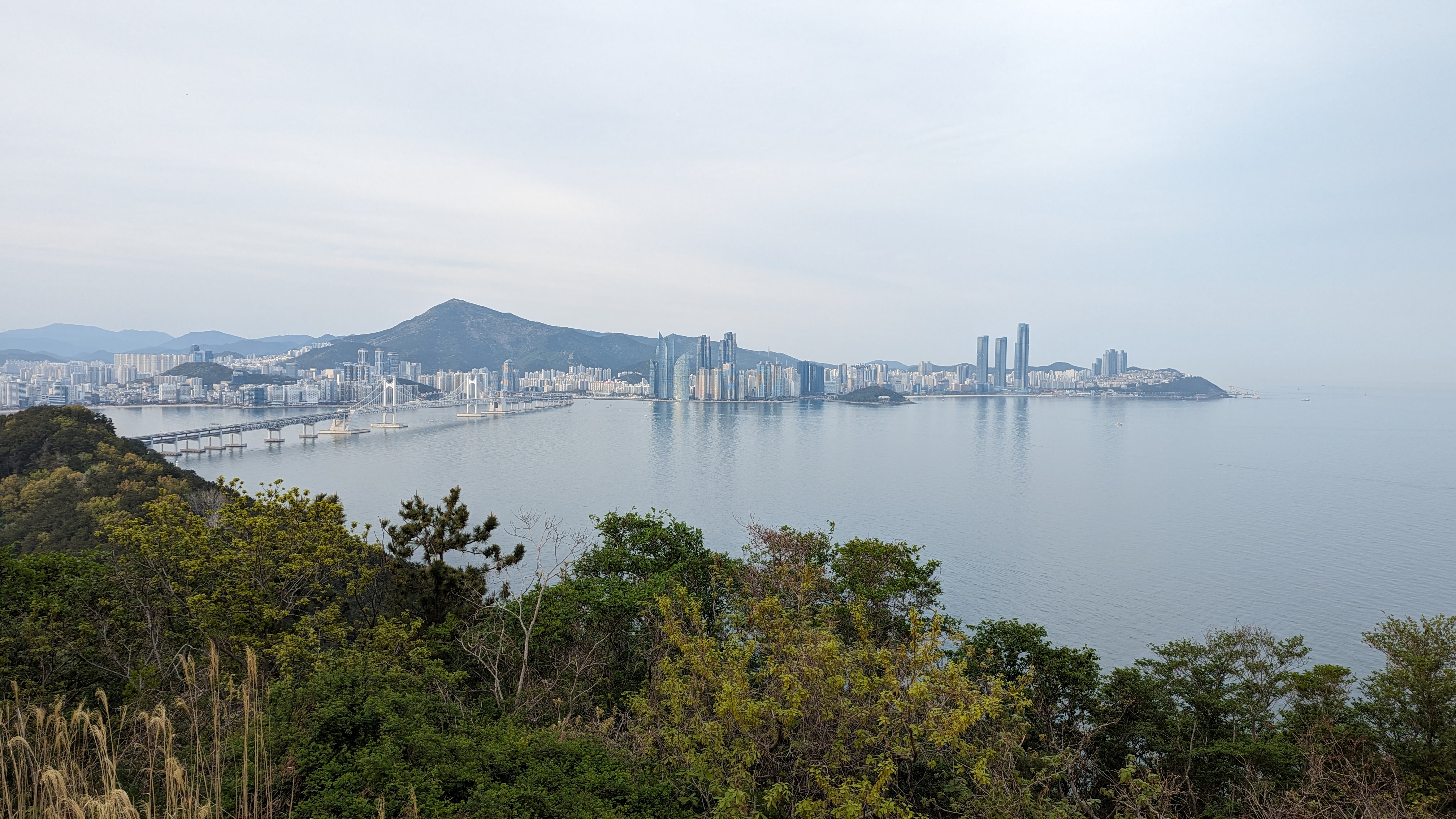
During our Korea trip we spent a few days in Busan. This lovely city is nestled among the hills on the southeast coast of the peninsula, and as you'd expect for a hilly city, has some good SOTA opportunities. Naina was in need of a nap, but I had plenty of energy, so I headed out one afternoon for a walk up a local peak. I chose Jangsanbong because it was reasonable close to a subway stop on the 2 line, and our hotel was also on the 2 line.
From Haeundae Beach, I think thats the summit I went to.
We only got one SIM card for the trip, and it was in Naina's phone, so I had to navigate the "old fashioned" way, with just the maps downloaded to my phone. It was not hard, since the phone maps will show you where you are using GPS. I got off the subway at the Kyungsung Univ.-Pukyong Nat'l Univ. stop, then went out exit 3. A u-turn at the top of the stairs then left turn had me heading down the right road.
The summit hiding behind the buildings.
I walked past Pukyong National University, following the main road. At a three way intersection I didn't have to cross, and beared left. Shortly after this there was a busy expressway crossing, so I had to wait for the walk signal. The area on the ocean side of the expressway was much less busy, and felt less built up. The road kept getting smaller and smaller, until it was two lanes with no median. I crossed at a crosswalk shortly before the sidewalk ended.
Helpful(?) map of the park and mountain. I followed the green path, more or less.
As you pass the last buildings, the road gets much steeper. Some meters of climbing later I passed a nice looking building, then a parking lot. There are bathrooms in the building, which was nice, and at the far corner of the parking lot was a trailhead. It was late Sunday afternoon, but the lot was nearly full, and I saw many people out in the park. After a quick glance at a map board, I decided it would be easier to just follow my phone.
Paved trail on the way up.
The trails in the park had impeccable maintenance. The steep parts were paved or had steps, and the trails were wide. It was nice to be off the city streets. At the top of the first climb, where I got onto the ridge, there was a free outdoor gym. People were using it. This was to become a theme. I followed the main trail up the ridge. Every once in a while there would be a small gap in the trees and a view of Busan, but don't come here if you're expecting views.
Marker at the summit. I'm not sure what its marking though.
Just below the summit there is a turn off to the high point. I walked through another gym, also in use, to the summit which was an open field. There was a big X in the field, with a path around the perimeter. There are some benches next to the main trail at the junction, in the activation zone, but I decided it would be easier to put up a wire in the open field on top. I used the bushes to hold the pole, and was soon on the air. I thought I'd get a lot of Japanese stations on 40m, but I only got two. I was getting worried as I switched to 20m, but it turns out 20m was probably a better band for getting Japan. I also managed to get a chaser in New Zealand.
Views of Suyeongman Bay and Busan. Haeundae Beach is on the right, below the three towers.
Once I had packed up I took the same route back down. I passed a viewpoint I had missed on the way up, and that small detour was worth it. The trees had been cleared enough to see the harbor, Hauendae Beach, and parts of downtown. The soft evening light made the scene beautiful. I managed to get through the city, ride the subway, and get back to the hotel just before dark. Though I wasn't too worried once I got to the streets since I knew they'd be lit.
Post-activation soju.
Trailhead: I started at the Kyungsung University stop on subway line 2, but if you have a car you can get much closer.
Route: From the Kyungsung University stop on subway line 2, follow the main road towards Pukyong University, across the expressway, and up past the church to the parking lot. Then take the main trail up to the summit.
We were in Korea for vacation, so naturally I wanted to do some SOTA. Korea is a mountainous place, and it looked like there were plenty of choices. The first summit we did is in the middle of Seoul, literally. The geographic center of the city is on the side of the plaza on top.
The tower is visible from a lot of places in the city, including this traffic island in Myeongdong.
Our hotel was in the Myeongdong neighborhood, near the Hoehyeon subway station. From exit 1, head uphill through the neighborhood. There was a flight of stairs just below a busy road, which we crossed to enter Baekboem Plaza. The tower on top was visible from here, and it was easy to follow the path to the bottom of the staircase.
From the plaza. Still some blossoms on the trees!
Since the summit is easy to get to in a big city, there were a lot of people out. The stairs up to the top were wide and paved. There are plenty of benches, and even a few viewing platforms on the way. It was hazy as we ascended, but we could still see Bukhansan a few kilometers away to the north. We were glad it was cool out, it probably would have been a miserable hike in the summer.
Base of the stairs.
You know you are close when you see the cable car terminal. This is also where it goes from busy to crowded. Once you make it up the last few stairs, there are plenty of benches around the plaza and under the structure. We sat for a few minutes taking in the scene. On one side the fence is filled with locks that couples have attached. There was even a vending machine to buy your own to add.
High point of Namsan.
We found a bench out of the way, and I got on 2m. I had been warned that Korean hams are chatty, and they were. It took a couple of minutes calling CQ, but I soon had a long conversation with someone who couldn't quite get my Korean callsign (HL1/AA6XA). The slash seemed to trip him up. After a long chat I got two more stations in the log. Some more CQ calls didn't get anyone else, and we were getting bored and hungry, so I packed up. I thought about trying HF, but there really isn't anywhere to put up a wire without getting in people's way.
At the geographic center of Seoul.
We took the stairs back down, then turned onto a different road to get to the bibimbap restaurant near the base. It was a tasty and well earned lunch.
Trailhead: We started from Hoehyeon Station exit 1, but there are myriad routes one could take
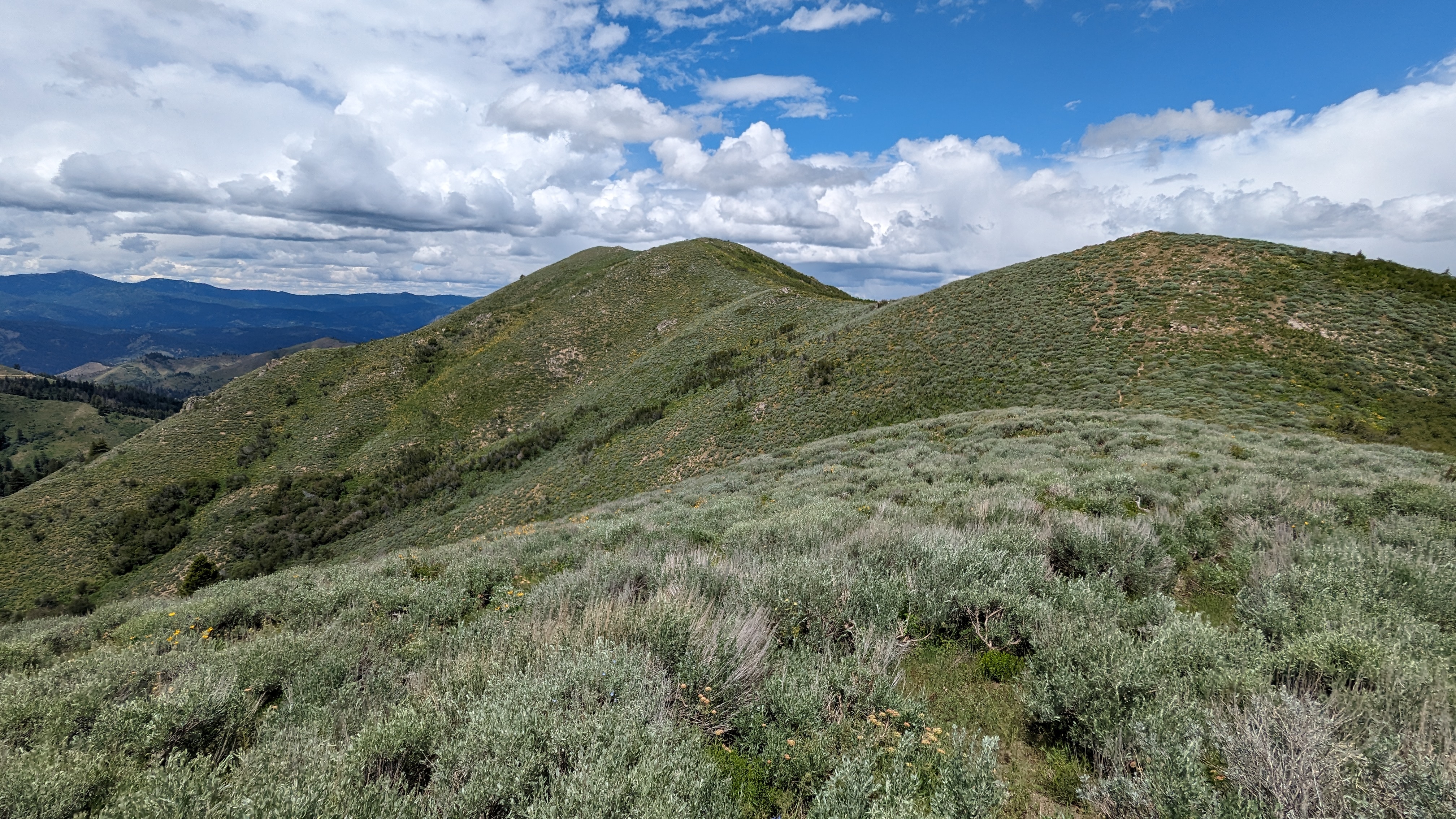
Frankish Peak is one of those peaks that doesn't look too bad on the map. Real life, however, is different. The trailhead for this peak is easily accessible, a large dirt pullout on N Mountain Ave. This is across the street from what appears to be a large dam. Probably to prevent floods when it rains and snows in the mountains. From here there is an unmaintained trail that heads up the hill.
Steep and dry.
The trail up to the ridge is steep. Very steep. Most of it is just regular steep hiking, but there were a few sections that were class 2 or even class 3. Not the most fun hike I've ever done, but I made it up.
Enjoying views of the San Gabriel Mountains.
The views do get better as you climb. There are a few short sections along jeep trails, but mostly it is narrow, overgrown single track. The final road section is just below the summit. On the summit ridge, the closer peak is a little lower, but the trail continues across to the high point. This is marked with a sign and a large open area covered in broken glass. I'd like to know how all that glass got up there.
QRV!
I did not have cell service on top, at least where I was sitting. I may have been able to find it by walking around, but RBNhole does a good job putting up spots, so I didn't try. I worked people on 20m, but surprisingly no one on 40m. On VHF I got a few people as I expected, looking down a such a large populated area.
The hike down was nearly as bad as the way up. Steep and loose in places. Badly defined trail. I nearly went down the wrong ridge, but caught myself before I got too far. That would've been bad, since hiking up in the dense chaparral would have been terrible. Back at the car I had a drink and headed across the mountains into the desert to my next goal, Fremont Peak.
Trailhead: Side of N Mountain Ave, across from the reservoir.
This is a fairly easy peak near Mountain Home. From the freeway, drive north on US 20, uphill and into the foothills. A few miles up, turn left onto Anderson Dam Road. This road is paved. Drive down the road until you cross a cattle guard and the pavement ends. There is a large pullout here you can park in at the base of this mountain, on the dirt side of the road.
Looking at the summit.
Since I didn't want to crawl under the barbed wire fence, I crossed the cattle grate and started up the hill. The route to the top was pretty easy to see, just follow the ridge up. There are some big embankments lower down, but they are easy to avoid. I wouldn't be surprised if people used this area for shooting.
Enjoying the beautiful day.
It was about a mile up to the summit, and it didn't take me too long. The first half is flatter, but much more brush to navigate around. After crossing what appears to be a power line access road, the steepness goes up. The views got better as I climbed which was nice, but the wind also picked up. It was, however, one of those beautiful fall days where everything is just perfect.
One of the embankments near the bottom.
On the summit there is the remnants of a fence. I used a conveniently located post to hold up my antenna pole, and was quickly on the air. I had good cell service for spotting, and the QSOs started rolling in. It was the Arizona 10 point madness day, but none of the AZ stations came to work me summit-to-summit. I was a little disappointed, but there were plenty of other S2S contacts.
One happy hiker.
Since I had to get back to Boise and the airport for my flight home, I couldn't spend too long on top. It was a pity, since it was so nice out. Oh well, there'll be nice days at home soon enough. I retraced my steps back to the car for the drive back to the capitol.
Trailhead: Where the pavement ends on Anderson Dam Road.
We were in Government Camp for a few days, so of course a SOTA peak or two needed to be done. We had done some hiking in the morning, so I picked an easy one for the afternoon. Multorpor Mountain is a relatively easy hike from Government Camp.
From our room at the Huckleberry Inn, I walked down the road to the east end of town. It was a bit scary crossing the highway, but traffic was light enough I made it across with a little patience. Just east of the main road is a dirt road that heads into the forest. I didn't see any signs on the road, so I'm not sure if it has a name or number.
Along the jeep trail.
The road heads into the woods. After a turn or two there is an unmarked trail near the top of a hill. Pay attention, I nearly missed it. This trail heads up the mountain, somewhat steeply. It was a nice change from the dry, open forest I'm used to in California. All the rhododendron made me feel like I was back on the AT.
Damp trail heading up the hill.
At the summit it gets steeper as you scramble up the rock outcropping. I was surprised to have a decent view. The north side is dominated by Mt Hood, but to the south there is a nice one. I set up and sat looking south. I had cell service on the summit, and spotting was no problem. Since the weather was a bit iffy, a few showers rolled through while I was on the summit.
Looking South.
After working the chasers, it started getting darker and cooler. I assumed some rain was coming in, so I packed up and started heading down. It didn't rain, but I was glad I didn't take the chance.
We had gone to Sequoia Kings Canyon National Parks for the weekend, and before heading home decided to grab an easy SOTA peak. The choice was the nearby Park Ridge. We packed up the campsite, then drove up to the Panoramic Point parking lot.
What a nice view.
There is a short paved trail up to the viewpoint. Definitely worth the trip up. From the viewpoint, it is a pleasant walk along the ridge. The ridge has open forest along it, and there are some nice views as you hike along.
Another view from Panoramic Point.
Just below the high point there is an obvious hill. The trail has a switchback or two up this last climb. On top, there is more open forest. I stuck my pole in some of the bushes, and ran out the antenna. Since I was planning a quick activation, I only extended it to the 20m link. I had a little service on top, enough to put out a spot. I quickly got some contacts, including Germany.
General Grant tree, the third largest in the world!
It was a quick hike back down to the car, with another stop to enjoy the viewpoint. Back at the car we drove down the hill and made one last stop at the Grant Grove to enjoy the giant sequoias before heading back home.
Every resident of Boise has looked up at this peak at some point and wondered what the summit was like. Or at least I assume they all have, since its what I'd do. Since I had a nice rental SUV, I decided to find out. One can drive pretty close to the top if one has some clearance. The road up the hill is a continuation of 8th Street. It is paved until around the Hulls Gulch parking area, and in good shape some distance past there. As you drive up, however, the road gets rougher. I doubt a regular sedan could get very high.
View down to Boise
Around the elevation where the forest begins there is a road junction. I parked here since I wanted to get some walking in, but if you drove this far you could easily keep going. Go left at the junction, and continue up the hill. The road goes past some private homes. They don't seem very friendly.
Looking over at Shafer Butte.
Below (southwest of) the summit the road turns to the right and starts to go around the peak. I took the left fork here, then decided to follow what seemed like a trail straight up the ridge. This was a mistake. The trail started off well, going around a pit to keep the vehicles out then up to a small outcropping. On the other side, however, was very dense forest. I pushed through, and eventually got to the open forest around the summit. It wasn't very fun, and I would not recommend this route.
Setup on the summit.
I found a nice spot at the high point in the shade to sit, and put up the antenna. There was ok service (Verizon) on top, plenty to put out some spots. Since I wasn't in a rush, I did all the bands I had. 17m was good, but the DX was all on 20m. After the pileup and Europeans, 30m and 40m seemed a bit boring.
On the way up I had seen a road a little ways below the summit, and I decided that it would be a better route down. This road is not in the activation zone. It was, except I wasn't paying attention, tripped, and got some nice cuts on my hand and legs. Back on the road I followed it around and back to the main road. This one near the summit doesn't appear on any maps.
Nice forest on the summit.
On the main road I headed back to the car, then had the long drive back to the pavement. There were a bunch of motorcycles and dirt bikes heading up. It seems like a popular area for OHV riding. It was nice to get off the washboarded and potholed road and on the pavement.
Trailhead: Forest Road 231 or 263, as far as you can or want to drive.
After activating Thorn Creek Butte, I headed over to Rabbit Creek Summit. This involved driving on some pretty narrow dirt roads. I was a bit apprehensive about the drive, but it turns out the roads were in decent condition. I mostly took roads 333 to 315. The SUV I had didn't have problems, but I wouldn't have wanted to be in a sedan or other low clearance car.
Nice views on the hike.
There was plenty of parking space at the col; there was even a family camping there. On the inside of the road bend a trail climbs up the steep embankment then heads up the ridge. This is obviously frequently used by motorcycles, but I didn't see any other people when I was out. It was a pleasant walk along the ridge, mostly in the shady forest.
There are a few false summits you have to go around before you get to the high point. I was faked out by the first one and went a little out of my way. There is not much remarkable about this summit.
Looking back at Thorn Creek Butte.
I set up and got on the air. There was cell service. The bands were not in good shape, and I struggled to get my four contacts. Luckily I got five, then packed up. I feared the drive back to ID21 would be a long struggle like the drive up to Thorn Creek Butte, and it was getting to be dinner time. I was wrong. Road 327 was a joy to drive, smooth and wide. Soon I was back at the pavement for the drive back to Boise.
This peak has great views, but is not easy to get to. Just north of Idaho City, forest road 304 heads into the woods. Based on the map I had, I assumed it would be dirt but not too bad, passable in a sedan. This was a bad assumption. The first part wasn't so bad, but I was glad the rental company had given me an SUV with a bit of clearance. Four wheel drive wasn't necessary.
There were views near the summit.
The road was rough. I was glad to be going 10MPH on a lot of it. Eventually 304 winds its way up to the Bald Mountain campground. I was done with driving, so I just parked and walked the rest of the way. I definitely could have driven farther up. The mile or so up to the summit was pretty easy, just following the access road. Just keep an eye out for all the OHV users. Some of them seem a bit crazy.
Summit outhouse. Nice views.
There is a fire lookout on top. It was staffed, but the gate was closed and there were a bunch of signs warning you not to go up. This was surprising, usually people in fire lookouts are happy to see other humans; I think they get a bit lonely. But their coldness didn't stop me from enjoying the view and setting up. There was a bit of cell service, so I was able to put up some spots. I was also glad the temperatures were in the mid-70's, compared to ~100 in Boise. A good day to be in the mountains.
A rather faded sign letting you know you're at the summit.
Sadly, there was quite a bit of RF noise, and conditions weren't that great. I made a handful of contacts, but wish there had been more people out so I could've sat and enjoyed the view a while longer. The hike back to the car was quick, and I then navigated some more rough roads to get over to Rabbit Creek Summit for another peak.
Trailhead: Bald Mountain Campground, or drive all the way to the summit.
I arrived in Boise and immediately headed for the hills. It was a cool day, perfect for a longer hike. I headed north up ID 21 to Lucky Peak Reservoir, then started driving around the north shore. Near the end of the lake the pavement ends. Since the rental company had given me an SUV I wasn't worried, but it turns out the road was very well maintained and any sedan could've made it to the trailhead. On the dirt I drove up past the Arrowrock Dam and continued along the shoreline. The trailhead for Mt Heinen is at a small campground, Irish Point, quite a ways around; at least an hour drive from the airport.
Starting up the trail.
The trail is unmarked but easy to follow. There is a short flat section, then the uphill begins. The trail gains the first 1000 feet in about 0.75 miles. It is steep. So, so steep. But, you do start to get views pretty quickly. Some sections of the steep were quite sandy. I could tell it would be a chore coming down them.
Looking back at the reservoir and campground.
Thankfully, it was a cool day, and the sun was in and out of the clouds. This is not a peak you'd want to do on a hot day. On the first flat section on the ridge there are some trees. Eventually the climbing slows down, and you start traversing the ridge. There is still a fair bit of vertical, but it is a reasonable grade.
Looking at the summit. Almost there!
I made it to the summit eventually. The benchmark was easy to find, and there was a register at the small summit cairn. There are a few bushes on the ridge, so it was easy to get my antenna up. I had ok cell service, enough to get out some spots. The bands, however, were dead. There was no one on 20m, and I barely got my four on 40m. I was a bit worried I had hiked all that way for zero points, but luckily there were a few chasers who were able to pull me out.
Set up on the summit.
There were rainstorms in the mountains in the distance, and I was really hoping they wouldn't come to me. I lucked out, and had a dry hike and activation. Since the hike up had taken me longer than I expected, I didn't linger too long on the summit. The hike back was long and steep.
Still a long way down to go.
The ridge traverse was pleasant, but the last two miles were just torture. Too steep to be pleasant or easy. But I made it down without slipping or my legs turning to jelly. The drive back seemed shorter, but it still wasn't quick. Back in Boise, dinner never tasted so good.
Trailhead: Google calls this the Mt Heinen Trailhead at Irish Point Campground
This was the second summit of our San Diego Trip. It was an overcast morning near downtown when we woke up. Perfect weather for an exposed hike. We drove up I-5 to Alpine, where we made our way through town to the dirt road that this trail starts from, 15S30. The Corolla we had had no trouble with the dirt road, and we made it to the pullout at the trailhead.
Parking at the trailhead.
With careful parking you could fit quite a few cars here, but maybe only when the giant puddles are dry. The trail starts heading up the hill, and keeps going up the whole way. It is a relatively constant grade, a pretty good one for hiking. We made good time going up. All those hours on the stair master must be paying off.
Looking over at El Cajon mountain.
Eventually the uphill ends and you find yourself on the long summit ridge. It appears this whole area is in the activation zone. We found a spot out of the way and got set up. There was good cell service on top, and spotting was not an issue.
Antenna ready to go.
KN6REU went first. Spots for SOTA and POTA meant she quickly had her four contacts, including France again on 10m. AA6XA did 15m CW, and got a good size pileup that took some time to clear. Since it was lunch time, we had some leftover Pizza Port pizza and cookies on top. A nice change from the sandwiches we usually take.
Looking down at the parking area and Alpine.
The hike down felt long. We passed a decent number of people heading up and down. It seems that this as a relatively popular mountain, and with excellent views of the San Diego area and easy access I can see why.
Trailhead: Pullout on Forest Road 15S30. This is a continuation of Anderson Road in Alpine.
We decided to go down to San Diego for the weekend. After an early flight, we arrived and headed for the hills. Our goal was this unnamed peak near the Mt Laguna recreation area. We had a pleasant drive through the mountains to the trailhead at the Pioneer Mail picnic area. The PCT runs through this area, and we did see some thru hikers, only a few days into their hikes.
Summit from the parking lot.
The trail is across the road from the picnic area. There is a crosswalk at the top of the hill. We crossed, then took the trail that leaves to the right. This briefly parallels the road before turning away and heading up the hill. As you climb onto the base of the ridge, there is an unmarked trail junction. Turn right here and start heading up the ridge.
Summit. If it had been warmer, the pole would have been a good antenna support.
This trail is obviously unmaintained, and it sort of just ends after a while. The brush is sparse enough that it is easy to find a path up. There are even some small cairns marking tricky sections. We had no trouble getting to the summit. It was quite breezy on top, so we found a sheltered area to get set up in. There was good cell service on top. On the bands, 15m was open to Europe, and AA6XA worked Ireland and Portugal. KN6REU worked F4WBN for the first time on 10m, so that was exciting for her.
Trying to make 2m contacts.
It was getting cool, and also to be lunch time, so we didn't linger too long on top. We took the same route back down to the car. There are so many path options higher up, but near the trail we found the small cairns and junction. Naina was so excited to be going down, she nearly missed the turn to go back to the car. Luckily Jeff wasn't too far behind.
Brush on the way up.
The drive back to San Diego was nice, where we went to Balboa Park for some lunch and walking around. Overall, a great hike and summit.
Route: Cross the highway, and take the trail to the right of the driveway. When you get to the spine of the ridge, turn right and take the use trail up to the summit.
We were on vacation in Kaua'i and decided to take a morning to hike up and do some SOTA. The only reasonably accessible peak on the island is this one, Nonou Mountain. It is also know as the Sleeping Giant because of its profile when view from the ocean side.
The west trailhead is a bit higher and a shorter hike, so we started there. There is a little bit of parking at the end of Lokelani Road, and we got a spot there. The trail starts up a grassy area until it enters the forest.
Start of the trail
Once you enter the forest, the mud starts. This is a muddy trail. Slippery and muddy. It is also quite steep in places, especially with all the mud. Be warned.
Heading up through the forest.
There were a fair number of people heading up and down, it seems like it is a popular hike on the east side of Kaua'i. Part way up there is a bench. As we climbed, a small rain shower blew through, which seems like the typical weather pattern on the island.
View down the ridge.
Once you get to the ridge the east side trail joins for the last part. There is a shelter with a picnic table and bench. This area would be great to setup at, but sadly it is below the activation zone, so we continued slipping along the ridge. Below the summit there are some rocky areas, class 2 (or a very easy 3). We decided to setup at a long outcropping just below the summit. It was long enough to run out enough wire for the higher HF bands.
View of Wailua and the ocean.
We had good cell service on top. Since it is a POTA area as well, we spotted for both POTA and SOTA. KN6REU only got one chaser on 10m. AA6XA had no problem on 15m cw. We didn't linger too long on top since there were a bunch of other things we wanted to do that day. The hike down was quicker, but still very muddy and slippery. We made it back to the car without any major falls, and headed down to Lihu'e for some lunch.
Trailhead: Small lot at the end of Lokelani Road. There is also another lot a bit lower on a different road, and on the other side of the mountain.
After exploring Joshua Tree National Park, we got up early and drove over to Death Valley. This huge park is a few hours drive through the desert. Our first stop was Dante's View, on the east side of the valley. Just above the parking lot is a SOTA summit, and that was our destination.
Operating from the summit.
There is a short trail that leaves from the far side of the parking lot. Watch out for cars while walking over. We were soon at the top, where we found a spot out of the wind to set up. I was worried there wouldn't be any cell service, and KN6REU wouldn't be able to get any contacts. It turns out there was decent service (Verizon) at the peak, and spotting was no problem. Naina got more contacts on 10m than she wanted, then headed back to the car. I stayed up to work a big pileup on 20m before heading back down.
Mosaic Canyon
From the viewpoint we drove down to the Furnace Creek visitor center to get a map and see if there were any souvenirs we needed, then continued around to Stovepipe Wells and Mosaic Canyon. This was a fun hike, up the canyon. We turned around before there were any difficult parts, but it is a hike we'd recommend.
Lowest people in the Western Hemisphere.
Next we made a brief stop at the Mesquite Sand Dunes on our way to Badwater Basin. This is the lowest point in the western hemisphere at -282 feet. A sign high up on the cliff above the road really drives home how low you are. A short distance back up the road we stopped again, this time at Devil's Golf Course.
Only the devil could play golf here.
I think this is one of the neatest areas, with rough salt formations in the middle of the valley. Worth a stop if you're in the area. Finally, on our way out of the park we stopped at Zabrisky point for a quick sunset. The dunes and rocks in this area are excellent, and I can see why it is featured on postcards.
Sunset at Zabrisky Point.
This is one of the largest national parks in the USA, and I wish we had more time to explore. We only hit the highlights, and it feels like we barely scratched the surface.