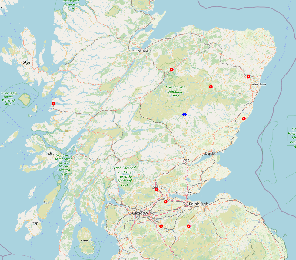
Reading view

There are new articles available, click to refresh the page.

Carn a’Gheoidh

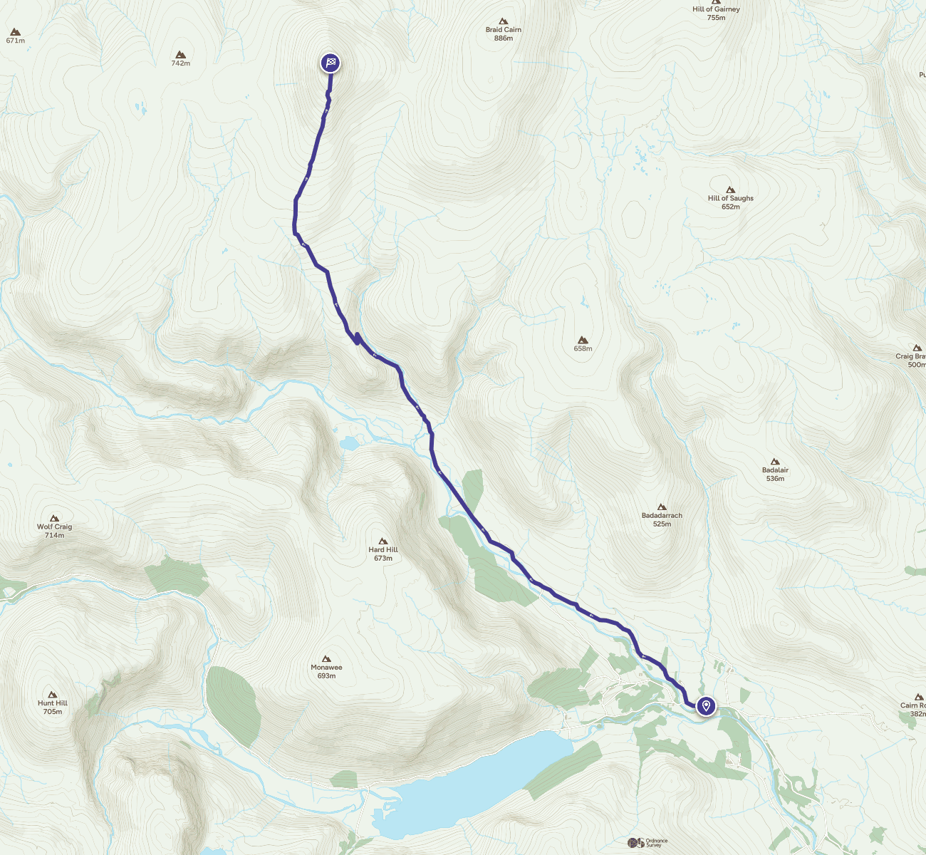
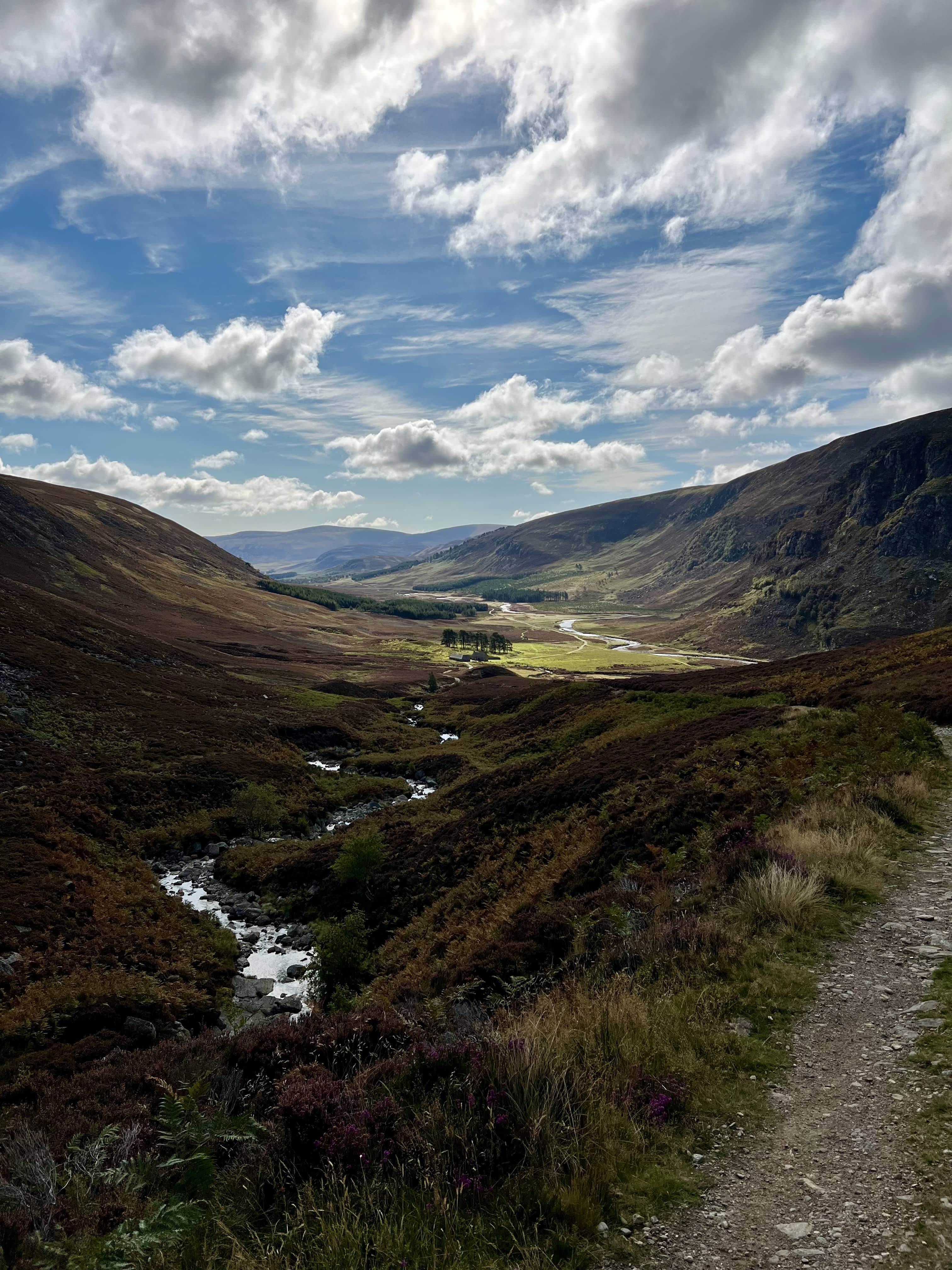
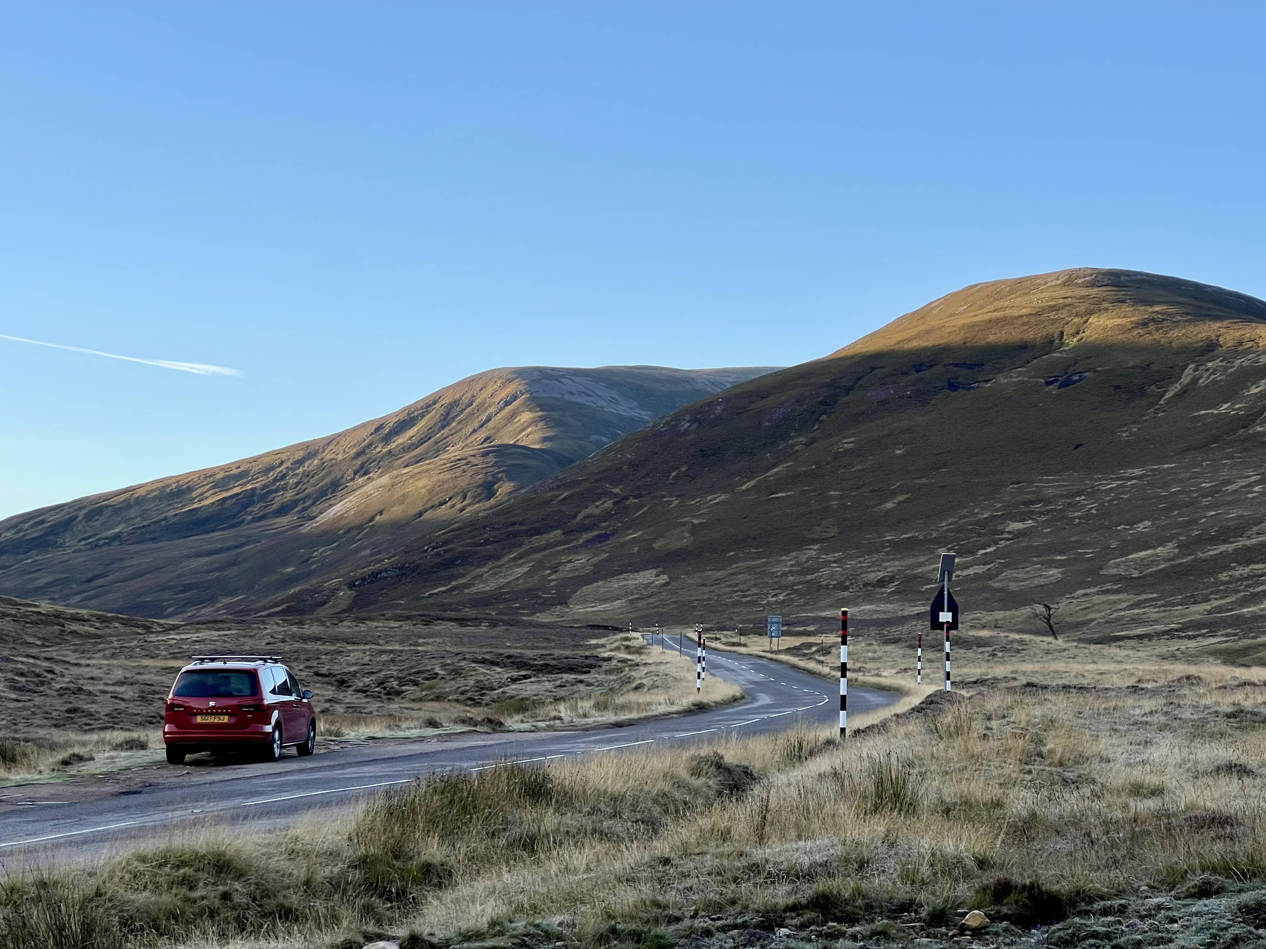
After a lovely day yesterday on Lochnagar and Conachcraig, I was looking to see where I could go today. There was a swimming competition on, in addition to the usual activities, so I needed to be back for 3pm. Last week when I was on An Socach, the others went to Carn a’Gheoidh, and I remembered them leaving later than me but arriving at the top at the same time. Sure enough when I check all the times, it looked doable to get there and back in time. The longest part is the drive to Glenshee ski centre, and that’s right at the limit of the electric car - returning home with 20 miles range still makes me a little nervous!

A grey day

A grey day

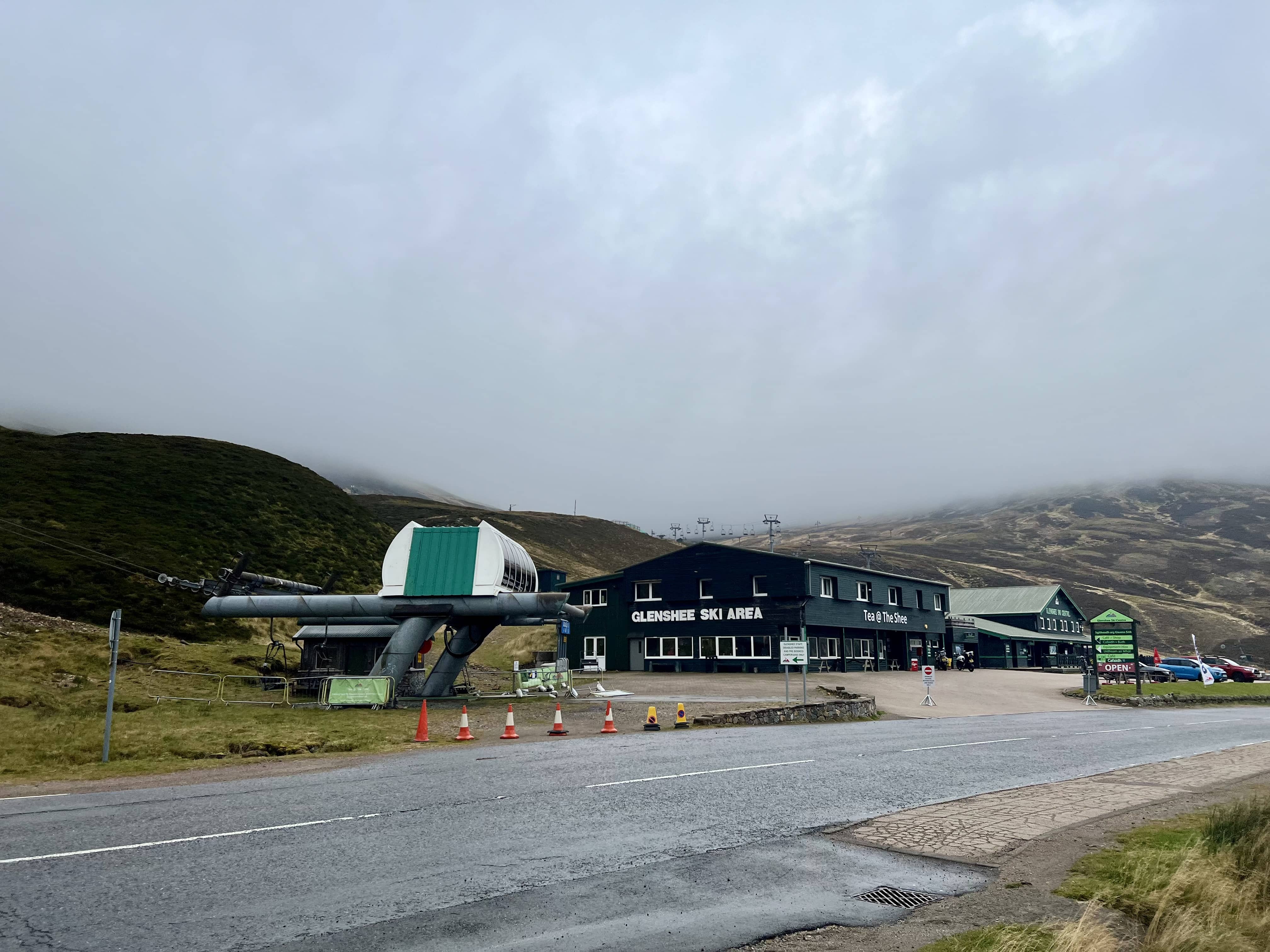
The weather forecast had it cloudy with chance of showers and reasonably breezy. It did rain a little on the way out but was dry when I arrived. I wasted about 10 minutes getting a parking ticket from the cafe - I should’ve just opened the link in the car park when I was up the hill and had signal, like I did with Glas Maol.

Look, snow!

Look, snow!

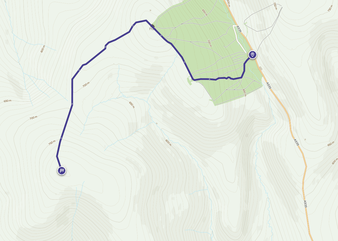
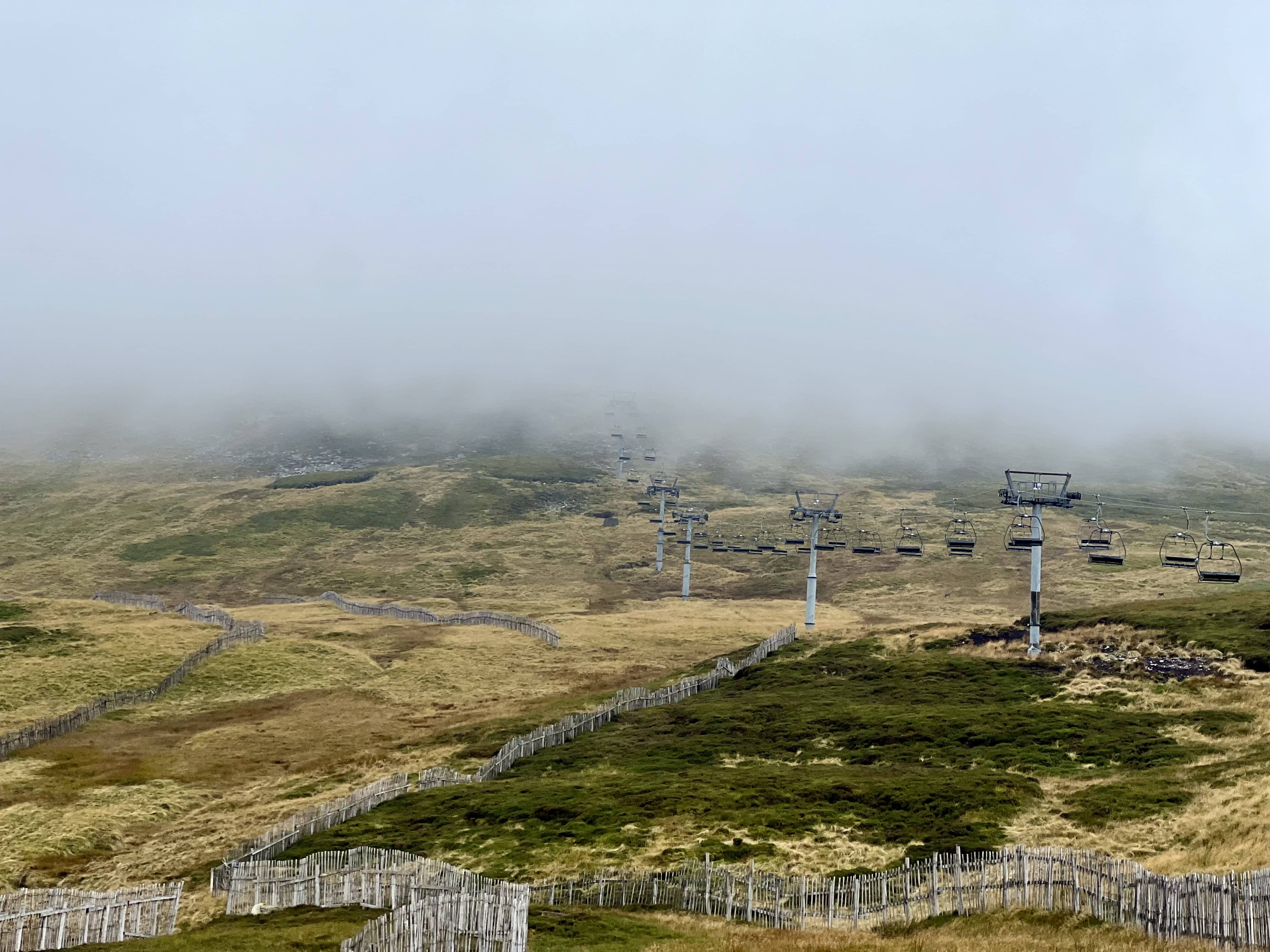
The track follows up the ski maintenance tracks, which are quite steep to start. There’s a shortcut across part way up which I just walked right past. My Inreach mini started beeping as I’d gone of course and so I backtracked and found it. It was a small track at right angles to the main path just behind a fence, so not too obvious, so thanks to the Garmin!

Navigation via Inreach Mini

Navigation via Inreach Mini

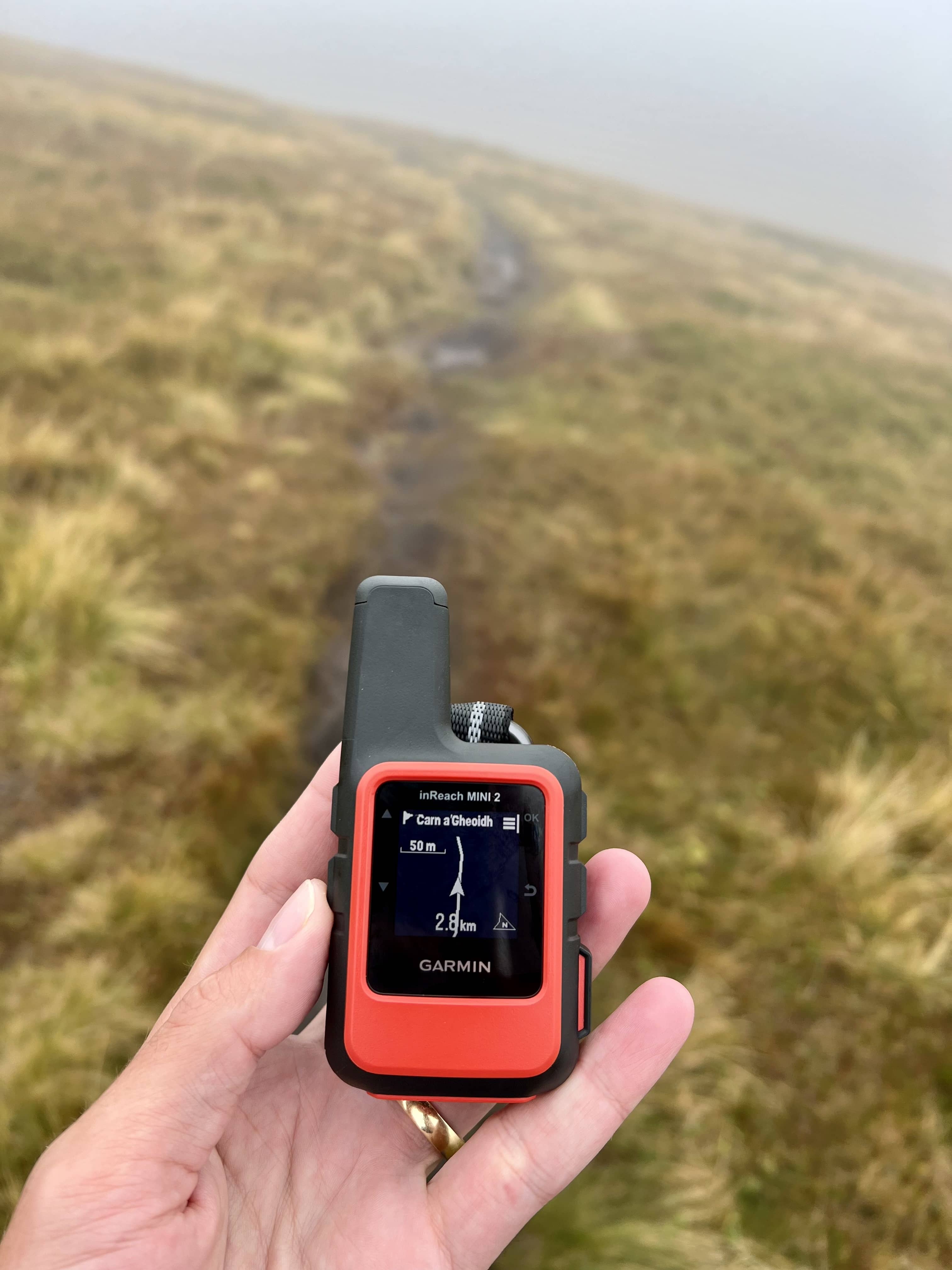
I was soon in the cloud and did check on the inreach every so often to make sure I was heading in the right direction. I doesn’t have topo maps, and just a line but it has a compass and so points in the right direction and is enough to make sure you’re following the right path.

Cloudy

Cloudy

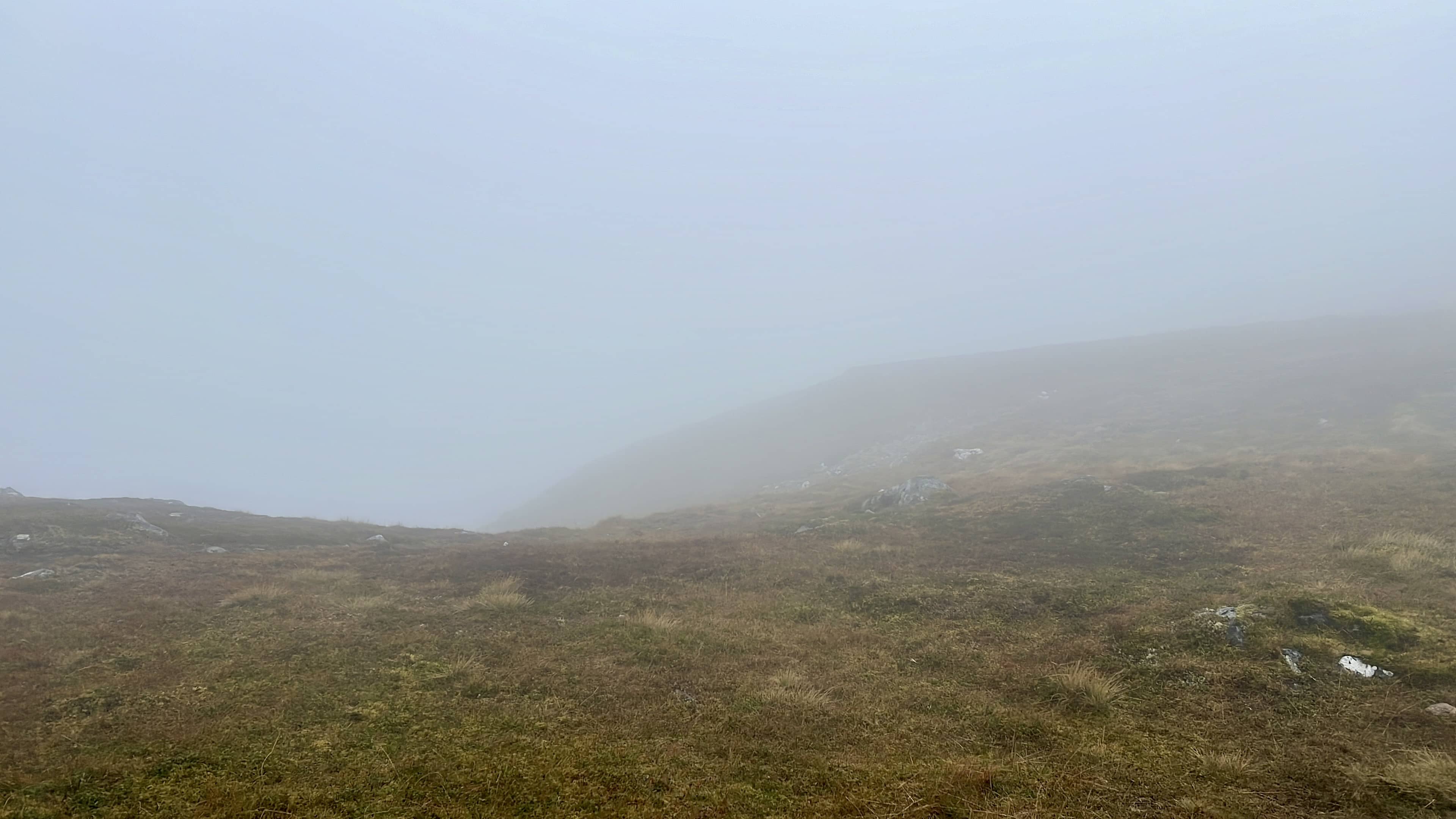
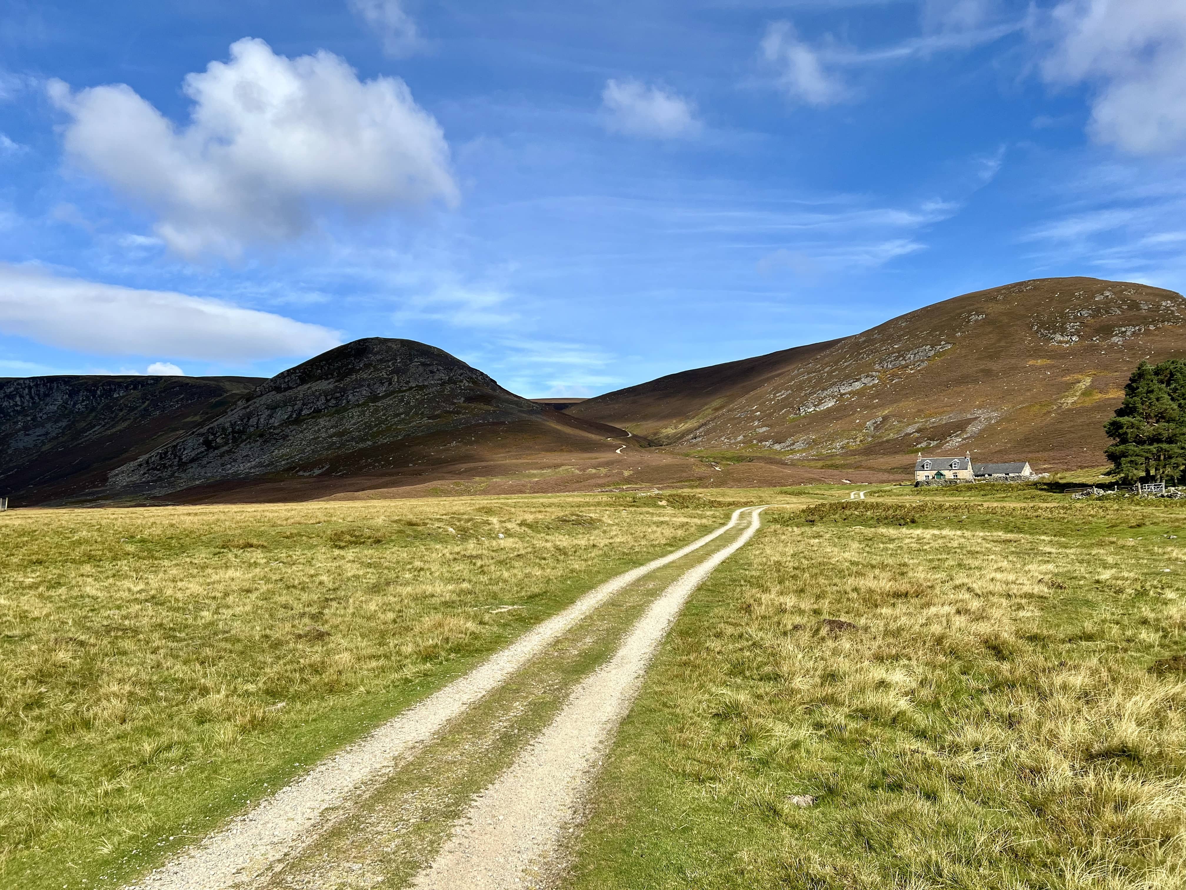
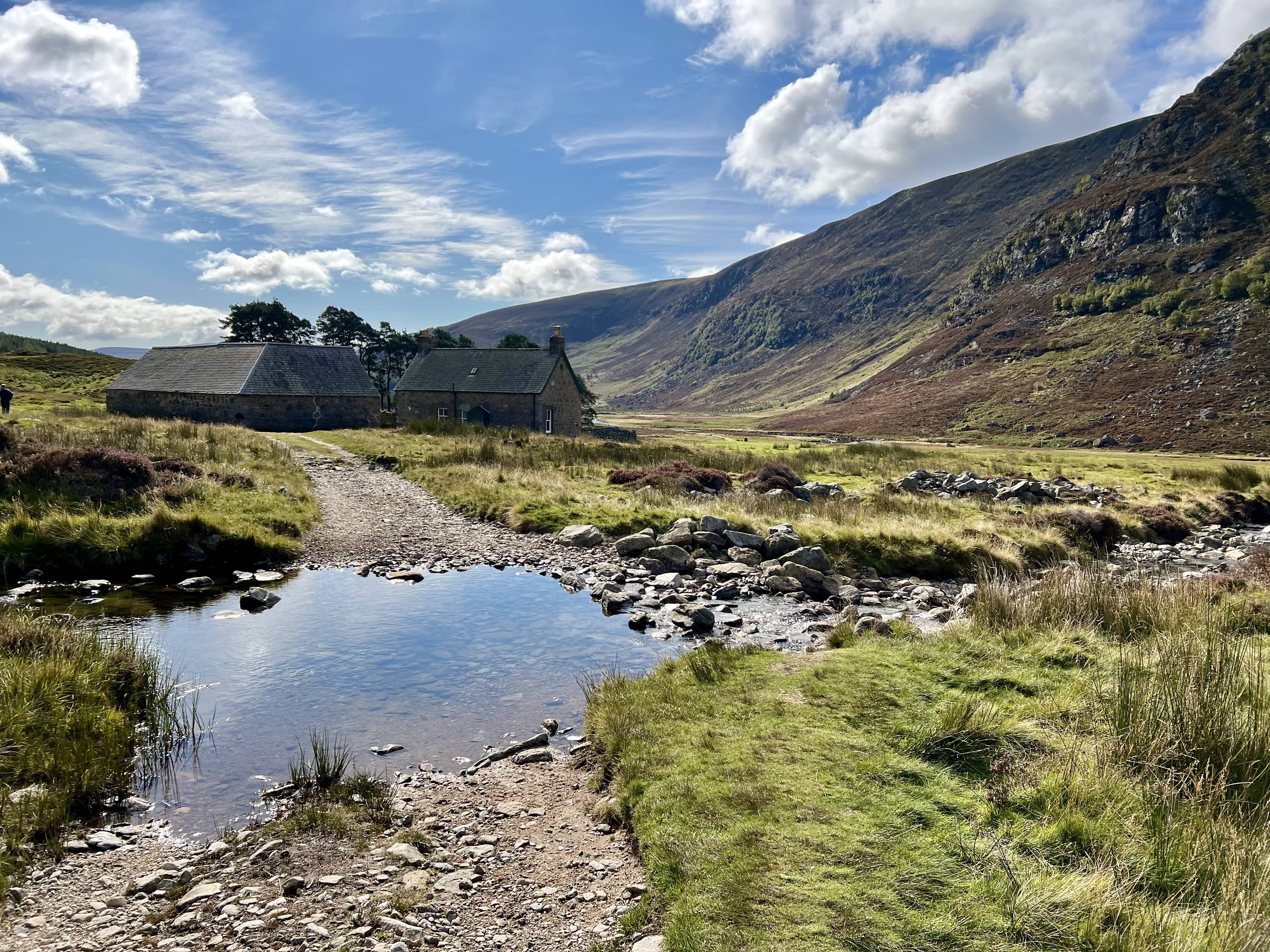
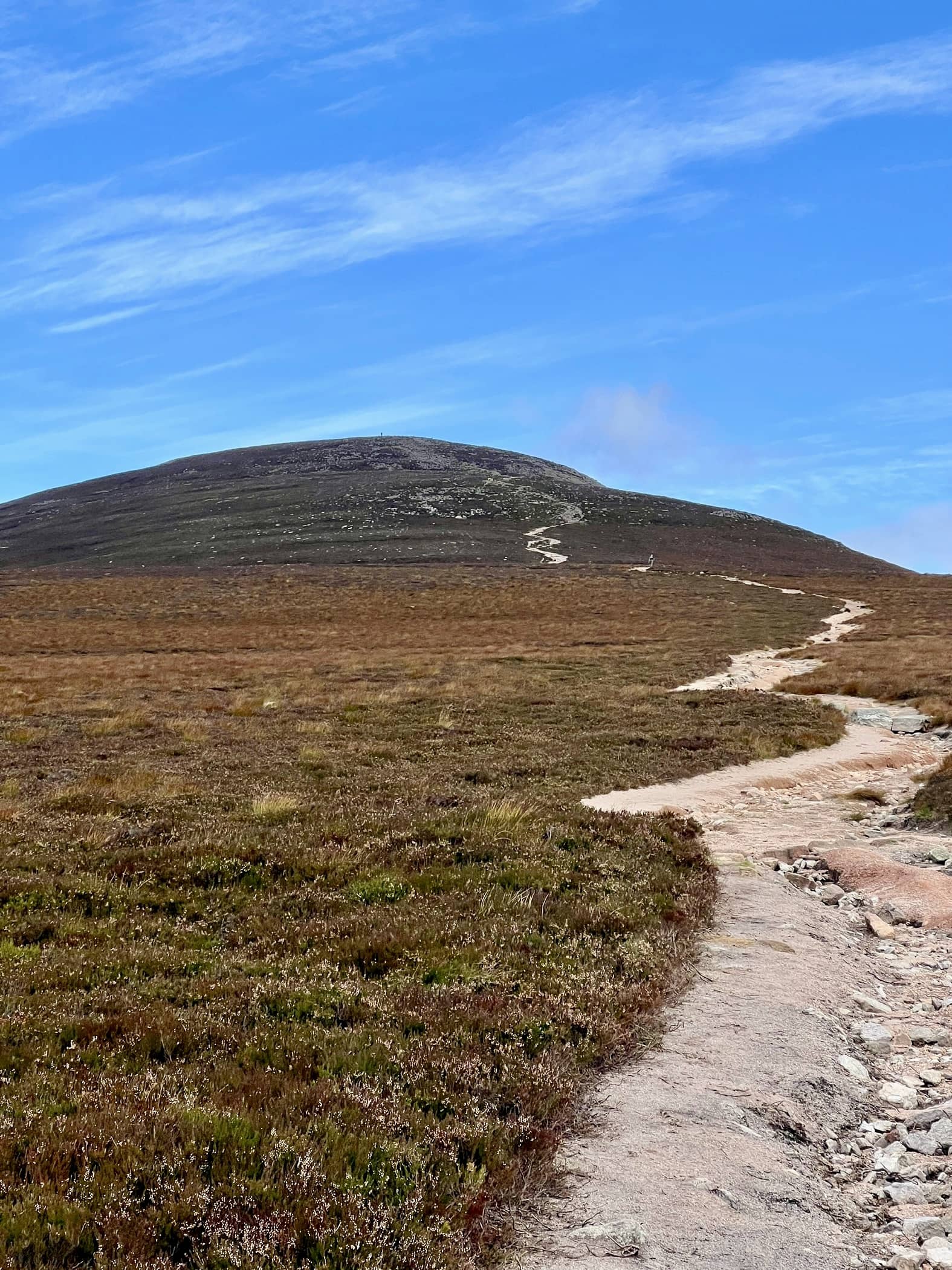
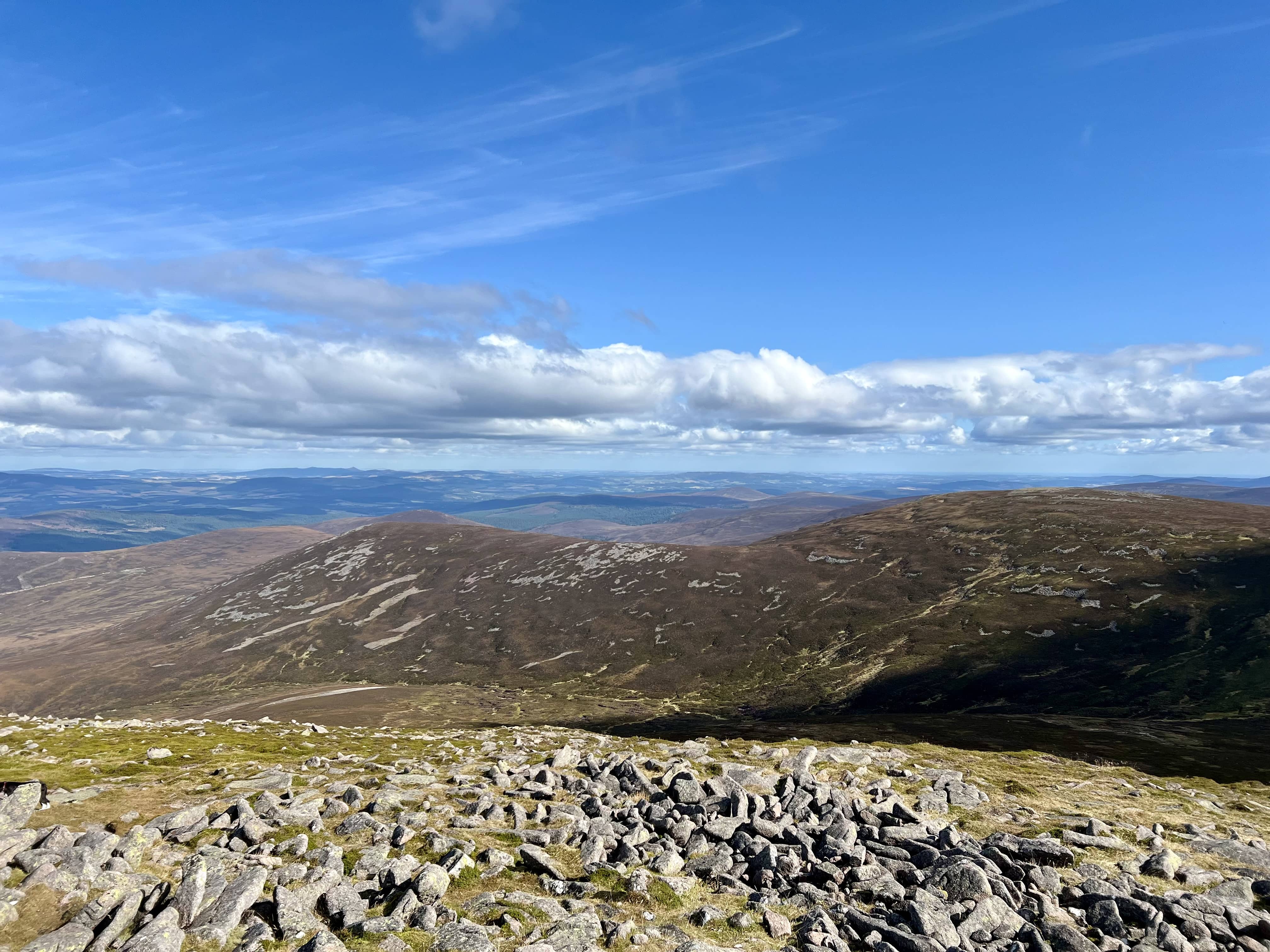
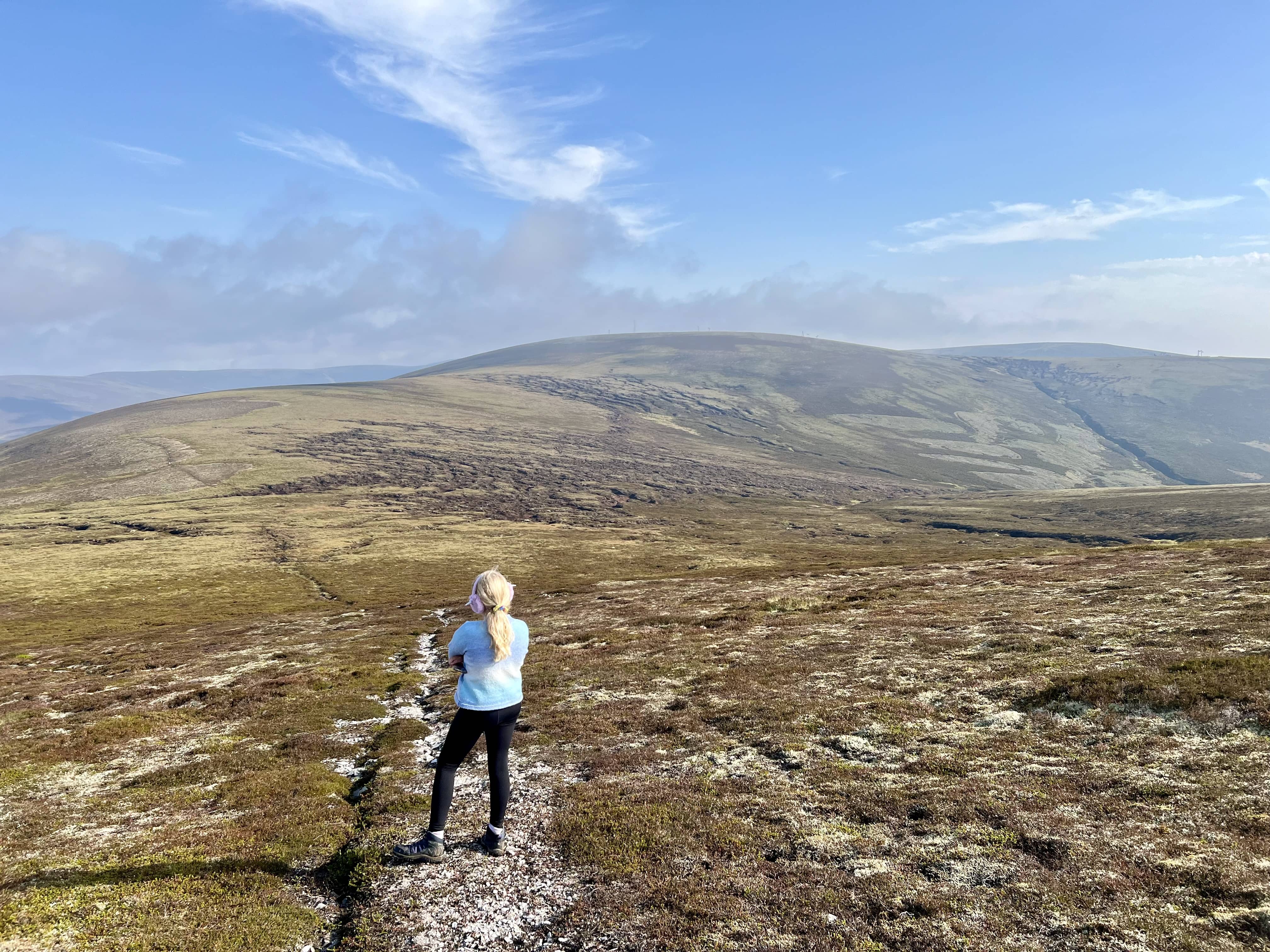
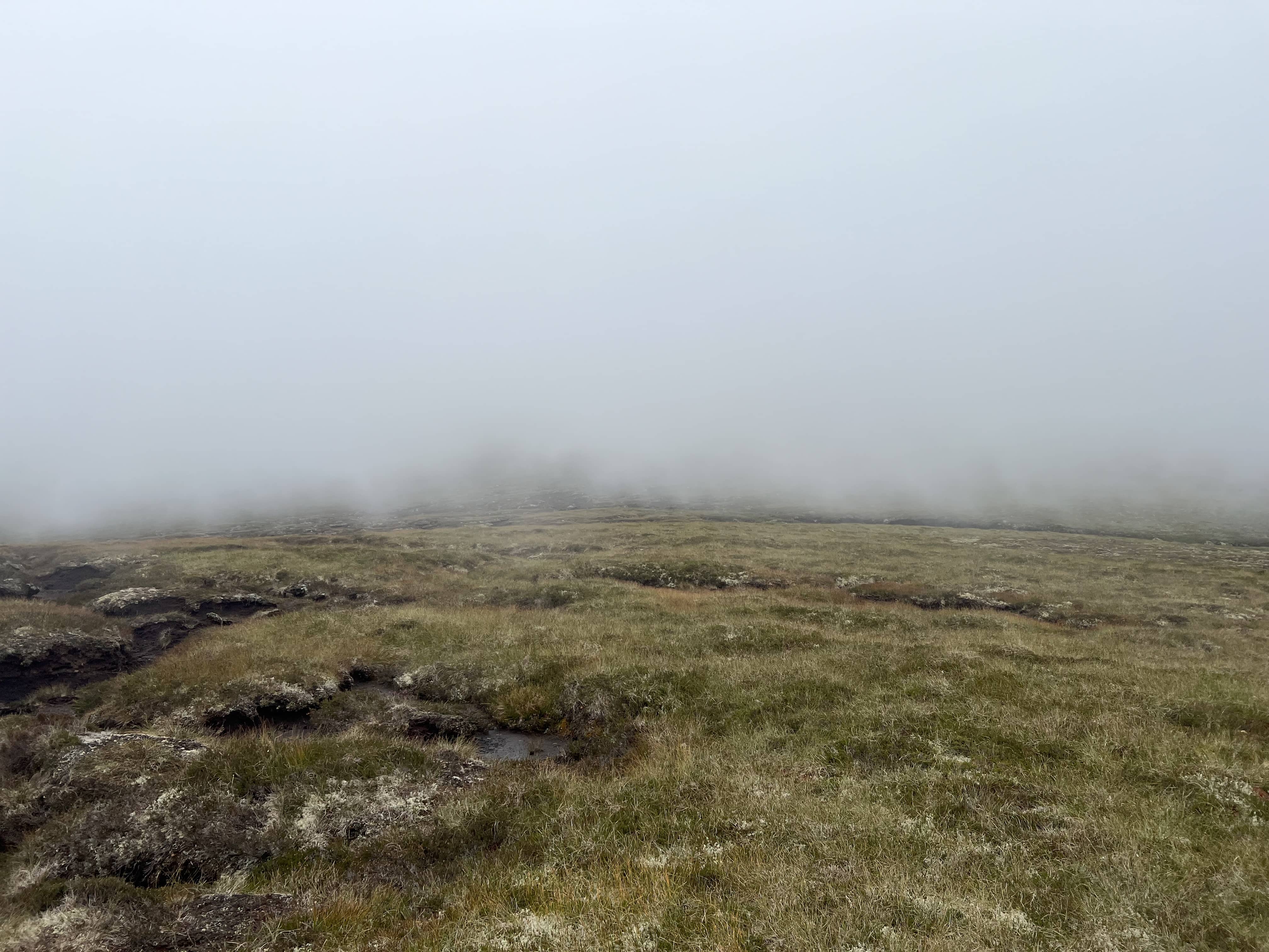
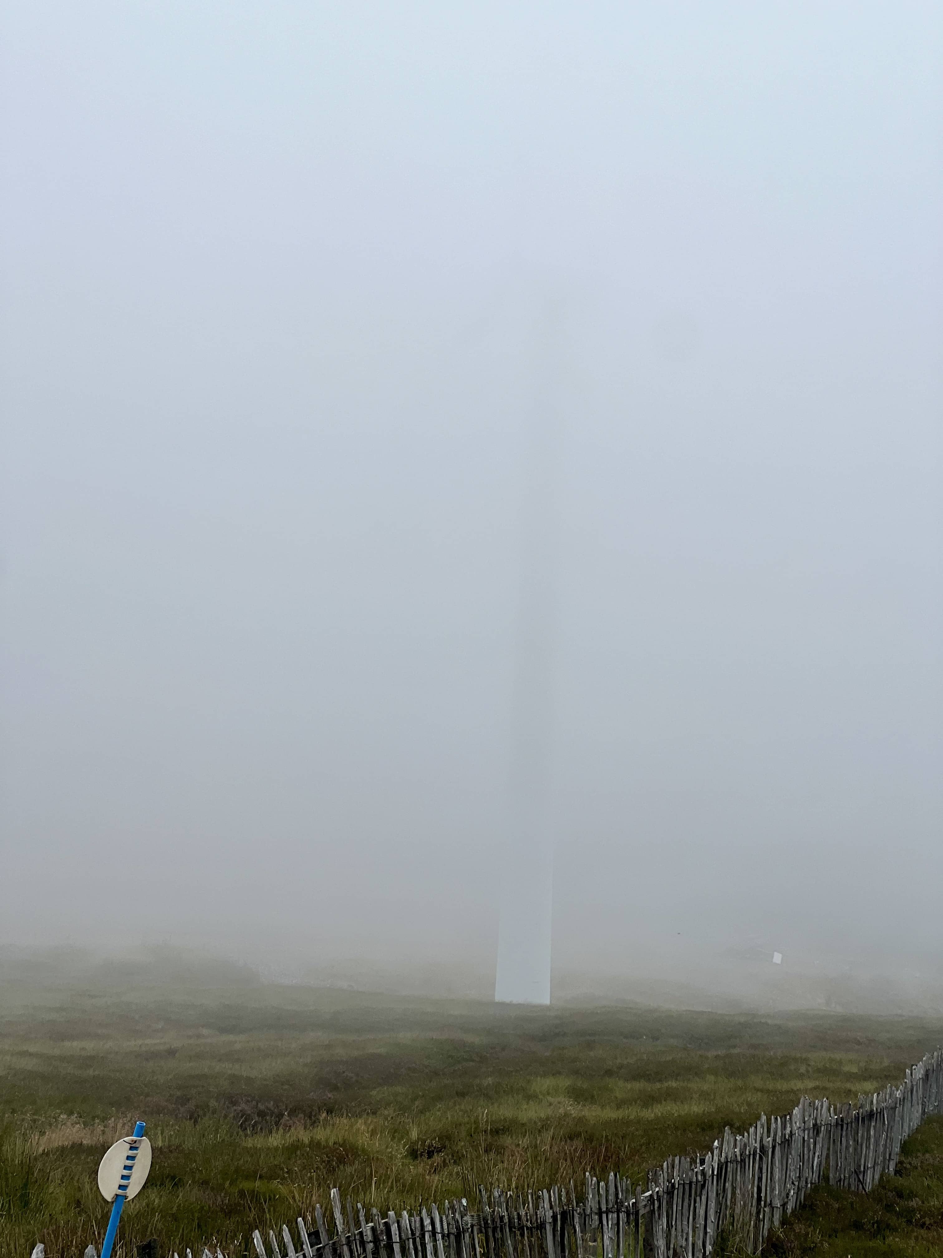
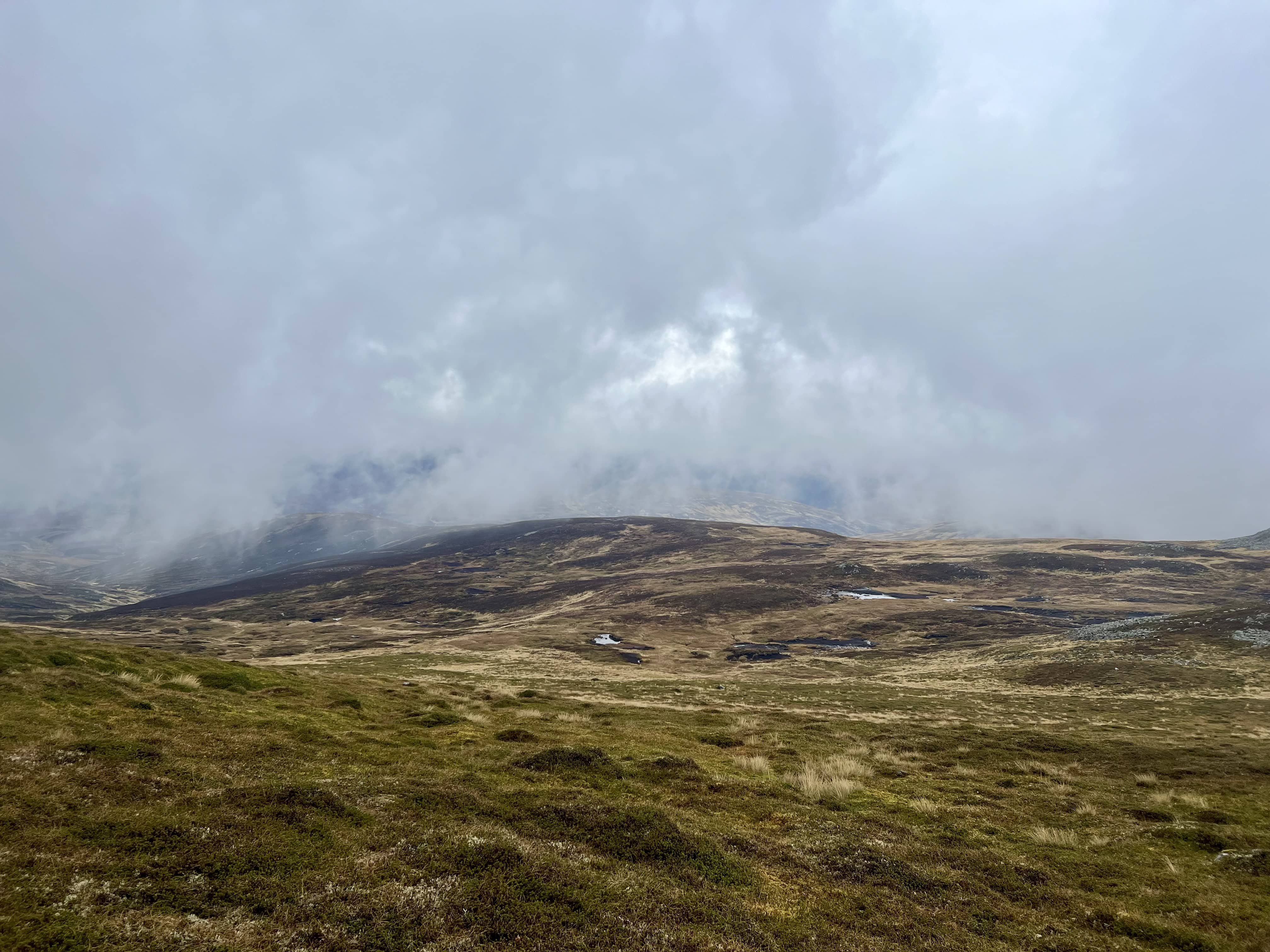
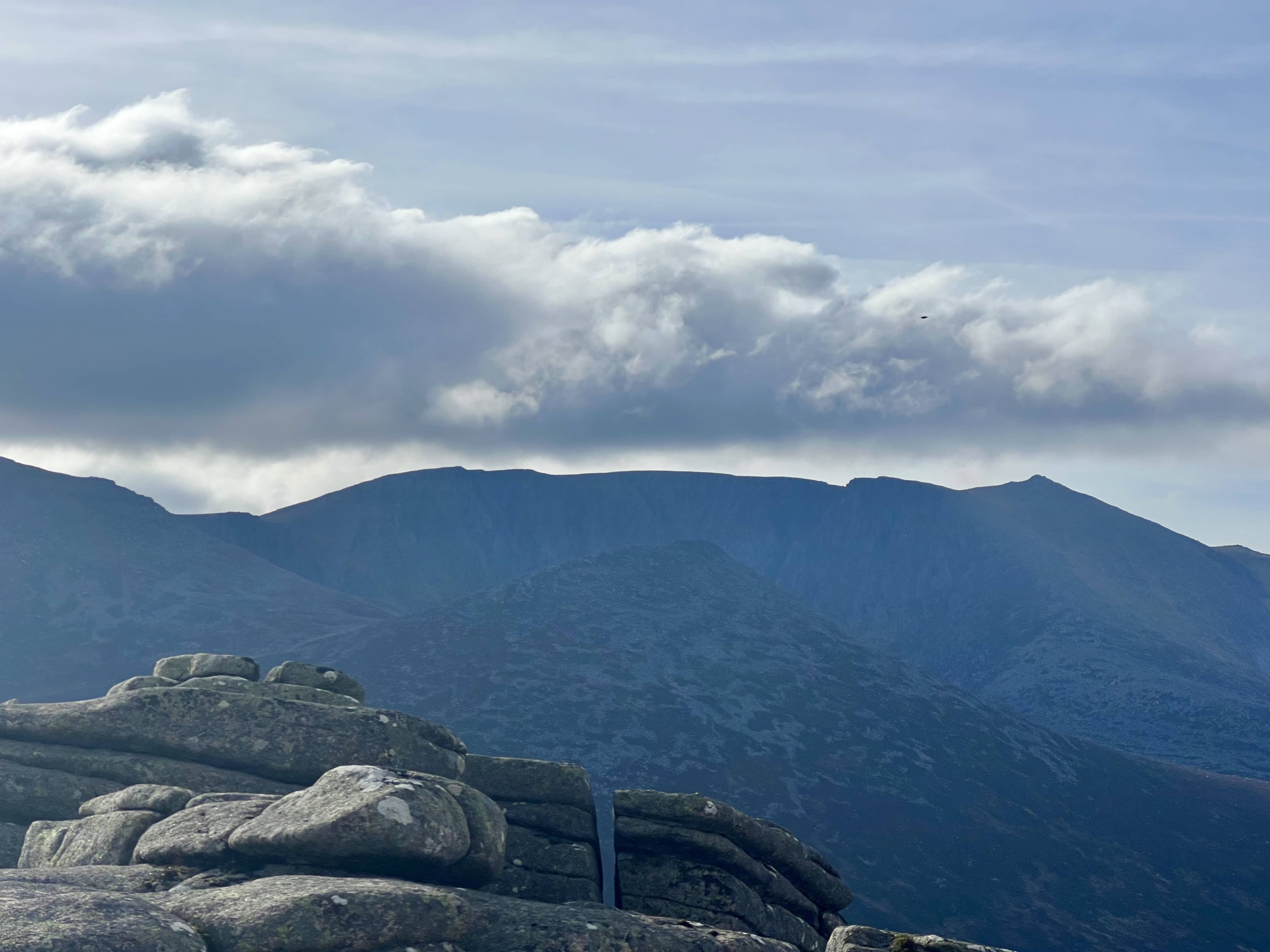
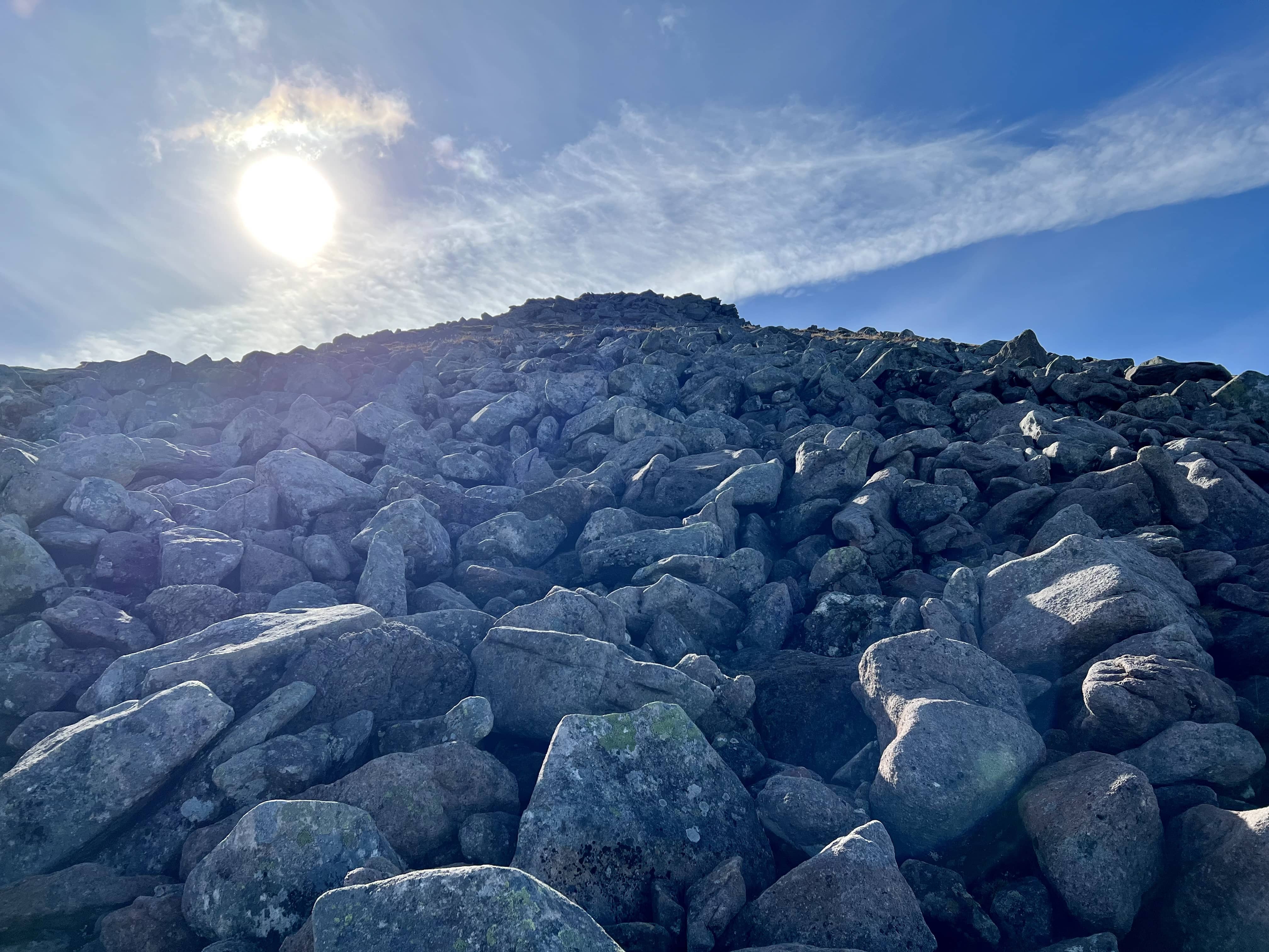
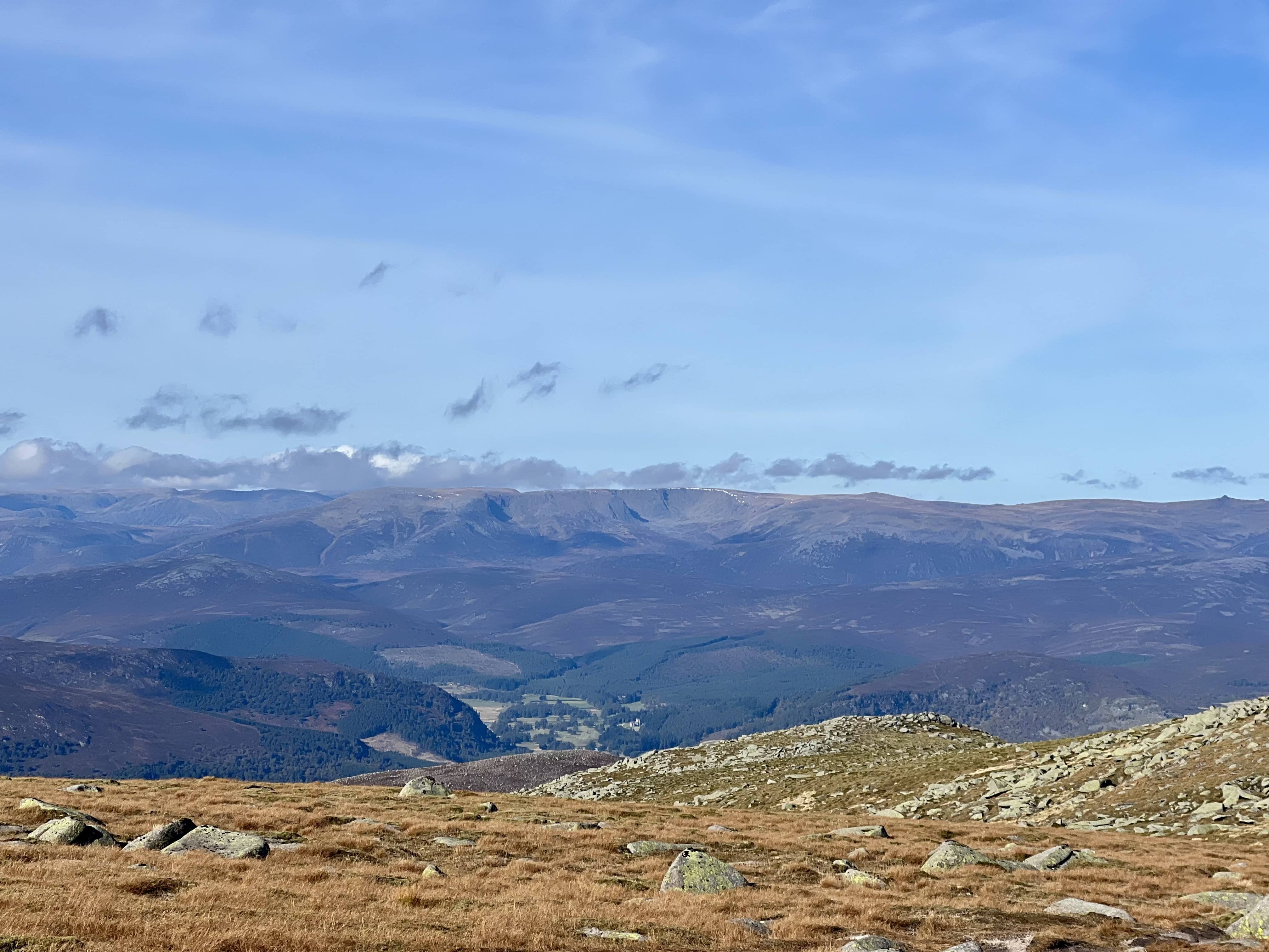
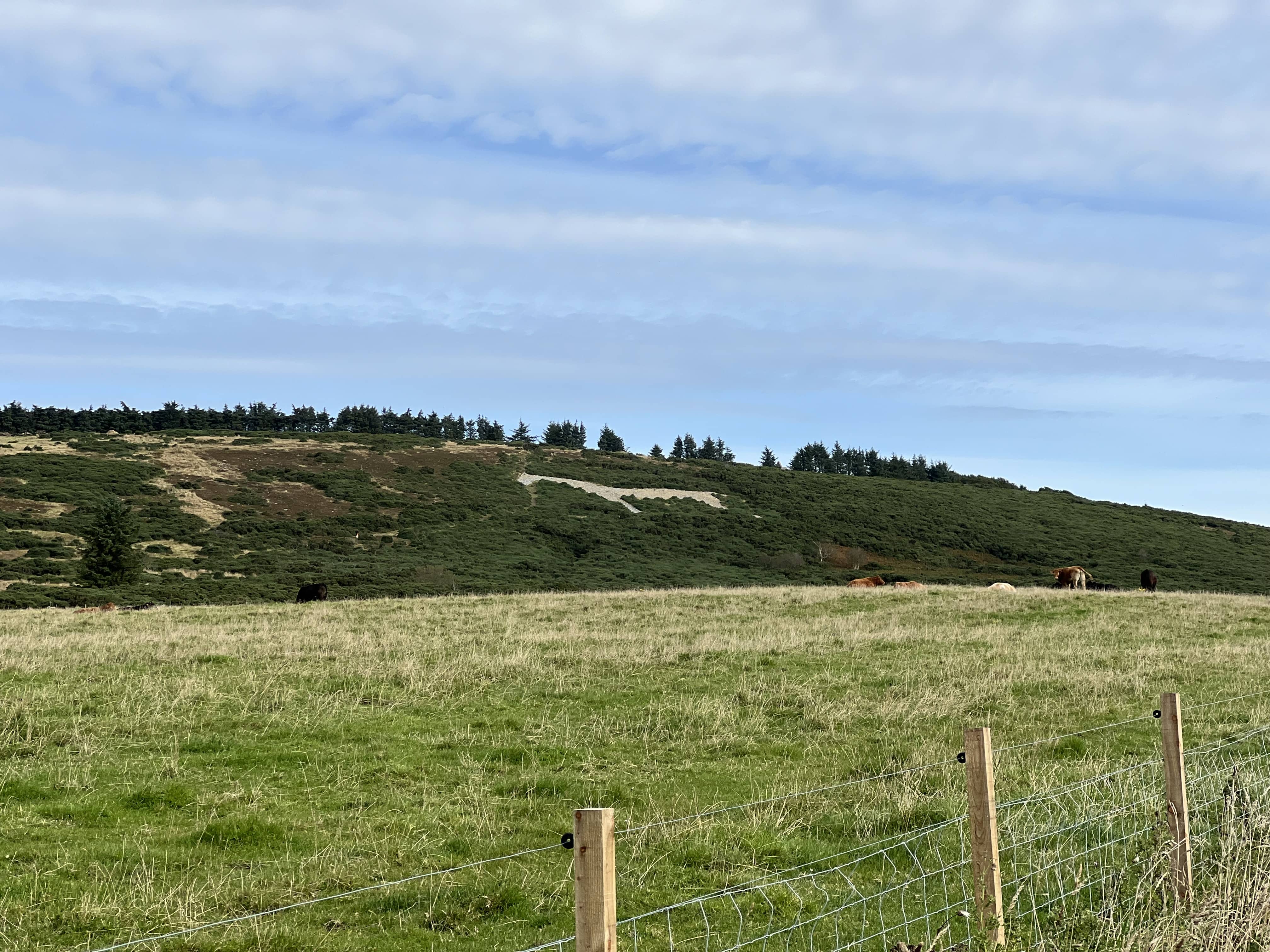
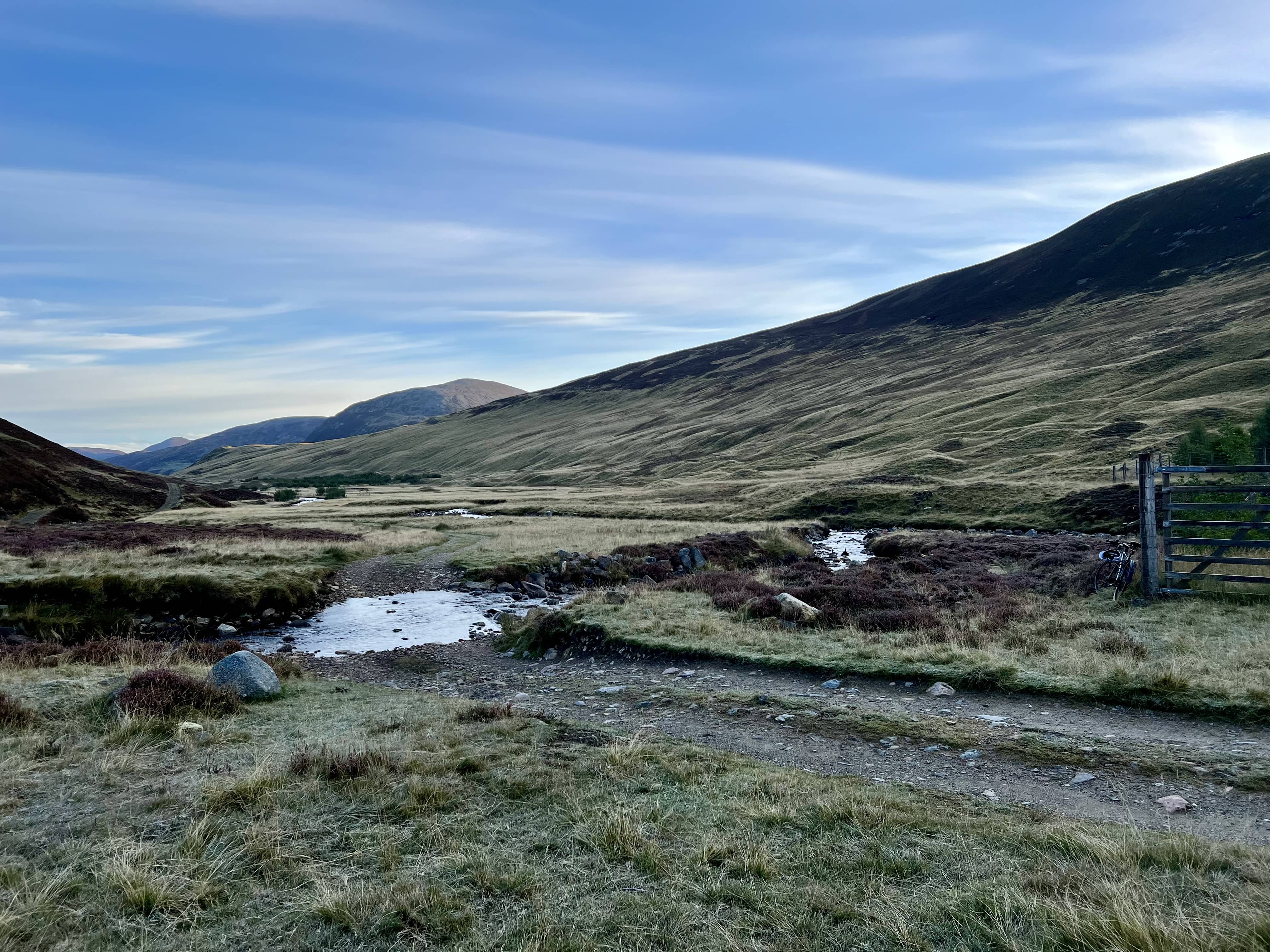
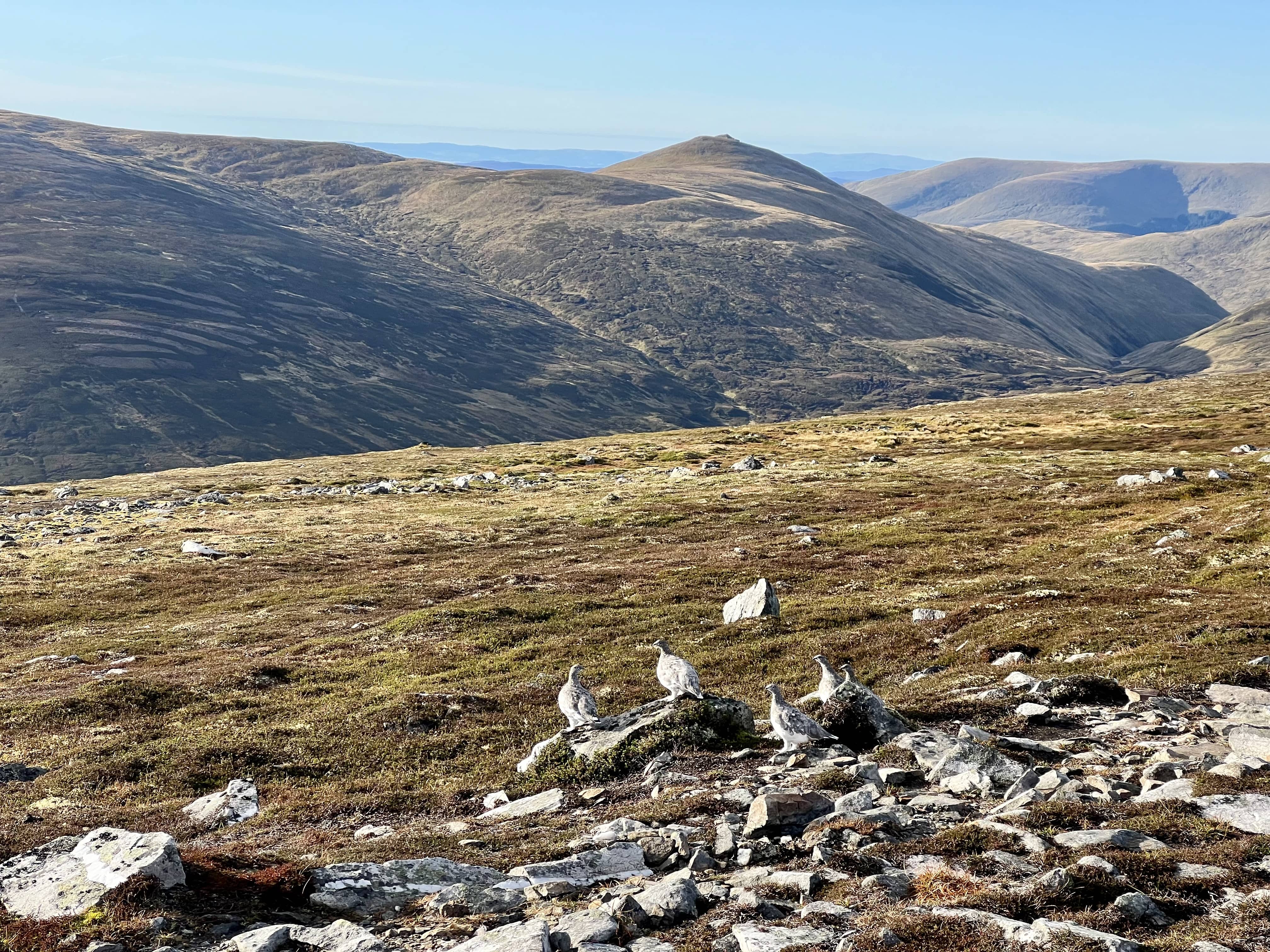
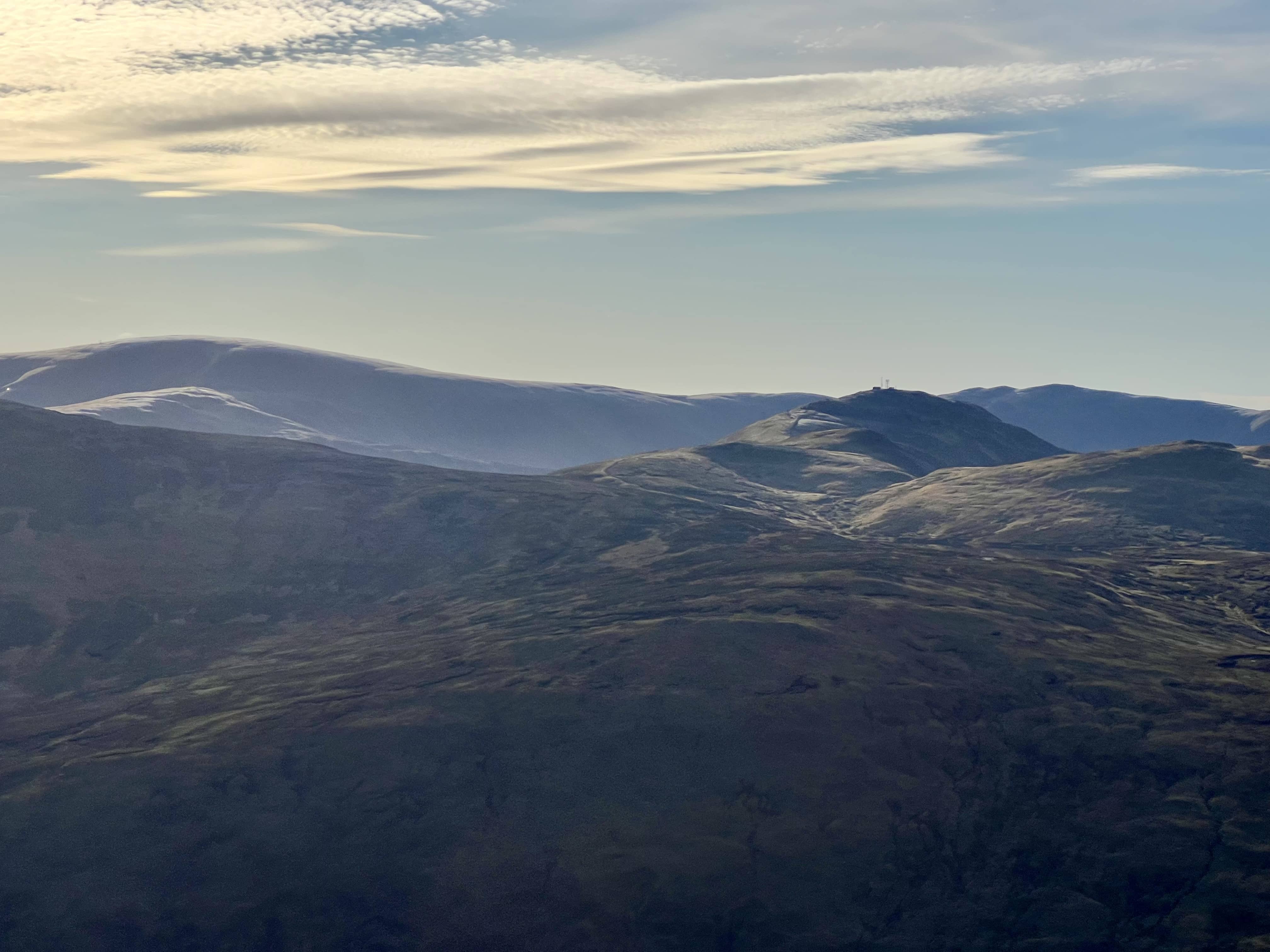
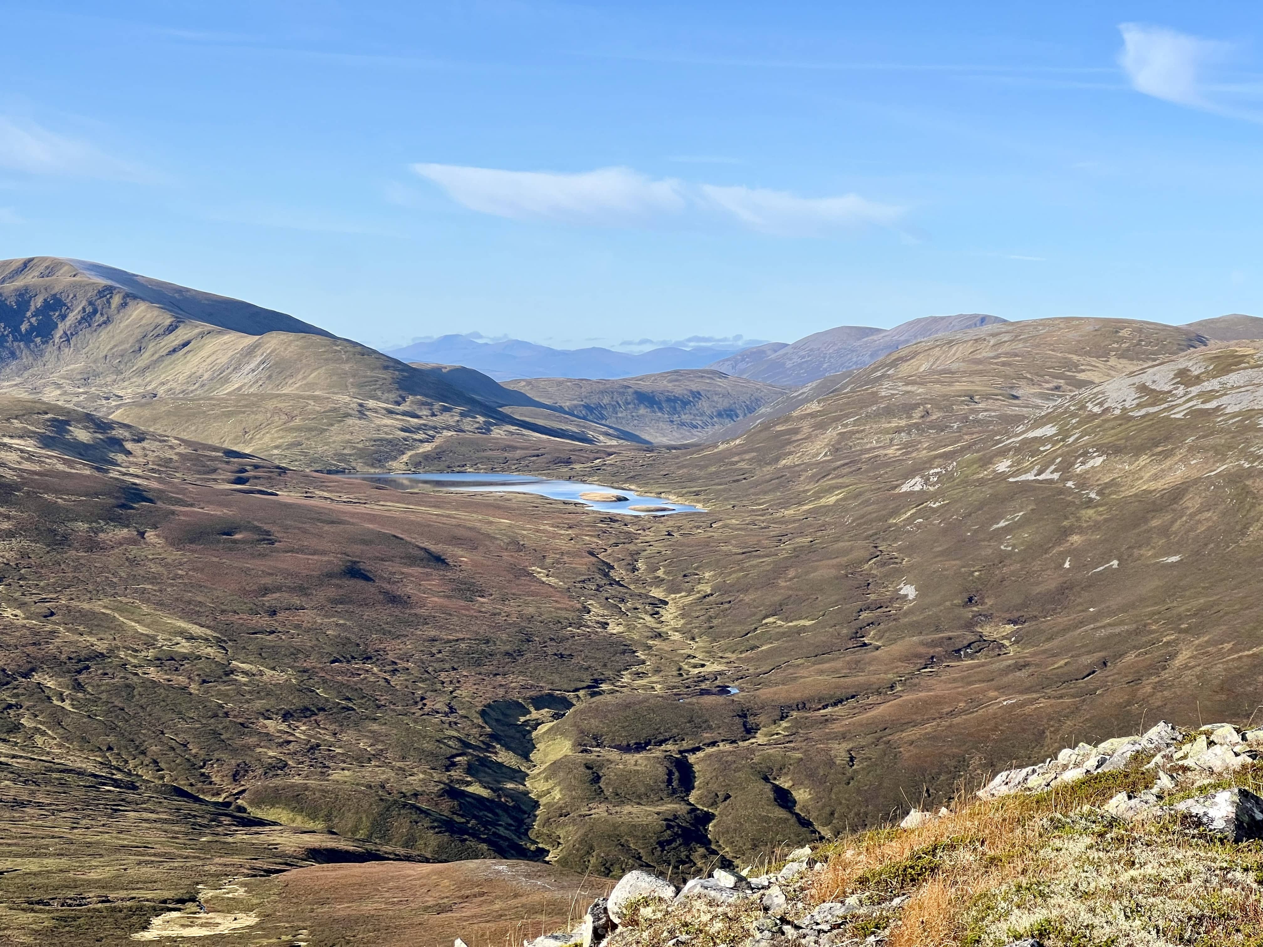
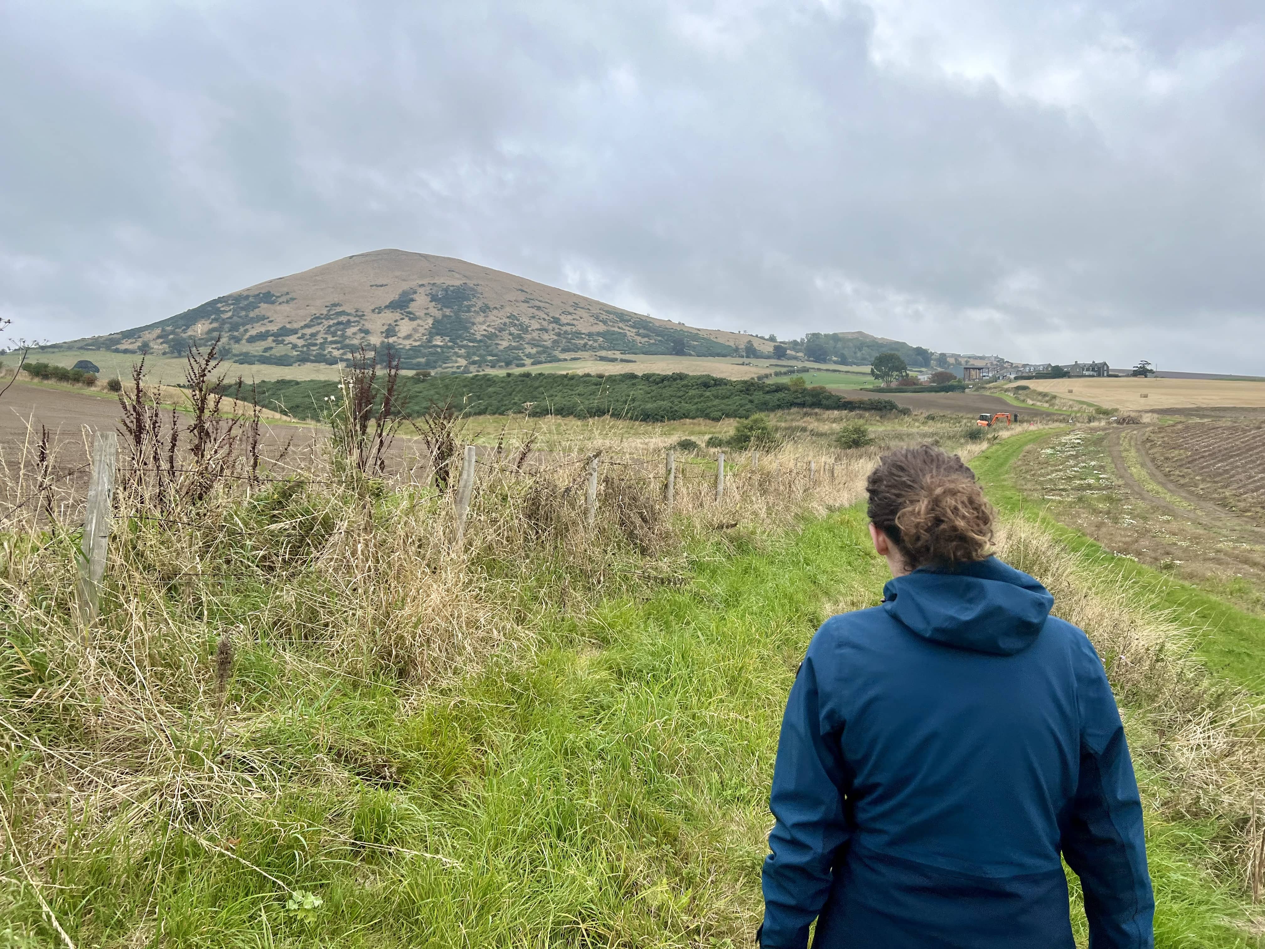
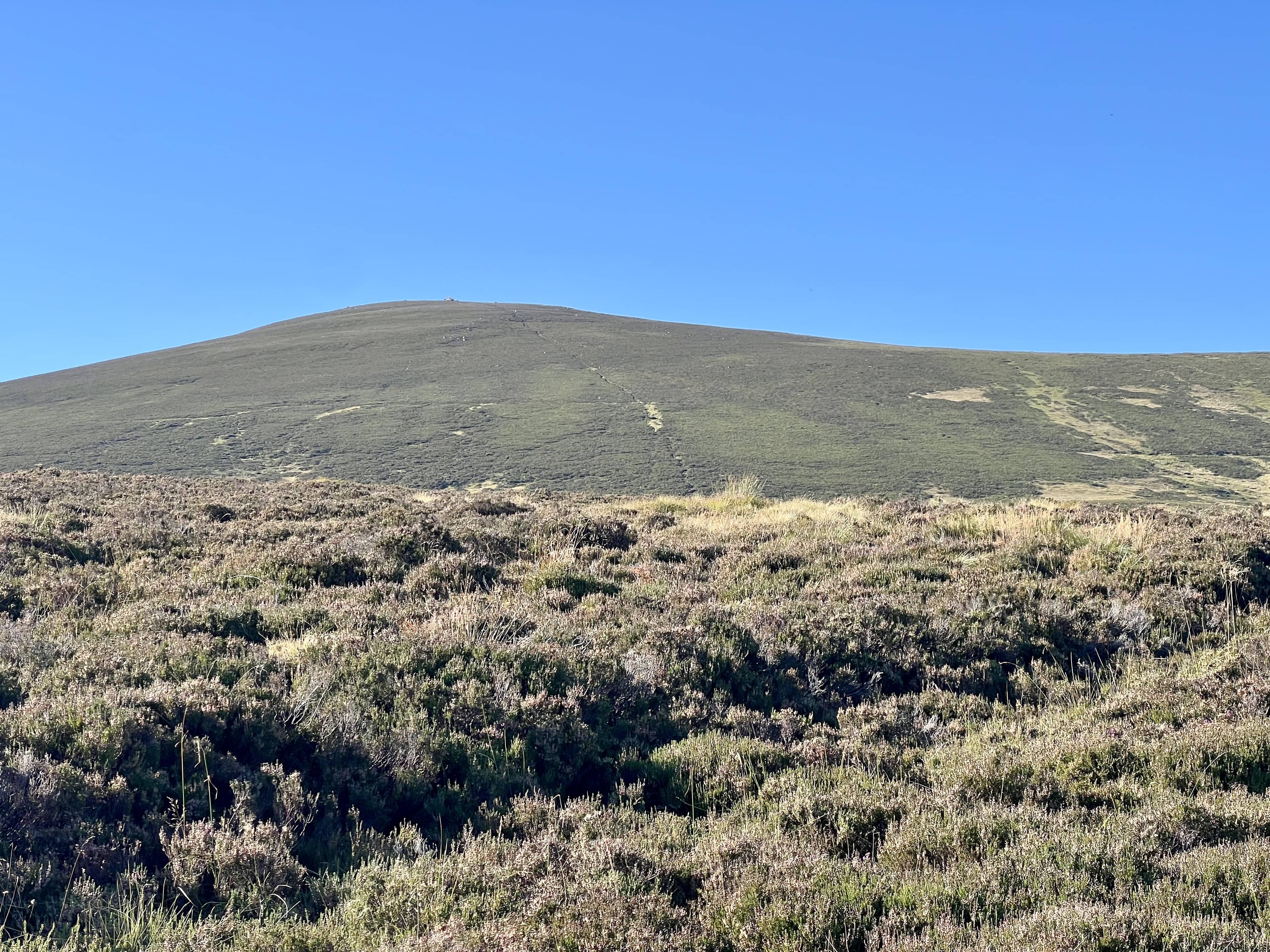
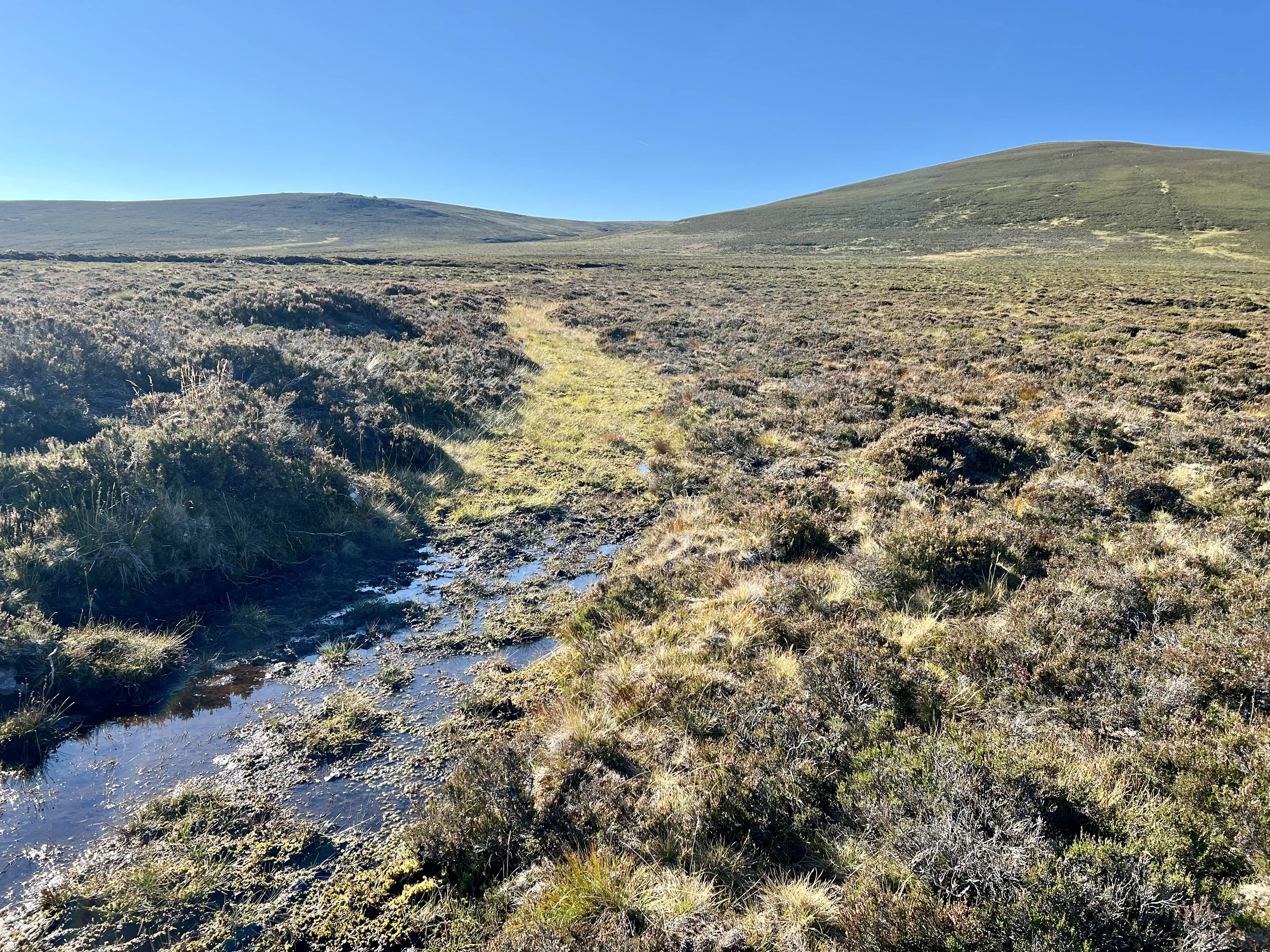
I didn’t see much on the way up, other than about 20m around me, mostly looking like the photo. In exposed places the wind picked up a lot and gave me a good push. At one point I was about 3m from a small loch and I didn’t realise until I was right upon it. The track was decent and only in a few places was it boggy but nothing like The Buck. The final ascent to the summit is steep again after a while of walking on the mostly flat plateau. At this point the wind was howling and I was glad there was a cairn at the top.

Made it!

Made it!

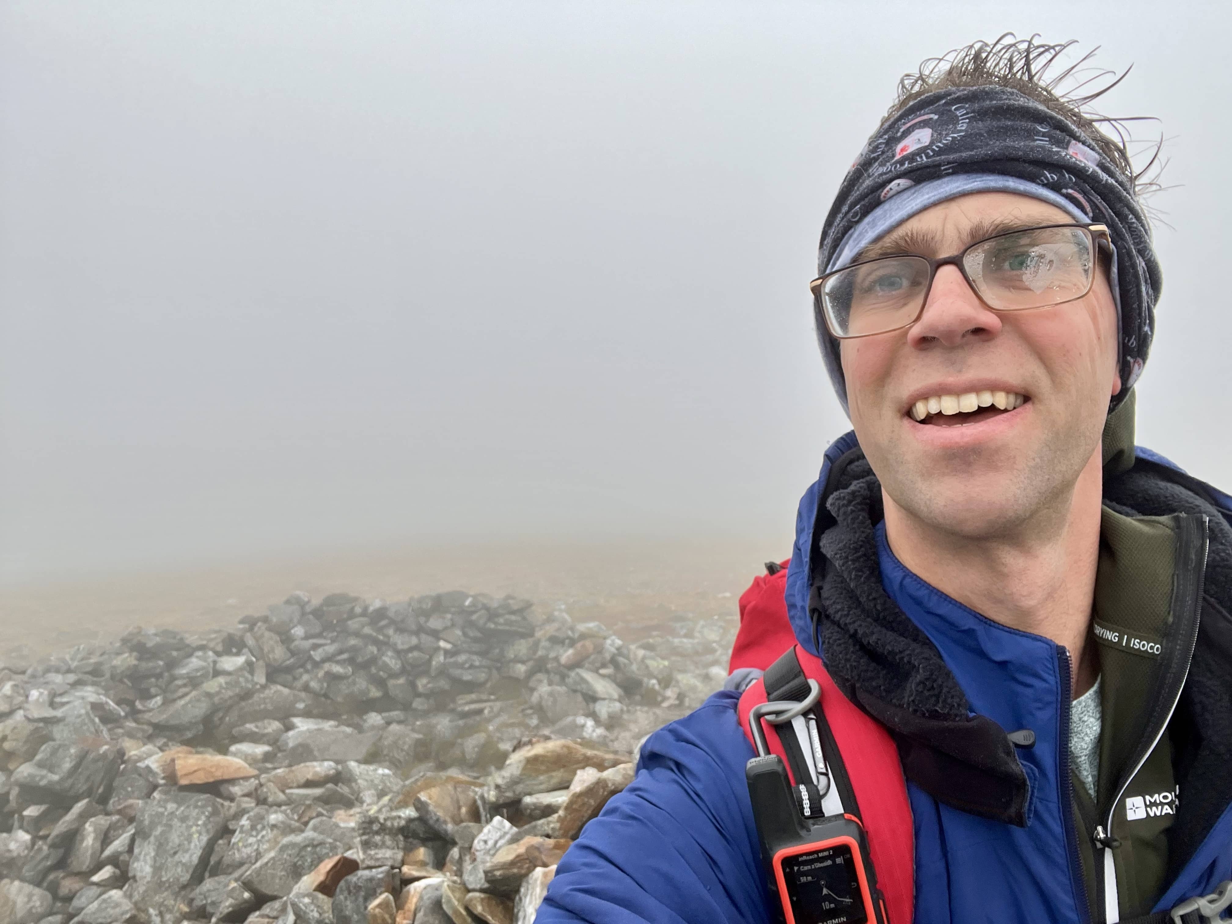
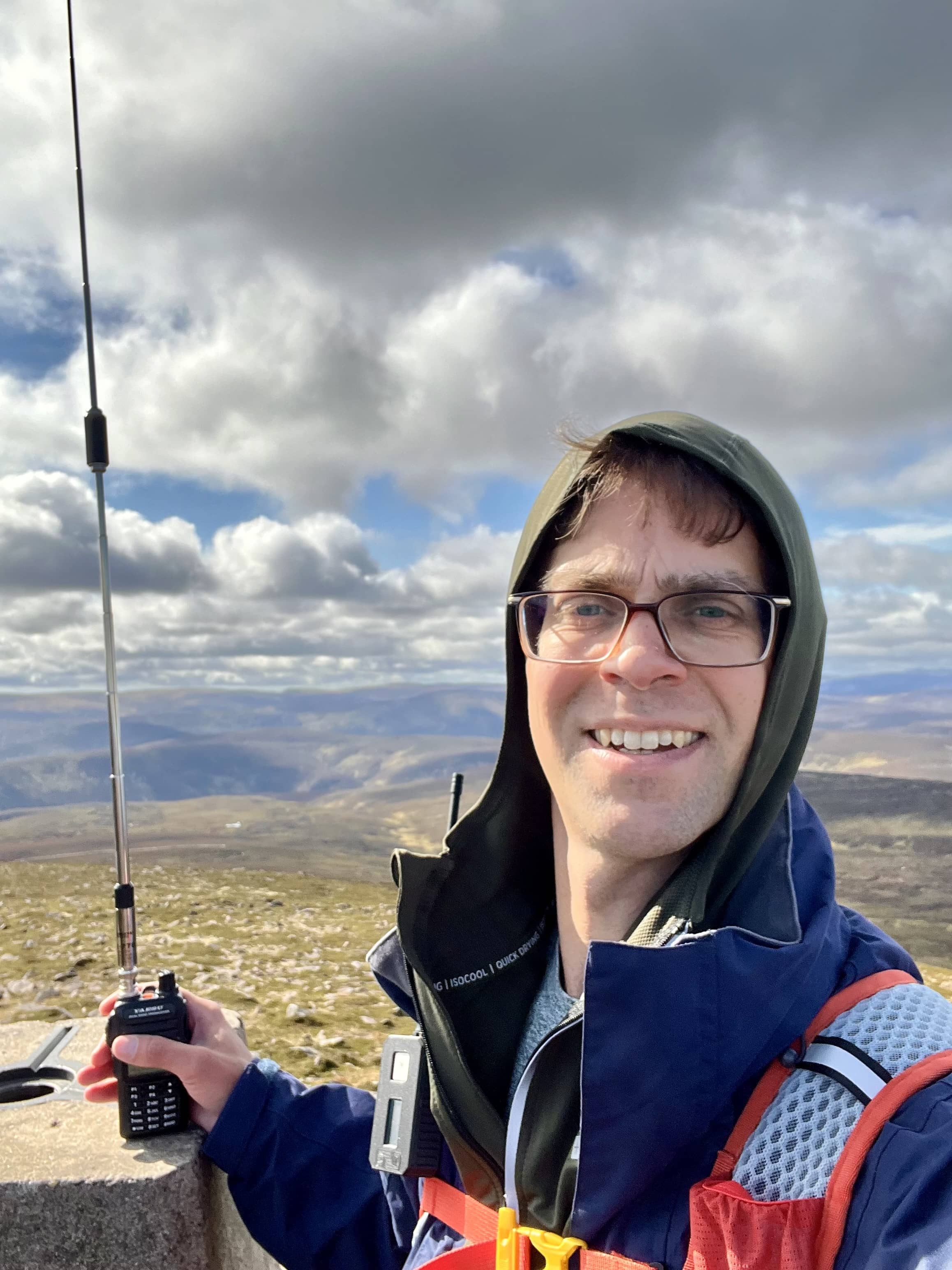
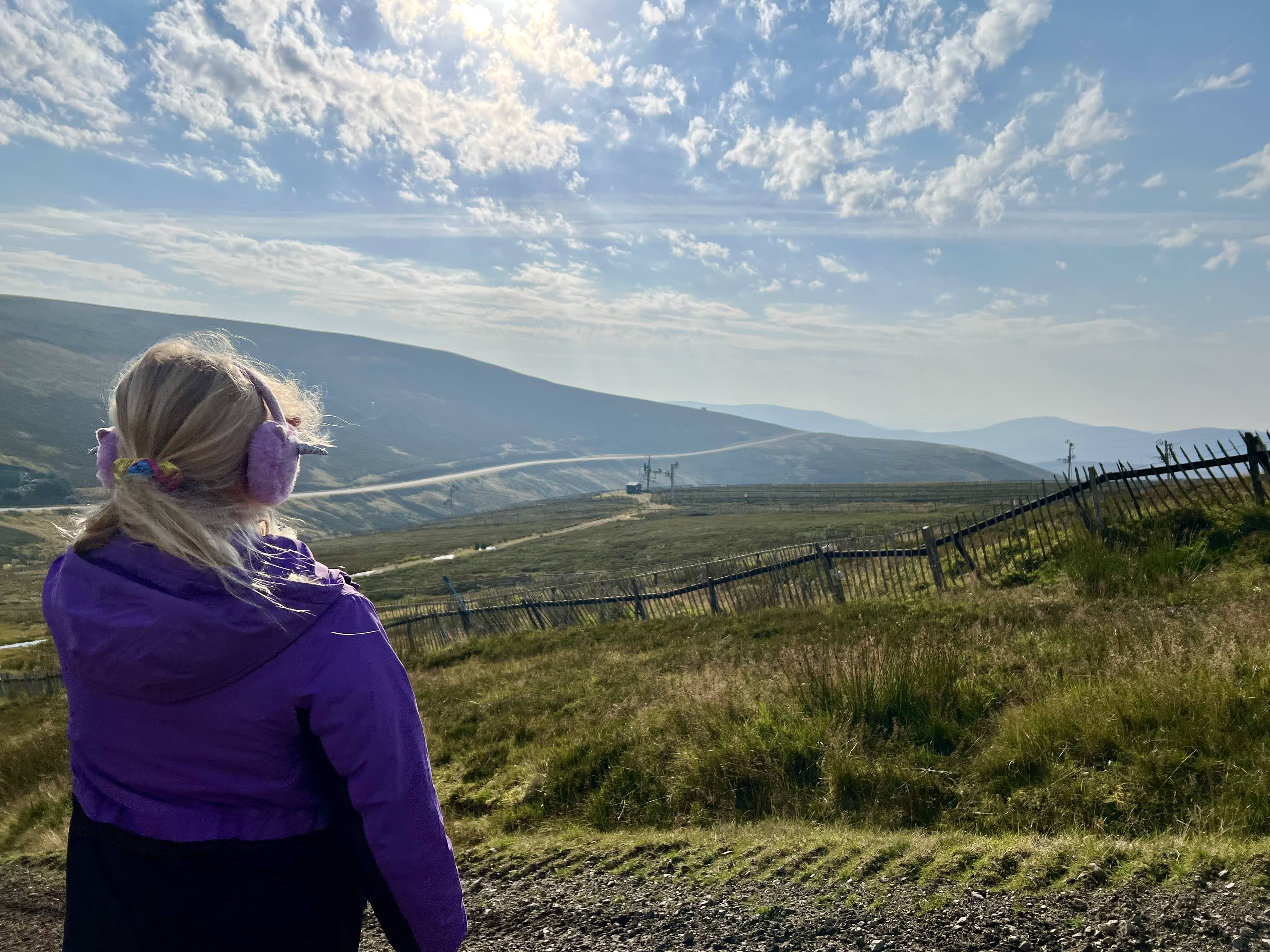
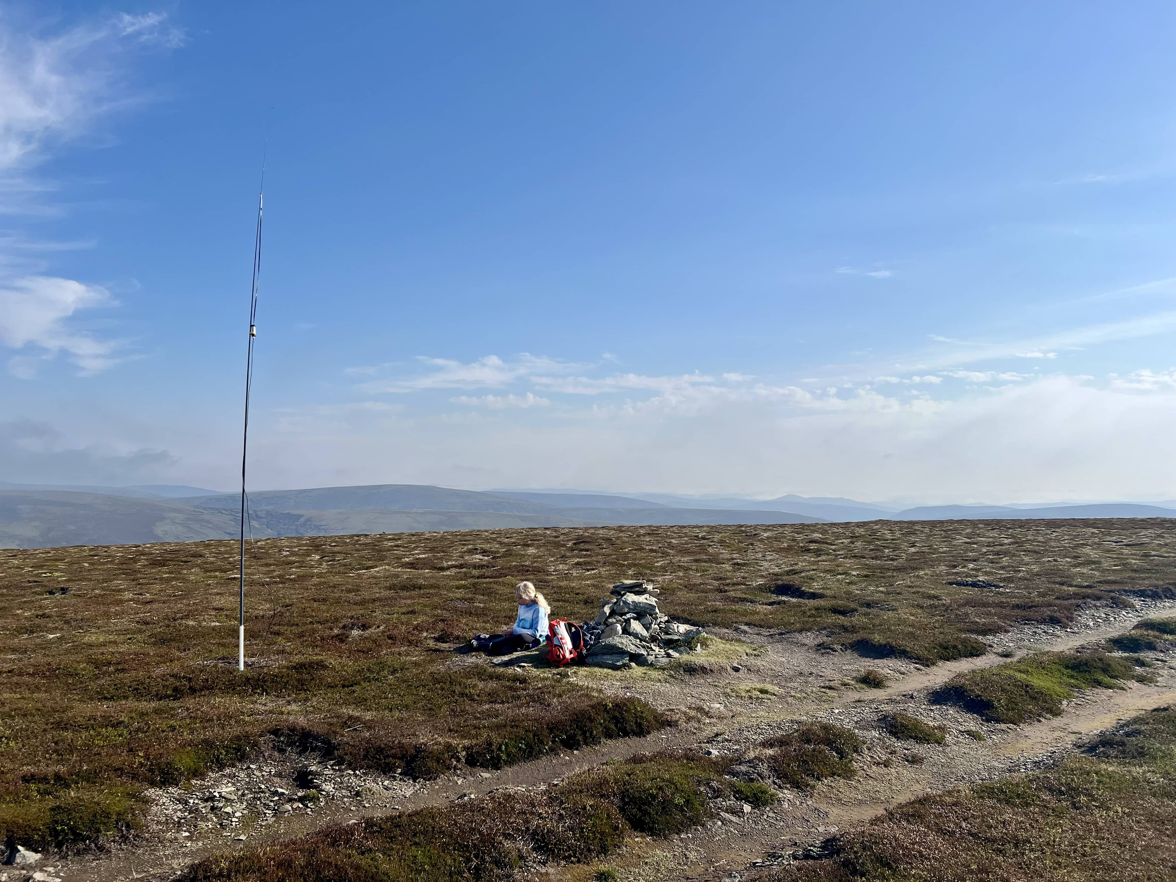
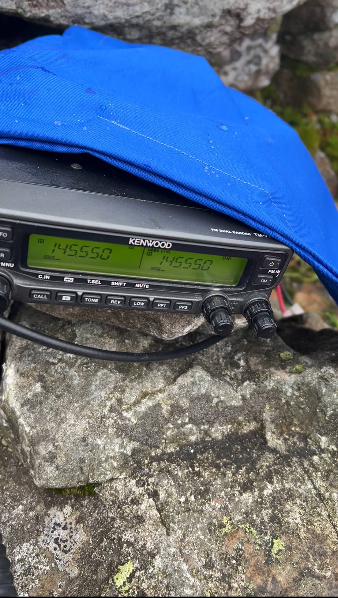
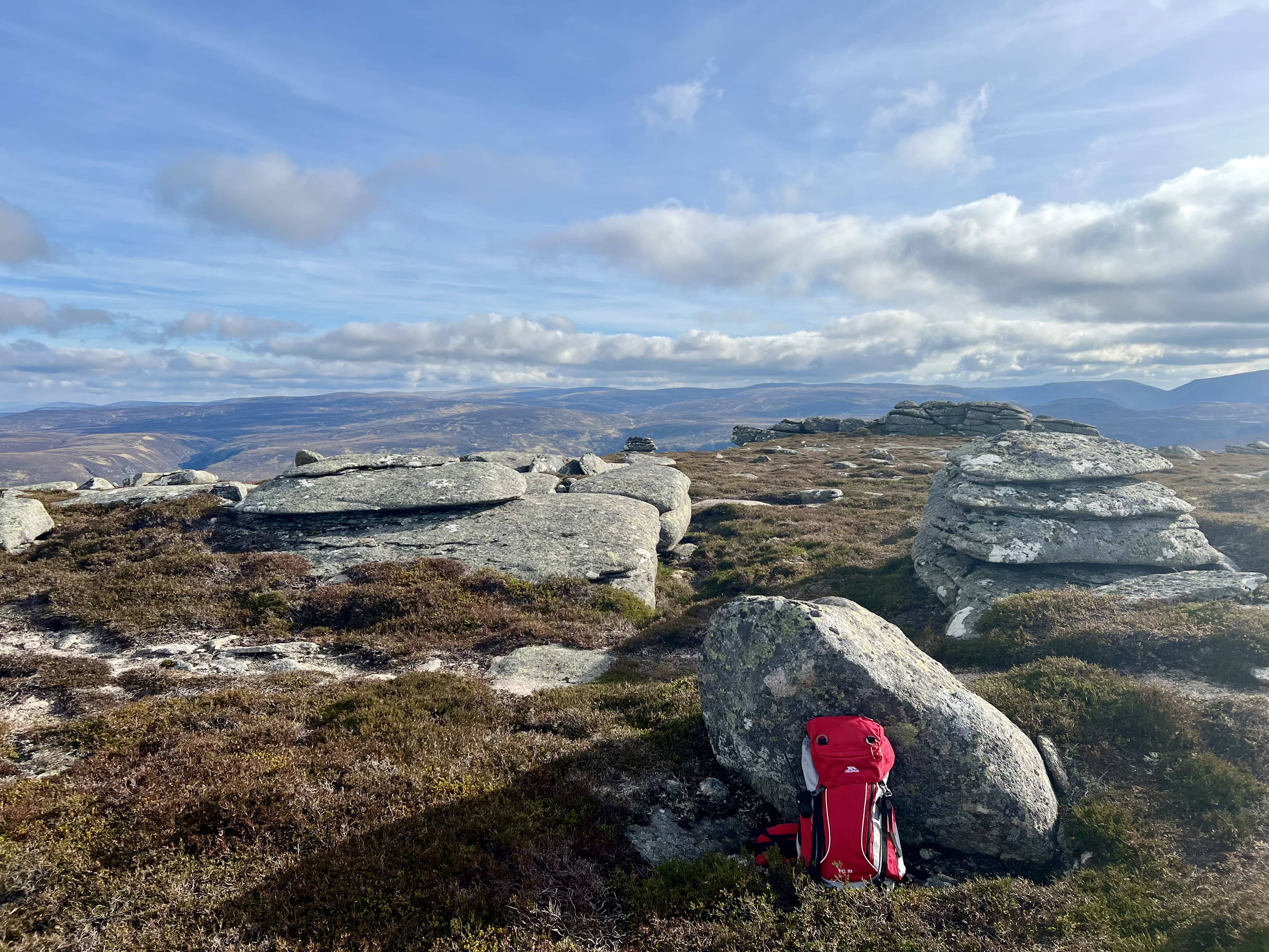
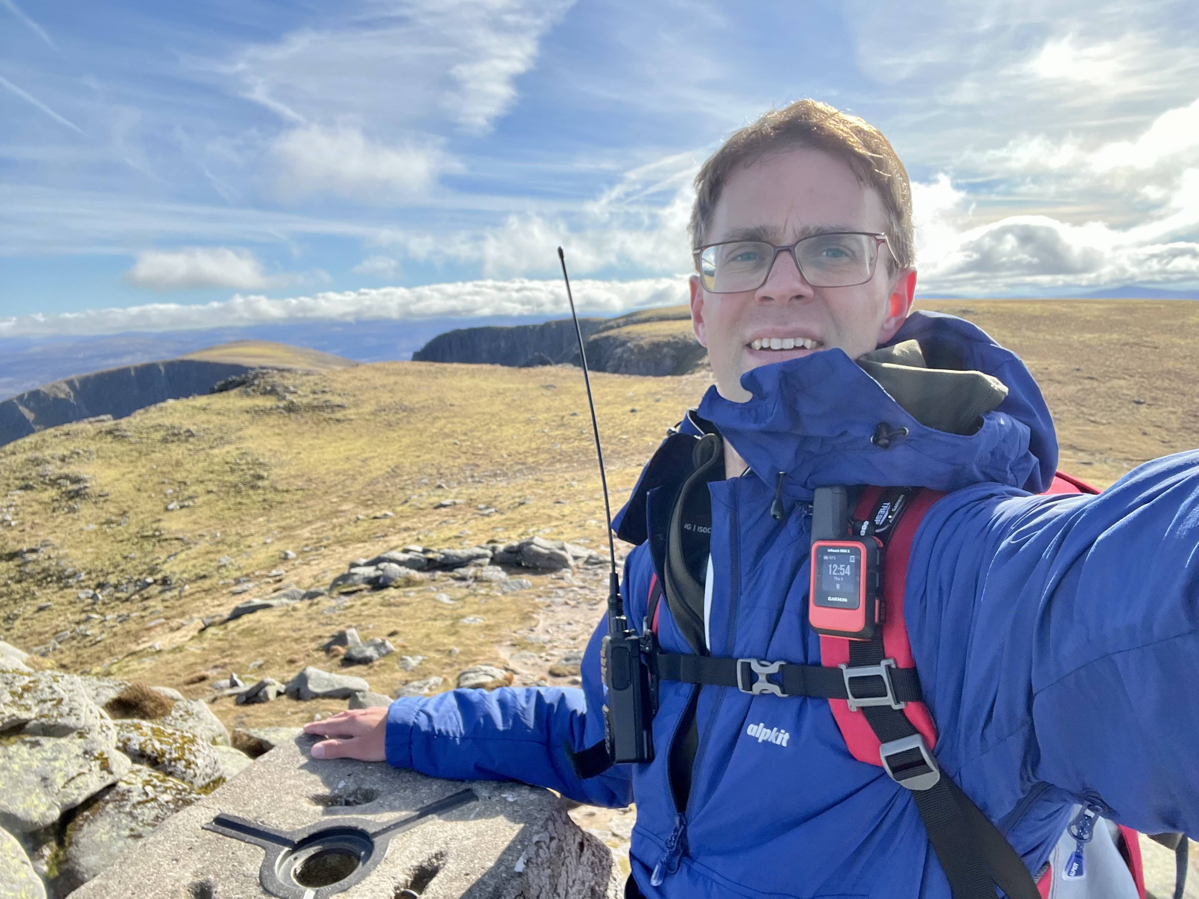
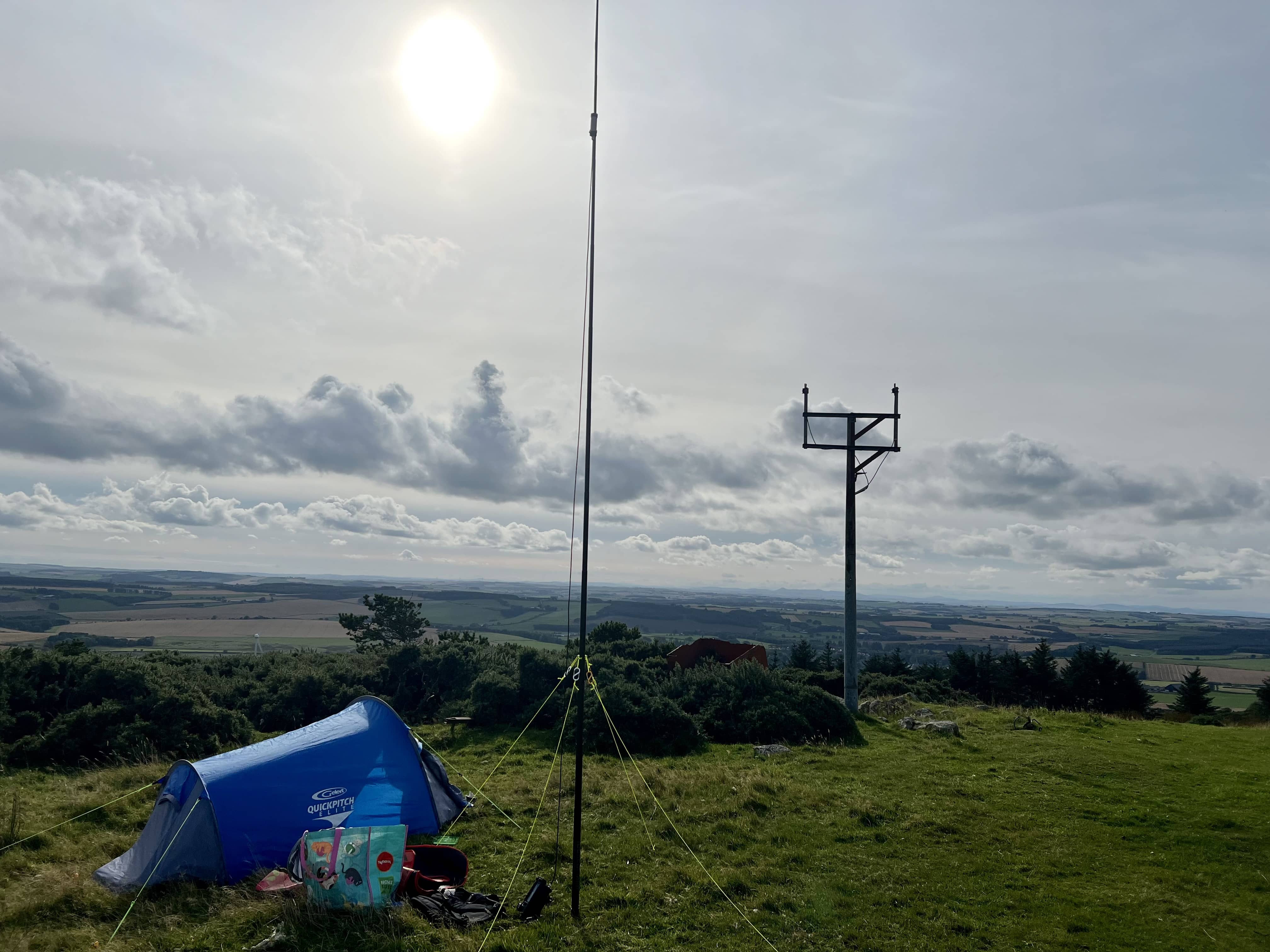
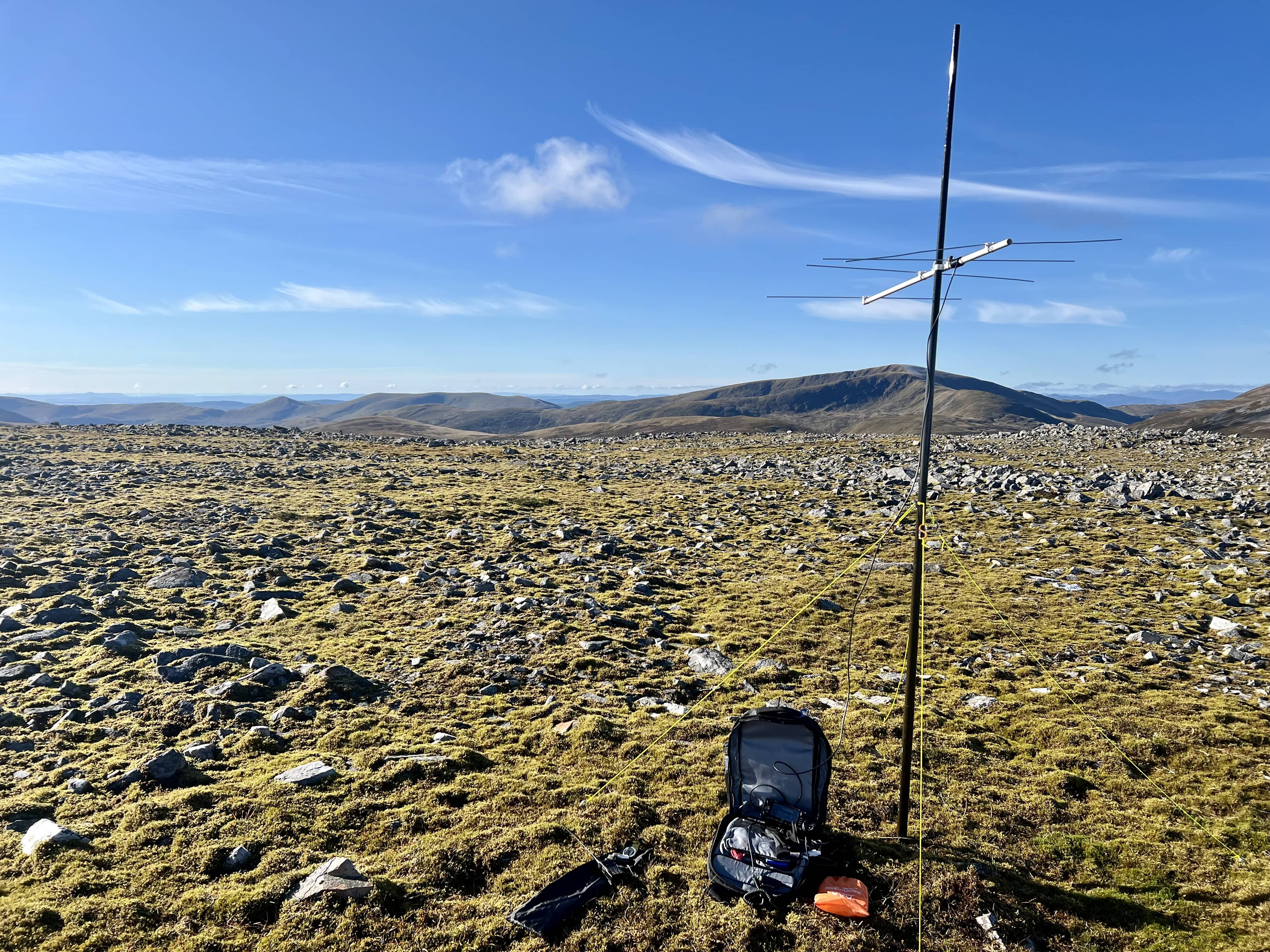
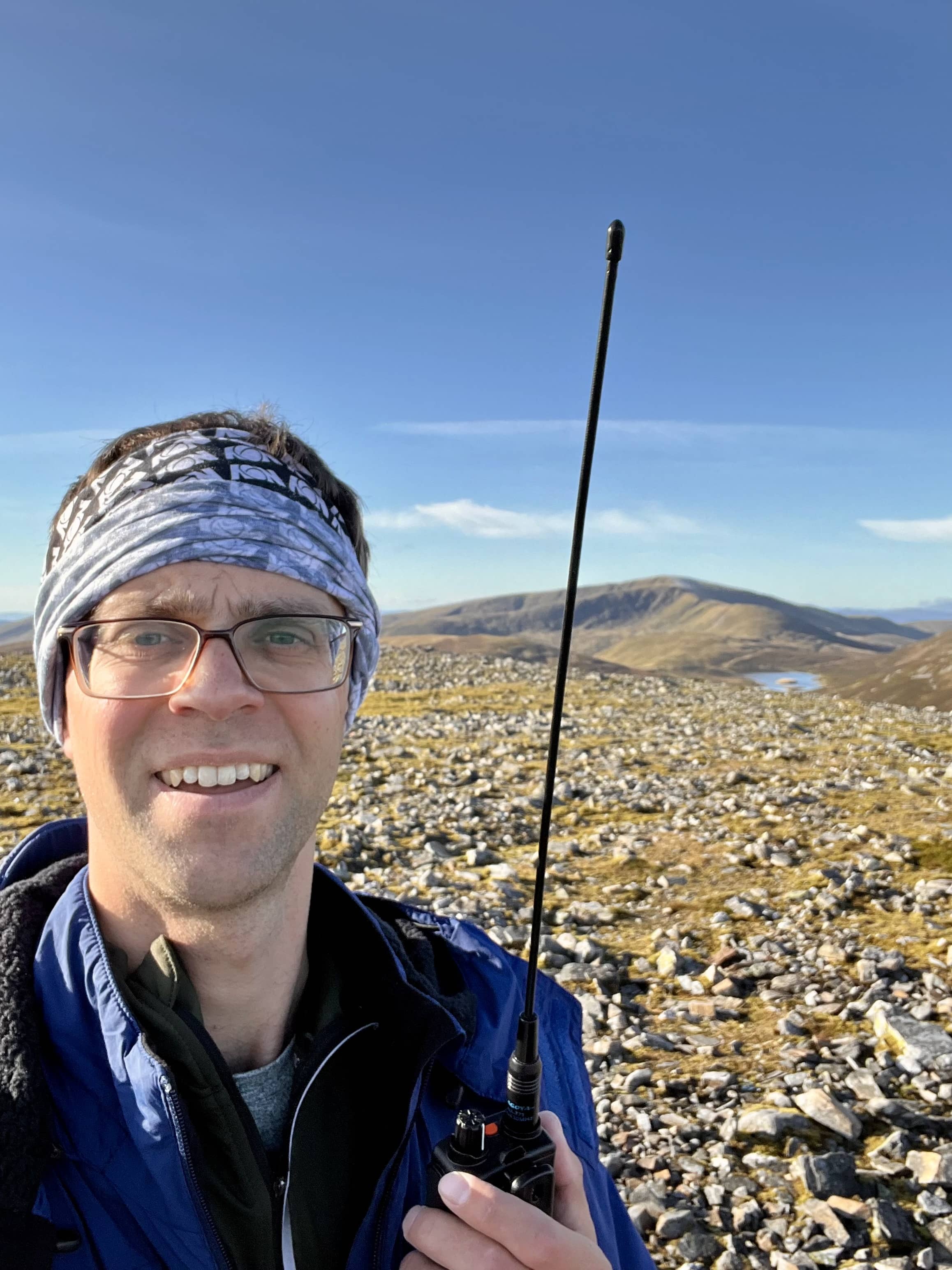
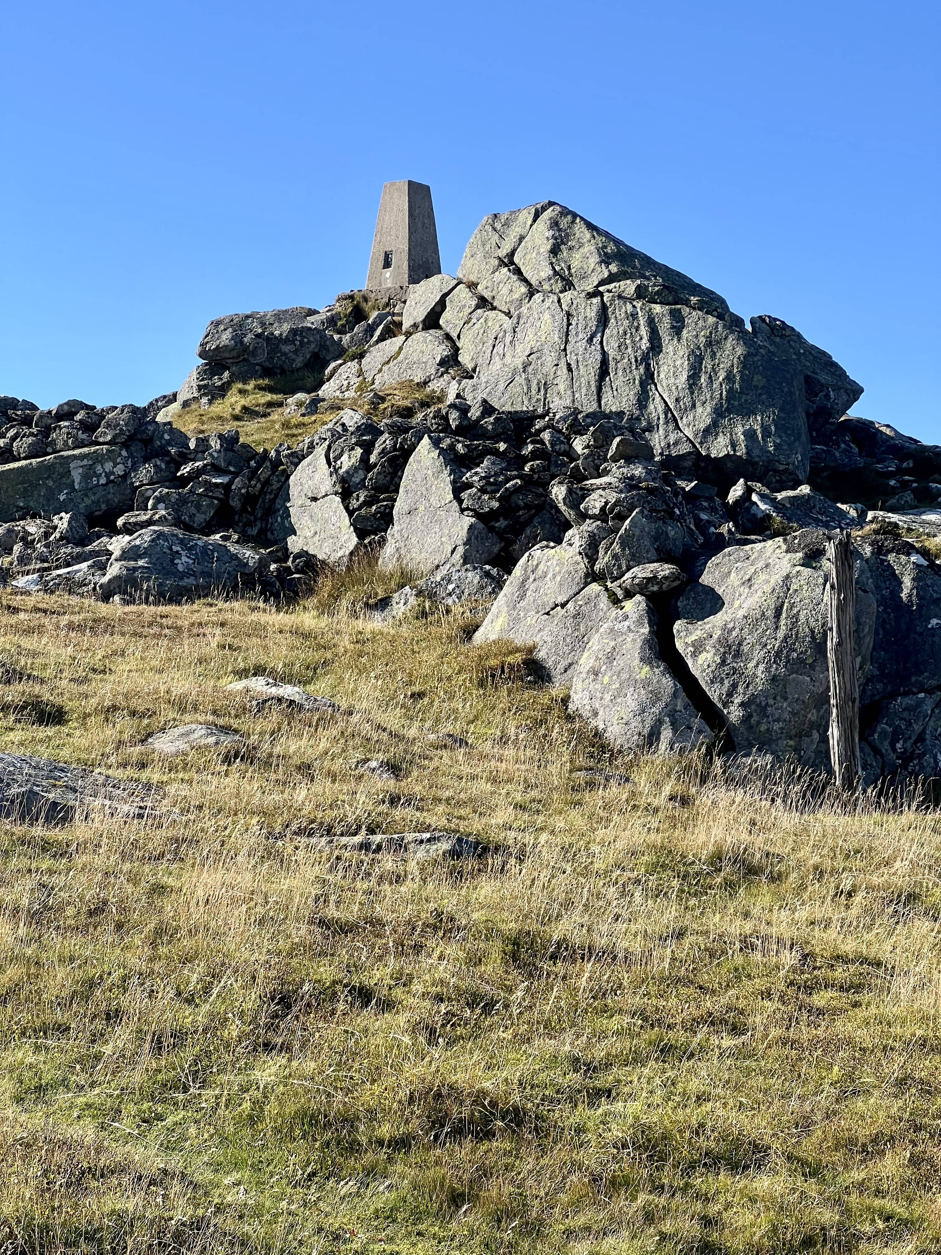
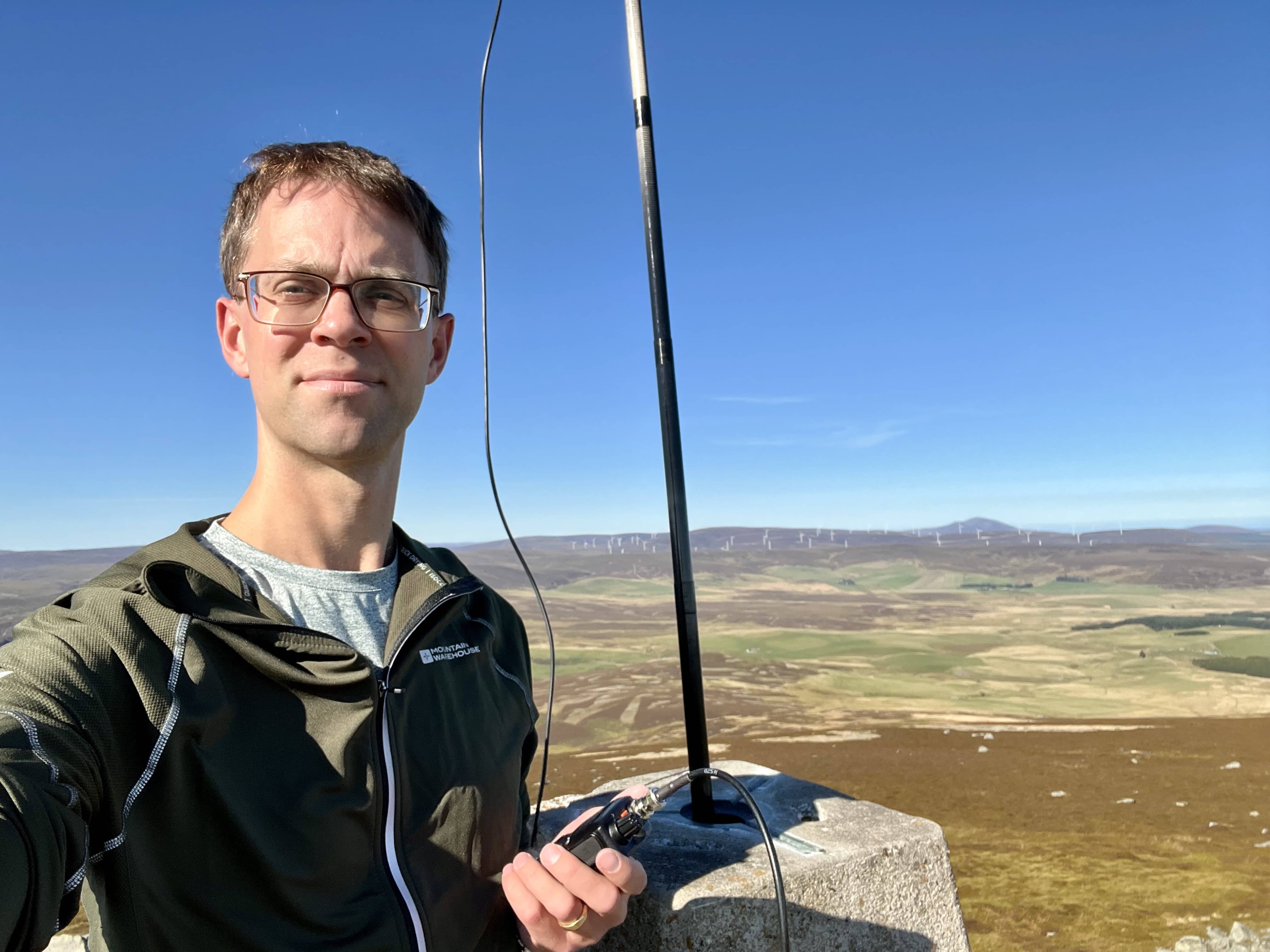
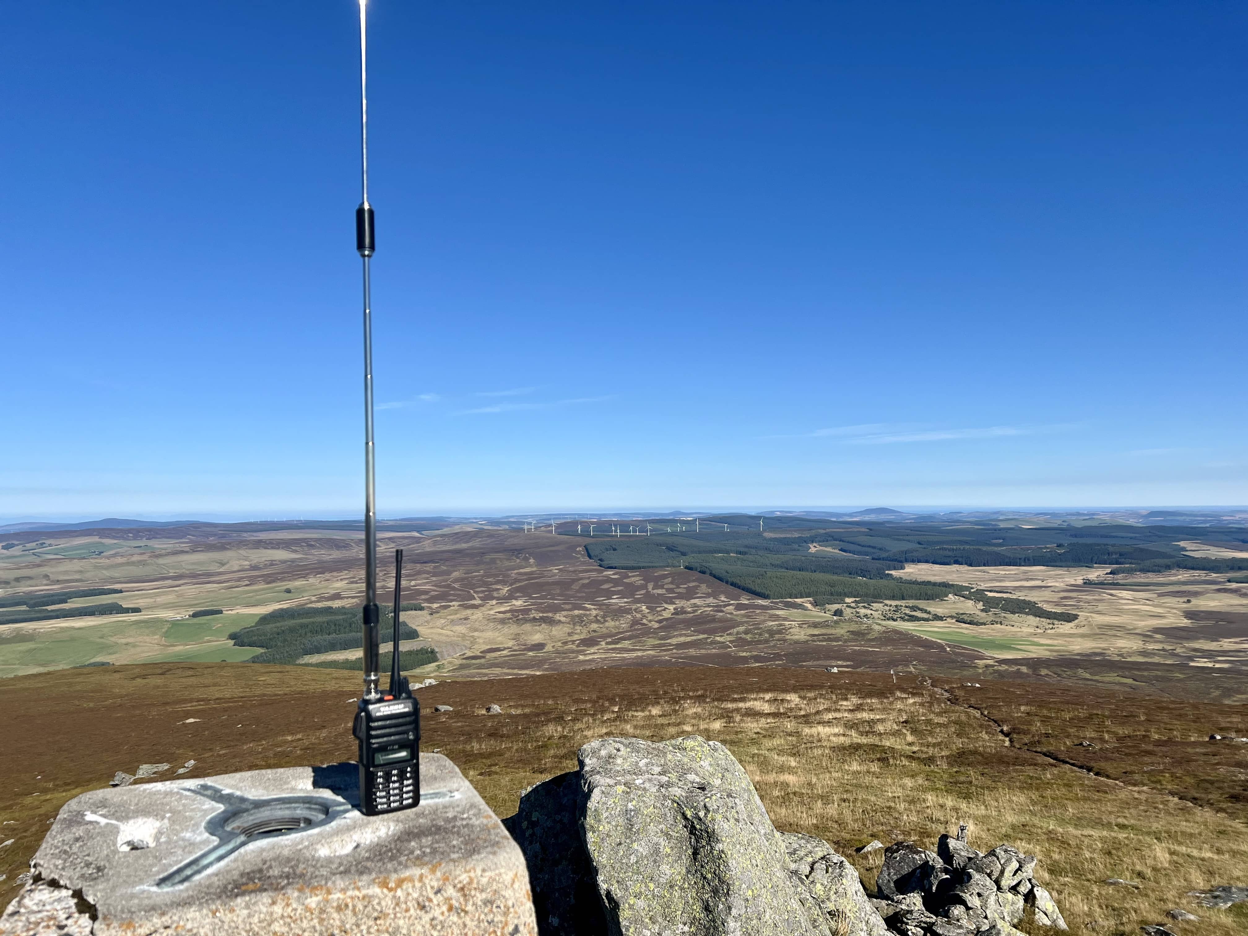
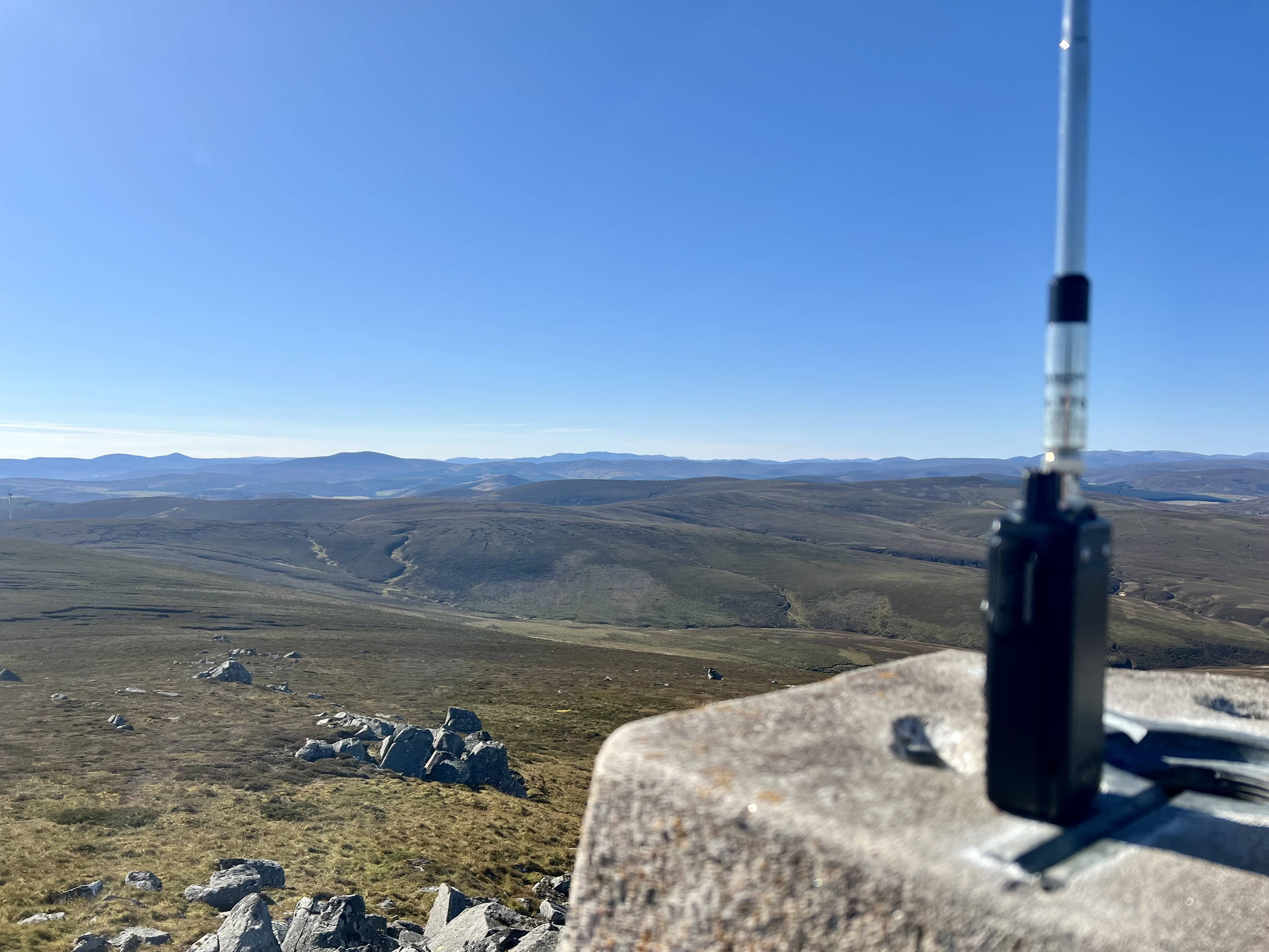
I setup behind the cairn, which was a very good shelter from the wind, had a sandwich and then got on the air. I thought I’d try a bit more power on 2m and see if I could get any further than usual. I’d brought the Kenwood V71 and battery. This is the first time I’ve taken it out with me, and I also haven’t used it much at home, so I was hoping I wouldn’t get into any operating issues with it! I had the slim G, and was glad I hadn’t brought the yagi to try and setup in the wind.

Wind battered carbon mast

Wind battered carbon mast

Kenwood V71, trying to keep dry

Kenwood V71, trying to keep dry

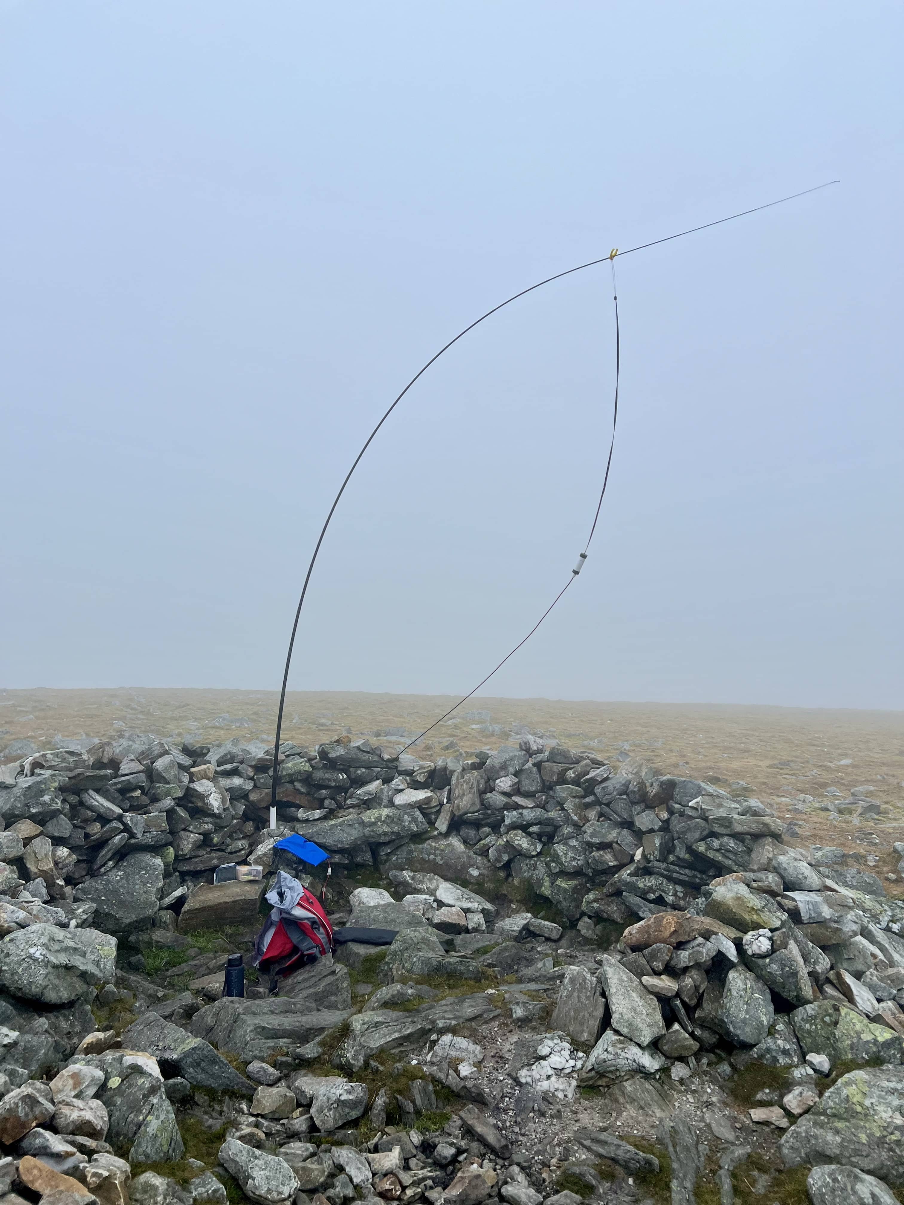
I now wonder if I’d setup the mast on the outside of the cairn pointing into the wind, if I could’ve made it more vertical. Particularly as right at the end the antenna got blown off and I ended up holding it with my arm to finish the QSO - I didn’t do an EMF assessment on that setup…

QSOs

QSOs

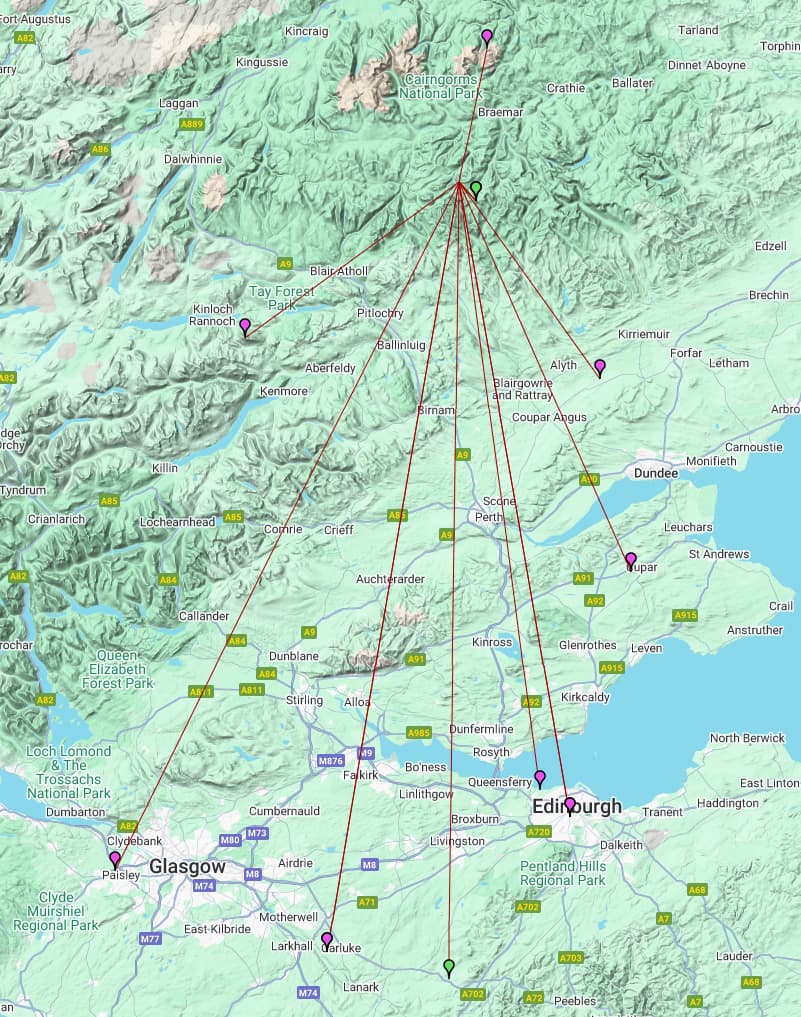
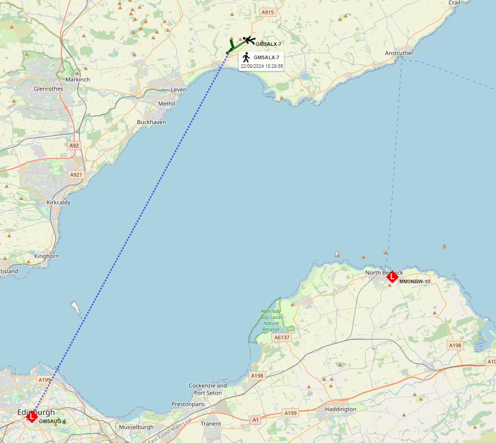
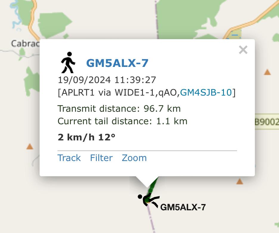
It was a little slow to start, but eventually I’d work 9 stations, including GM4OAS 90 miles to the west in Mallaig. I did find the lowest squelch on the V71 was quite high and not breaking for several stations. I eventually turned it off and then heard several locals and others. I do wonder how many had been replying to my CQs before. Did 50W make any difference? The map looks remarkably similar to when I was on Glas Maol, and that was with the 5W D72 handheld. Technically, it’s 10 dB which is 1.x S points, and on Glas Maol GM4OAS gave me 32 and this time he gave me 42, so whilst not more power, I was readable more? I do like the form factor of using the mobile rig with the fist mic, means I can position things easier than being tied directly to the end of the mast, but probably for the most part it makes no real difference and it’s all in my head!

Cloud clearing…for a moment

Cloud clearing…for a moment

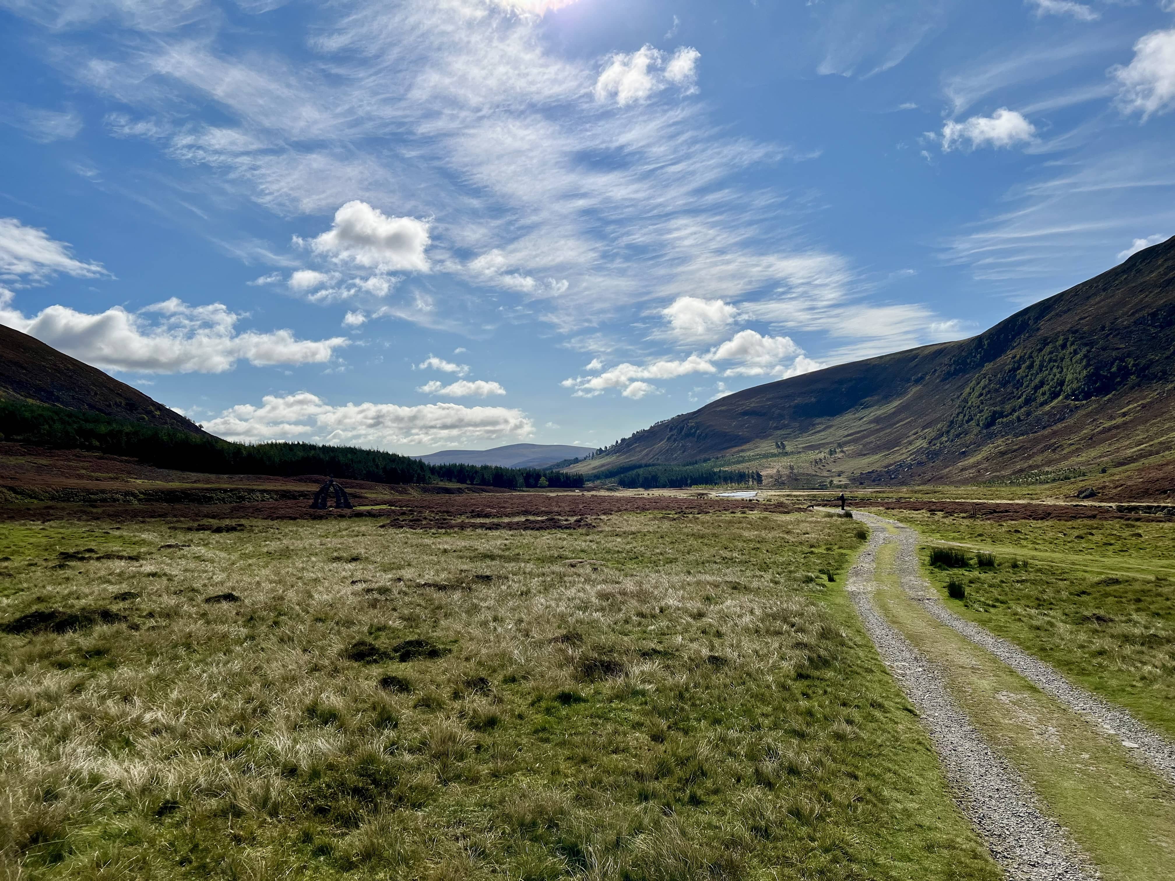
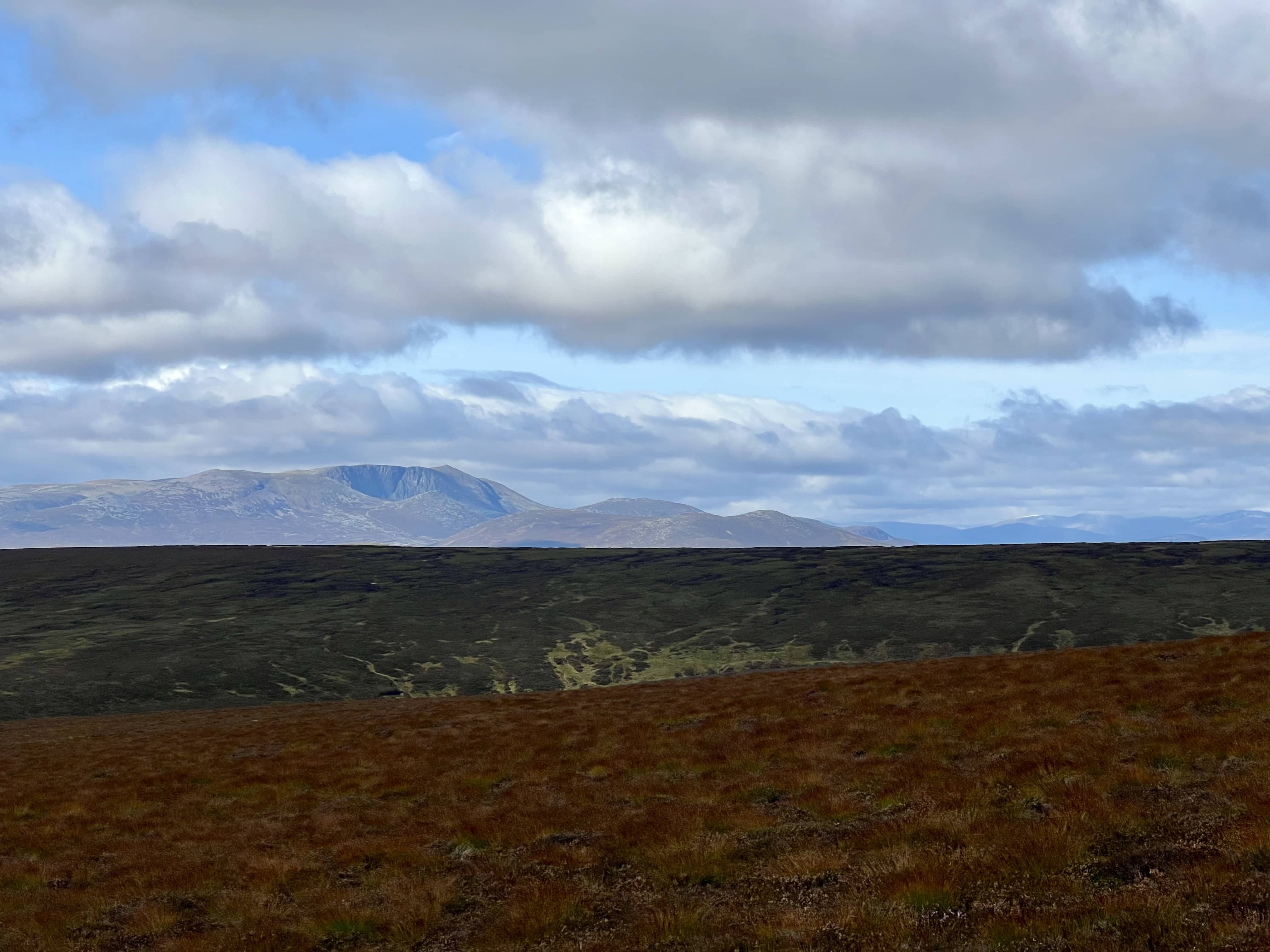
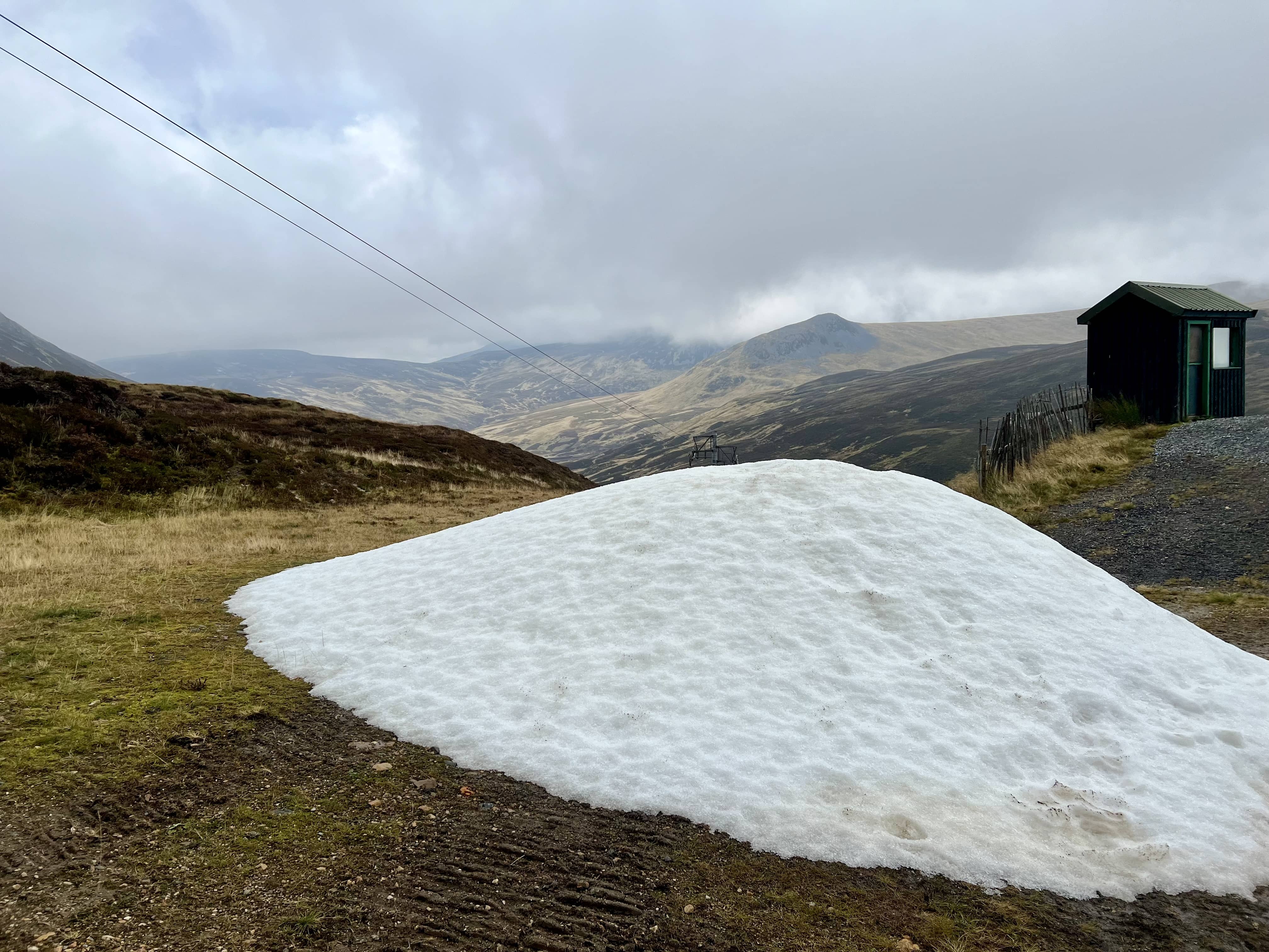
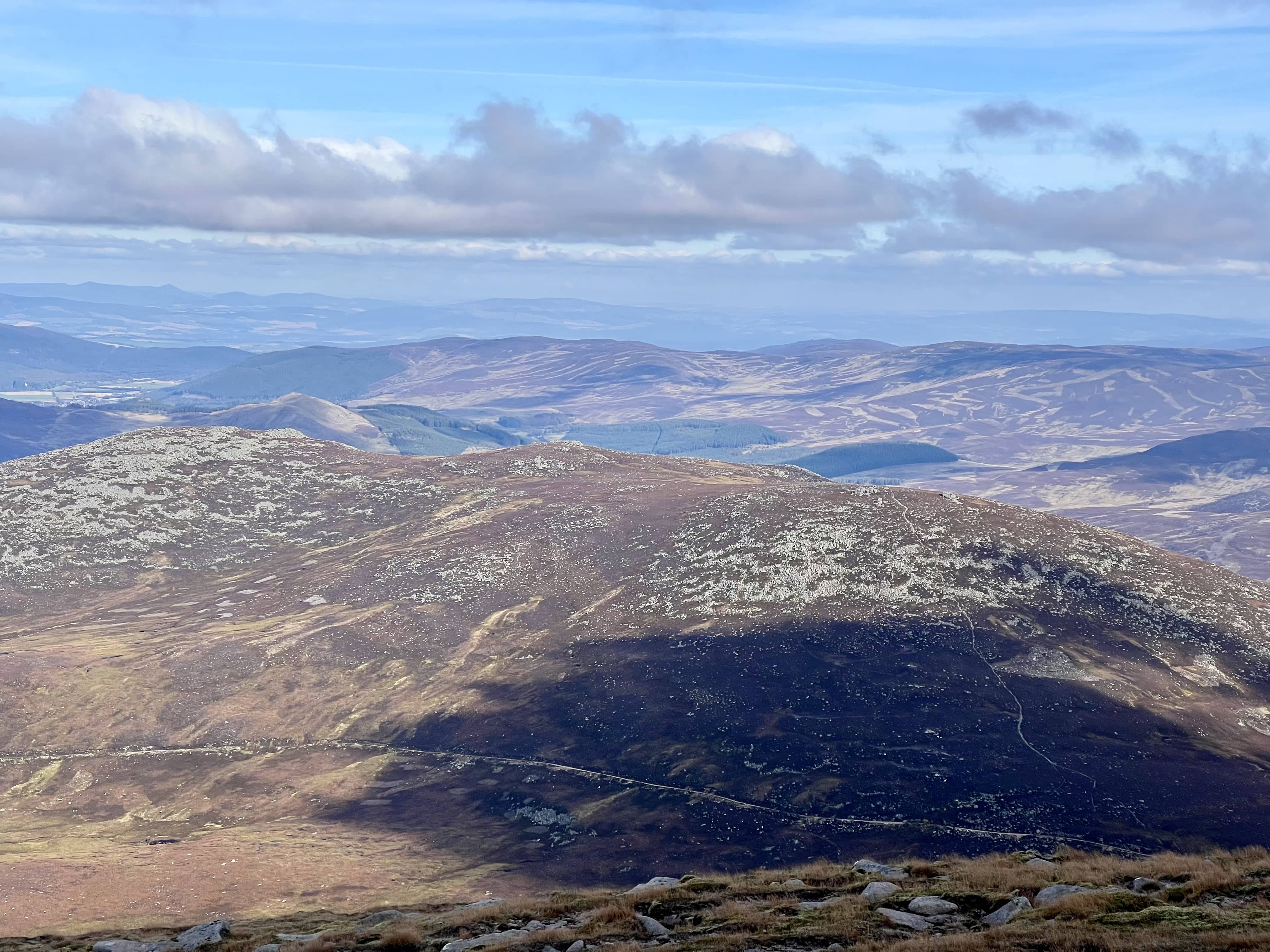
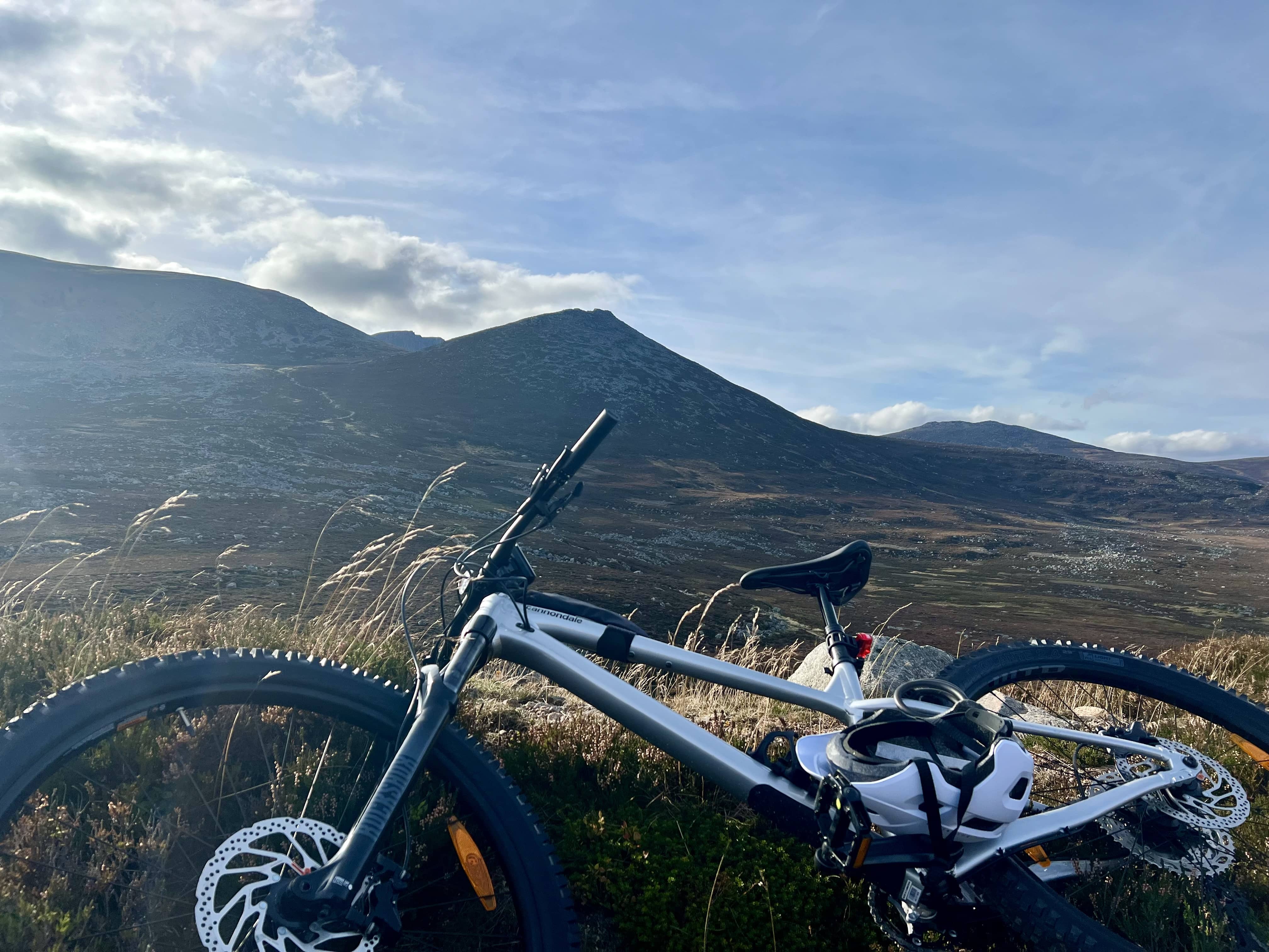
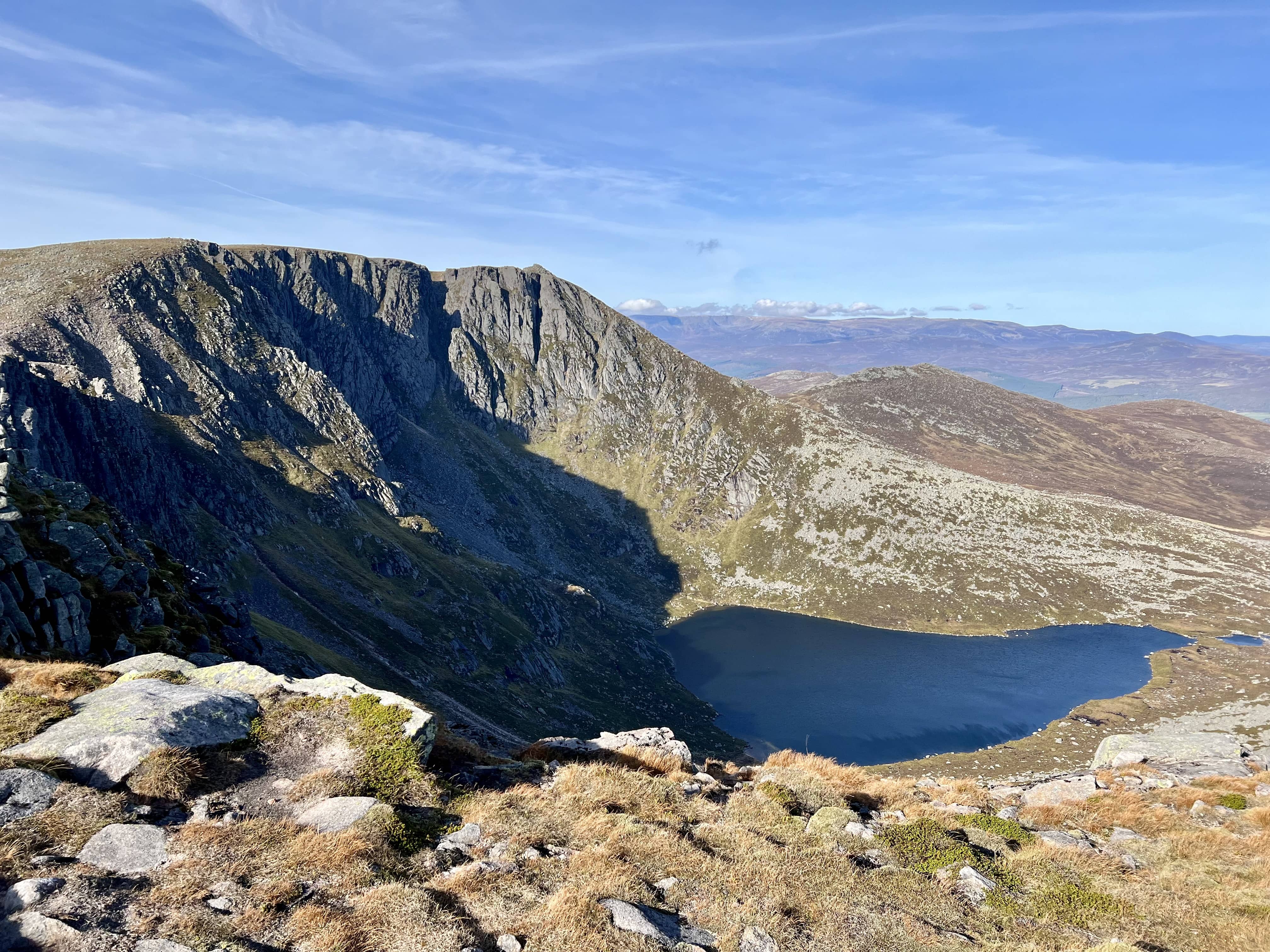
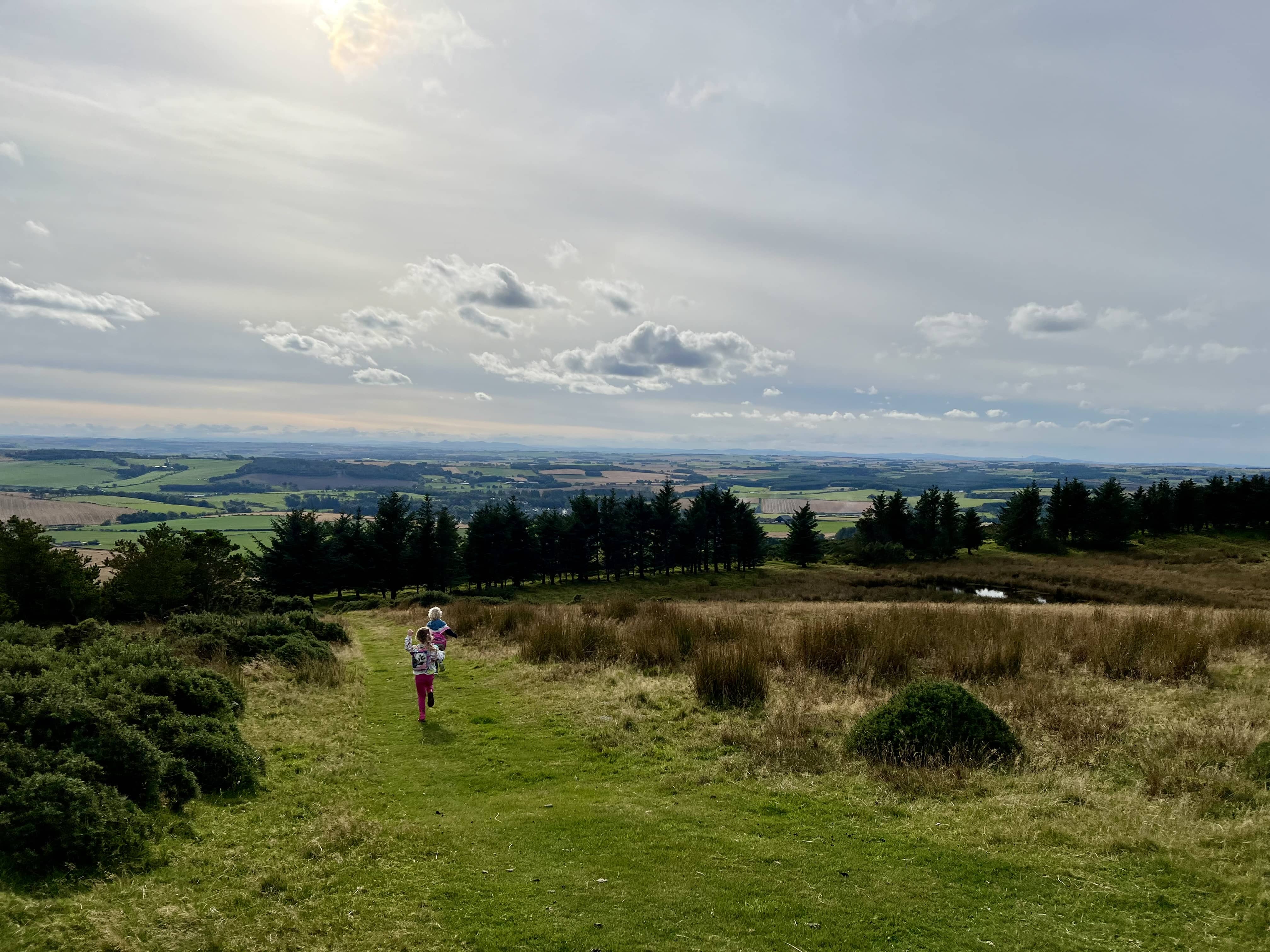
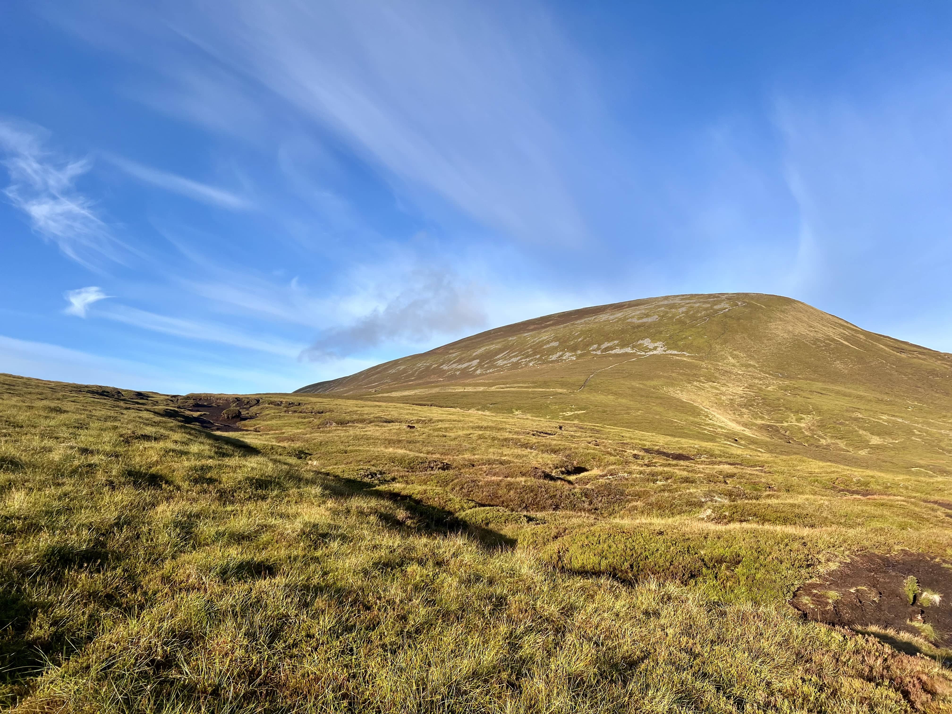
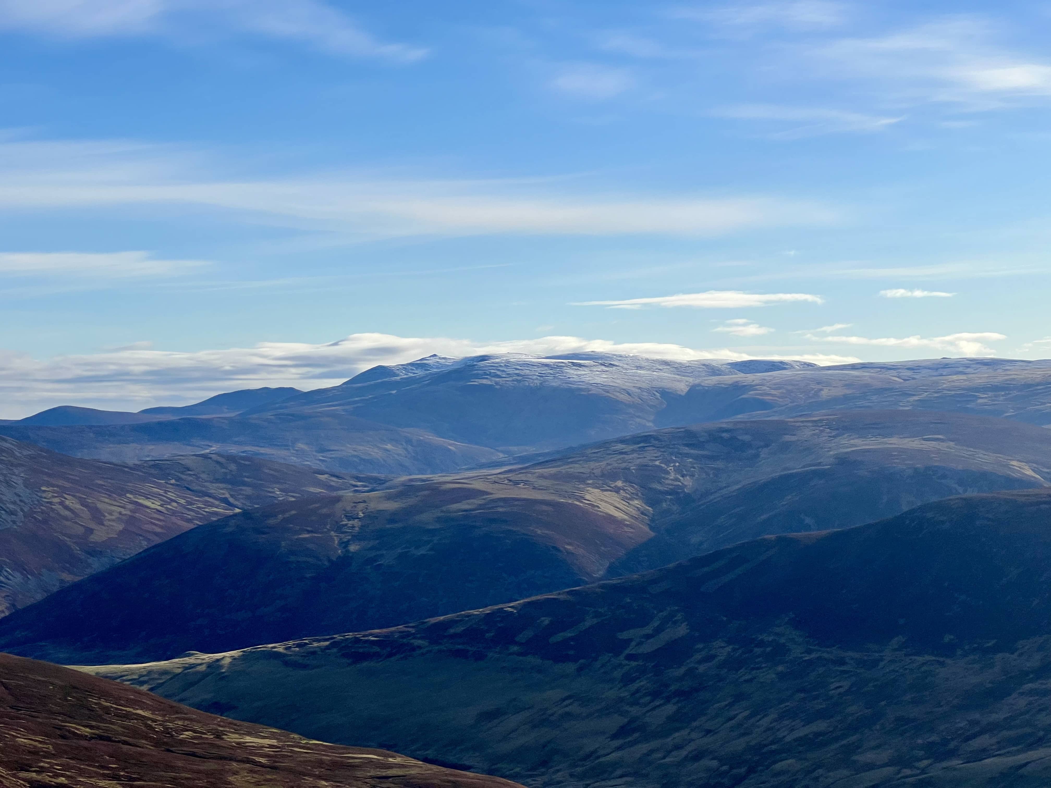
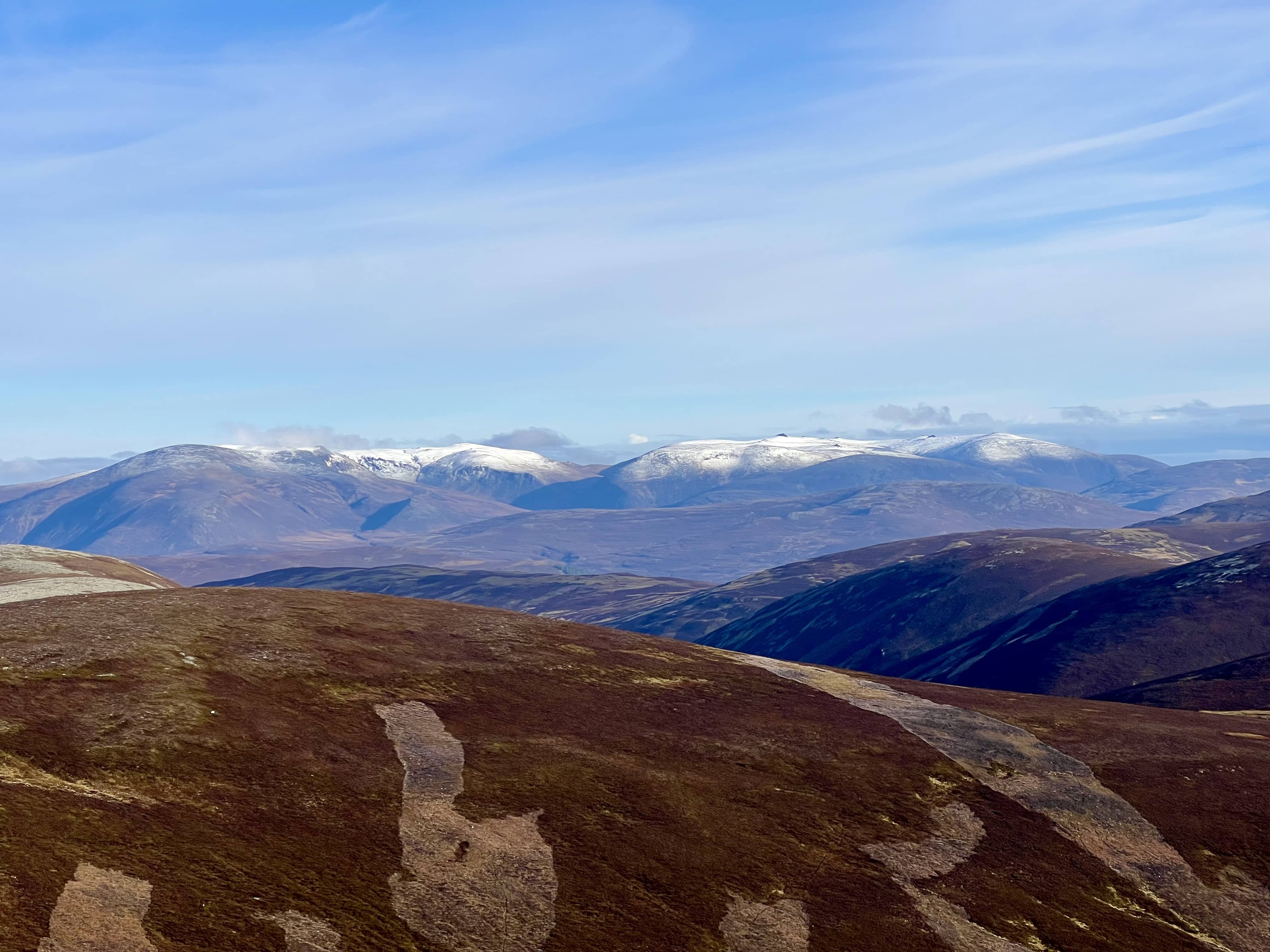
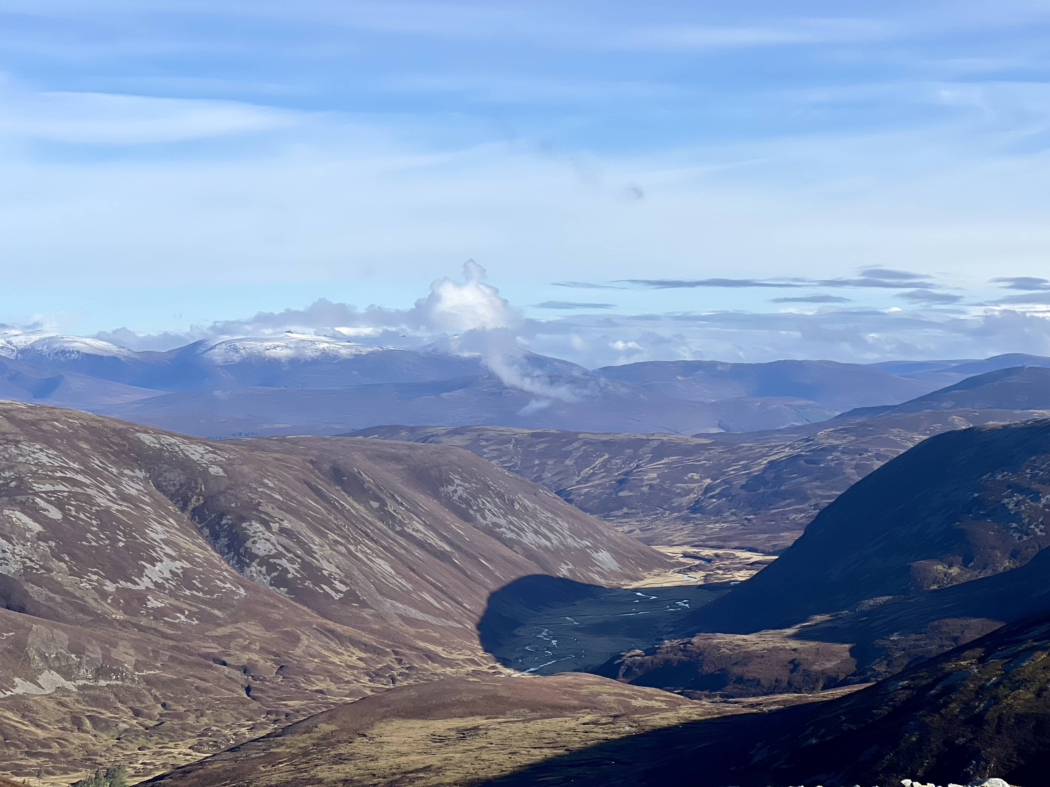
Keeping an eye on the time, I needed to pack up and head back. The wind was still relentless and on the top I had to lean into it. I was grateful of my big hood as I followed the path back down. It’s amazing how you can forget some of the details of the walk on the way back, being surprised that I had to climb up and down a few places which I didn’t remember on the way up to the summit! For a few moments the wind seemed to blow the clouds away and there was even a hint of sunshine coming through. The view opened up and I could see all around. Certainly not the spectacular views of last week, but enjoyable for the few moments. Back down to the car and back home.

Lift to the clouds

Lift to the clouds

I think this summit and Glas Maol would make a nice day trip out, one in the morning and one in the afternoon, with the option of a hot lunch at the ski centre cafe. For 6 and 8 pointers, they have fairly easy and short walks, and both great locations for 2m, particularly to the south. Doing both would be 14 points, and a lot less walking and climbing than my 14 point day yesterday on Lochnagar and Conachcraig!

Conachcraig

After the big hill, it was time to do the small one - Conachcraig. It certainly looked small from Lochnagar summit but it’s still a respectable 865m tall.

Looking down on Conachcraig from Lochnagar

Looking down on Conachcraig from Lochnagar

It felt like a short, straight up route on a nice track. I turned and looked back at Lochnagar and could see the cloud hovering over the summit, although not submerging it.

Clouds looming on Lochnagar

Clouds looming on Lochnagar

The rock formations on Conachcraig are interesting to look at, I haven’t really got a good photo of them so you’ll have to go there yourself. Unsurprisingly, no-one else was at this summit with me and I ducked down behind a rock to keep out the wind whilst I setup again on 2m.

Station location

Station location

Thanks again to Fraser, MM0EFI, and Chris, 2M0RVZ for their contacts on both summits, then with Simon, GM4JXP, and finally Richie, GM1LKD, in Aberdeen I was set. It was now 3:05pm, and I needed to be home by 5pm, and with an hour+ drive, it was time to pack up and head back to my bike.

Back on the bike, and bye bye Lochnagar!

Back on the bike, and bye bye Lochnagar!

The downhill bike ride back only took 20 minutes, and was a great way to end the trip. 28 km all in, and home in time!

Lochnagar - Cac Carn Beag

I’ve been eyeing Lochnagar GM/ES-008 for a while, and this Thursday’s forecast was looking reasonable, so decided to take the day off. It’s little neighbour, Conachcraig GM/ES-019, is asking to be activated at the same time. I was going to take the common route starting at Glenmuick, but Fraser, MM0EFI, suggested biking from Balmoral castle.

As I was trying to fit this into the family schedule, any time I could save would be an advantage. I used plotaroute to figure out the times for the biking and hiking sections, matching the speed I think I move at, plus the drive back and forth, it looked like the cycle route would be the quickest. 8:05 hrs for the cycle route vs. 8:40 for the walk from Glenmuick (times include driving). I considered cycling from Glenmuick but supposedly the path isn’t great beyond the forest, so not really worth it.

Was only a few degrees at the start in Crathie car park, but cycling generally uphill and in the sun I was soon roasting! It was around 1:15 cycle up to the intersection of Lochnagar and Conachcraig and I’d had enough of the bike! Much of the route is a gentle incline but there are areas where it’s steeper and much less enjoyable.

Summit in sight

Summit in sight

I met a nice German couple on the way up Lochnagar. They’d been in Scotland for nearly 3 weeks and had brillant weather all round. Climbed Ben Nevis, Ben Lomond and visited several cities and towns.

“Of course the weather is always like this”.

A german ham I know told me: “Nice German” is as redundant as “false error” or “undead zombie”. His choice of words. Enough chit-chat, I had a schedule to keep and kept going.

Boulders!

Boulders!

I’ve not been on a popular summit for a while and was surprised to see so many people on a random Thursday. I say so many people, it probably it was about 15, but compared to zero to two, it seemed a lot.

The forecast had said cloudy in the afternoon and I was due on the summit at 1300 local so I was hoping it would stay clear. I wasn’t disappointed.

Lochnagar

Lochnagar

Up to the summit

Up to the summit

I waited my turn in the queue to take photos at the summit, offering to take those of others. The wind was strong at this point and you wanted to be sure of your footing whilst scrambling about on the top. The views were incredible in all directions, and anyone on a summit in GM/ES would’ve had a great day.

At the top!

At the top!

Looking NW into the hills

Looking NW into the hills

I’d made it to the top ahead of schedule but I spent a long time admiring the views and walking around. The wind was strong so I looked for somewhere sheltered and away from the main path to setup, but ended up just sitting on the grass to one side. With my back to the wind it wasn’t too bad. I setup the slim G on the 6m mast and used my HT to call CQ. I was hoping to qualify the summit on 2m and in short order to keep on my way. I also noticed the clouds rolling in from the south. Got 5 in the log, mostly the locals plus Jace MM7VXJ who called when I was eating a biscuit. Credit to Jace for trying to relay messages to Jack, GM4COX, who was a 59 for me but think I was a 01 for him, and he wanted to move to sideband. I was surprised not to get anyone else further south.

Summit instructions from 1924

Summit instructions from 1924

Time to head back. I should’ve taken a photo of Conachcraig from the summit, as it looked tiny from atop Lochnagar! All around the cliff edges are openings that just drop away, and on a lovely sunny day they’re interesting to look at but if it were cloudy these are a literal death trap!

A straight down

A straight down

Back down, passed my bike, and then up to the next summit.

Conachcraig

Conachcraig

Waughton Hill

The 145 Alive! event was planned for today between 1-3pm, which I wanted to join in with. Should be the perfect time to activate a summit on 2m! I had the three little kids with me for the day, so it had to be a easy summit. Particularly as I wanted to bring up the tent and lunch and things for them, to keep them entertained whilst I was on the air. The previous times I’ve brought them, I’ve only been about 20 minutes at most and trying to go much longer would be tricky. Eventually I want to qualify all the GM/ES summits, and so Waughton hill is on my list. It’s quite out of the way with nothing else nearby, so it’s a trip in itself and for one point, I’m not wasting a day off on it! It’s also the lowest summit in GM/ES, and seemed perfect for our adventure.

White Horse

White Horse

The path up is short, although does cross a field full of cows, and you soon find yourself by the white horse. Walk by its head and you’re on the top of the rise, and heading towards the old hunter’s cottage. The actual summit is a bit further away, requiring you to go down and up the side of the hill again. However, the hunter’s cottage is in the activation zone and the kids thought we’d reached the top and started playing in the house. There was also a nice piece of grass without any sheep or animal droppings on it for the tent I’d brought. The tent and mast went up easily enough and lunch and various toys were unloaded into the tent. It was about 12:55 and I wanted to be on the air for the start of the event, so I swallowed down my rolls and setup the IC-705. Turns out the coax on the slim G with the 6m tactical mini mast is just a little too short for the radio to be on the ground. I usually don’t notice as either using the carbon 6, where the antenna sits a little lower on it, or a HT which I’m holding at standing height. So I ended up having to hold the 705 in my hand the whole time.

Station setup

Station setup

I’ve not long had the IC-705 and whilst it is very simple to use, sometimes I get into some modes or settings that I don’t know how to get out of. Today I was already on 2m FM but would the VFO change the frequency? No. First I was worried I’d bashed it in my bag and the dial was broken, then thought perhaps I’d selected 10 or 100 Hz increment but that didn’t seem to matter. I ended up just pressing stuff and then going to band and choosing 144 MHz again seemed to fix it. Phew!

QSOs

QSOs

It was nice having the waterfall to see is there was any activity and there certainly was some! I knew MM0EFI and MM0RFN were going up Ben Macdui and Glas Maol respectively, but not sure if they’d got to the summit in time. Fraser was supposed to be on 145.250, so I tuned to it and heard Bill, GM0NRT, talking to someone but couldn’t hear the other end. I was worried I couldn’t hear Fraser on Ben Macdui, but turned out was just someone else. Tuning around, I heard a guy down at the car park by Hill of Garvock and ended up qualifying the summit with those on his net. I managed to work four summit to summits, two on Ben Macdui, Glas Maol and then Morven. I heard a station down in East Lothian calling on 145.500 but he didn’t hear my reply. After about an hour, I had 10 QSOs and thought it was about time we packed up.

Off to Aden Country Park

Off to Aden Country Park

We headed back down, and went to Aden Country Park for some more fun. Turned out to be an old timey tractor fair and there were loads of them on the roads as we drove there.

Was a fun day all round, and nice to join in with this event. Maybe next time I’ll try for a higher summit!

The guys up Ben Macdui had a fun trip.. Not jealous in the slightest…😅 Also afterwards, Chris, 2M0RVZ, was boasting about his points compared to mine…challenge accepted!

An Socach

Fraser, MM0EFI, messaged asking who wanted to do a Munro midweek, and I thought it was a good opportunity to go. He also rallied Chris, 2M0RVZ, and Simon, GM4JXP. I decided to go up An Socach, whilst Fraser and Chris were going up Carn a’Gheoidh, and Simon on Glas Maol. A notice was posted on the reflector, and several others were keen to go up summits in Scotland and England. Later on we came to realise that the time posted on the reflector and Alerts was two hours late! Oops…no wonder no-one else turned up “at the right time”.

Car Park

Car Park

I got to the start around 7:45, and it was a chilly start, with -1.5 degC in Braemar as I drove through, however, the weather was stunning with clear blue skies and not a breath of wind.

I cycled along the estate track until the actual ascent starts - probably saves about 20-30 minutes walking each way, as I thought Fraser and Chris would have a quicker walk back on their summit. I need to buy an actual mountain bike as this and Mount Keen the other week have felt like I was going to shake the bike, and me, to pieces. The bike made a helpful support when crossing the ford before turning up the hill.

Bike ends here

Bike ends here

Quite boggy on the way up until the final steep ascent onto the long plateau.

Up to the plateau

Up to the plateau

The first cairn is only 6m below the actual summit but still around 2km away. At this point I called in with Fraser and Chris on the HT, and they were a similar 1.5km away from their summit.

Passing the residents

Passing the residents

Lots of good views and, as already said, lovely weather! I found a nice grassy patch near to the cairn to setup the yagi.

Yagi and IC-705

Yagi and IC-705

Some good QSOs on 2m FM and SSB, not quite what Fraser managed but his summit was higher and so he was in the way! 😅

Pink for FM and green for SSB

Pink for FM and green for SSB

After calling for a long time on sideband I was impatient on FM and kept jumping around when I saw activity on the waterfall, either following Fraser like an annoying puppy, or jumping onto the calling frequency when it was free. Probably should’ve just stayed still!

I made use of the flat plateau and large activation zone to start heading back but still ready with the HT for Alan, MM0VPM. SotaGoat app kept me in check and that saved a bit of time coming back. My worries of being slow down were unnecessary as I ended up being at the Bothy for a full round of cakes before the others arrived…and I couldn’t let them feel guilty for eating in front of me.

G4IPB reported hearing me on from Blencathra - in the lake district just north of Keswick - and after seeing his report I realised that I also heard him but we were in the middle of some other QSOs so I never followed up and changed frequency. I was only on the HT and RH770 but he’d give me 55 and he was clear to me, although the first QSO was a bit muffled and dogs barking made it unclear.

The views were spectacular all around, with snow on the high summits.

Largo Law

My wife and I had a trip away for the weekend, and I suggested a nice walk nearby…which of course was a SOTA summit! We were staying near St. Andrews, which is quite a flat area, however, there are a few granite lumps you can climb. Today’s one was Largo Law. If the weather was good, we’d have a lovely view of the Forth, Edinburgh and East Lothian. However, that wasn’t the case today…more like gray and cloudy.

Summit ahead!

Summit ahead!

The route is straight forward, as shown on Sotlas, park at the school/cemetery, up towards the farm and then straight up the hill! The track was tricky in places as the ground was dry and covered in loose soil, but we made it up fine.

Looking back down the path over the Firth of Forth

Looking back down the path over the Firth of Forth

I setup the slim g on the 6m carbon mast, put out a spot and called CQ. It took a few calls but stations did start coming back. Good coverage across Glasgow, Edinburgh and up to Montrose area. Had a nice chat with GM4PKJ, who lives very close to where we used to live around 10 years ago. His wife is a ham too, but I didn’t realise until I got home and looked him up on QRZ, otherwise I could’ve said hi to her too.

Horses in the field

Horses in the field

Got my four contacts and packed up. My wife was sat nearby and commented the radio conversation was so “old man”. It was mostly what’s the weather and setup but I probably do adopt some old man tendencies when talking…it’s as though you’ve got to fit in. I should just ignore that and say whatever I want. Although I do like describing the weather on a summit, as quite often it’s different from “ground” level.

Heard across the water

Heard across the water

I had my Lora tracker with me and looked up if I’d been tracked. Two stations across the water had followed me up and down the summit. One was a new one in the centre of Edinburgh owned by GM5AUG.

GM5AUG-6

GM5AUG-6

We headed back down and then back to the hotel, to enjoy the silence of no kids for the rest of the weekend!

Smile!

Smile!

Should I Submit A Log?

Lately, I’ve been getting questions about whether a ham needs to log radio contacts, whether they need to submit a log, and how to do it. Logging is a complex topic that can require a long and detailed explanation, but I am going to focus on the questions I’ve been hearing lately. I’ll also provide some links for further investigation. Continue reading Should I Submit A Log?

The post Should I Submit A Log? appeared first on The KØNR Radio Site.

💾

The Buck

Not wanting to waste a glorious day, I had time for a quick activation in the morning and The Buck was the recommendation.

Short ascent

Short ascent

The route is pretty easy, not quite a straight line as I’ve drawn but I parked slightly east on the road and walked up until I met this fence line. A quick march and you can be at the top in 30 minutes. The sub-500m area is pretty boggy and wet, even today when it hasn’t rained in a while. It was a little slow in places, trying to avoid plunging my feet into ankle deep water. The path is also vague at this stage but then becomes more defined within about 1km of the summit.

View to the top

View to the top

Squelchy

Squelchy

The weather was amazing, brilliant sunshine, blue skies and not a breath of wind. I was roasting on the way up!

Trig point on top of the rocky summit

Trig point on top of the rocky summit

Even at the top the wind was minimal, and I’ve never seen my carbon-6 stand so straight at a summit before! I made use of the nice clear hole in the trig point and put the mast in it with the slim g on top. I could see for miles and miles!

Setup for 2m

Setup for 2m

I was hoping it would be a quick activation on 2m, as I needed to get back home by lunchtime, and this summit would cover a huge area. Back from his hols in Barbados, MM0EFI was first in the log. After 5 minutes, Bill in Aberdeen, GM0NRT, called back, and whilst we were talking I heard another station call. This time it was GM0UDL up in Fortrose, just north of Inverness who had seen my Lora tracker being picked up by GM4SJB (even further north!). He told me about his lora setup and how everyone around that area has setup iGates and DMR repeaters. Sounds like a great setup they have. Not long afterwards my fourth 2m contact, needed to qualify the summit, came from GM8ZKU across to the east by the coast. Again, another nice QSO with Simon for the first time. Time was getting on and I did need to be back home, I tried on more CQ but then called it a day.

I

Looking North

Looking North

had a quick look around for the ancient engravings but couldn’t find them. It was a quick walk back down the hill to the car. I’d forgotten about the sogginess but managed to escape with dry feet.

When I got home I looked up the Lora tracking on EA2RCF’s mapping page, and was surprised to see just how far away GM4SJB’s receiving igate was! It had also tracked me nearly the whole route up and down, which I then realised was me walking the county boundaries. The power on the tracker is tiny and the antenna isn’t amazing but this time it all worked well. I’ve been carrying it with me on most summits but there haven’t been any igates nearby that have picked me up.

Lora 70cm distance

Lora 70cm distance

Tracking my route

Tracking my route

Speedy!

Speedy!

A nice quick 4-pointer summit - I’m beginning to think Morven is a brutal 4-pointer! - although not for a wet day, or post a lot of rain. The summit is quite exposed, although maybe you could find some shelter depending on the wind direction. It’s a popular summit to do with Tap O’Noth, as that’s just a few miles away, however, I just didn’t have time on this occasion. Maybe they’ll be a good combo next year during the winter bonus period.

What the Buck

What the Buck

Should I Submit A Log?

Lately, I’ve been getting questions about whether a ham needs to log radio contacts, whether they need to submit a log, and how to do it. Logging is a complex topic that can require a long and detailed explanation, but I am going to focus on the questions I’ve been hearing lately. I’ll also provide some links for further investigation. Continue reading Should I Submit A Log?

The post Should I Submit A Log? appeared first on The KØNR Radio Site.

💾

Should I Submit A Log?

Recently, I’ve been getting questions about whether a ham needs to log radio contacts, whether they need to submit a log, and how to do it. Logging is a complex topic that can require a long and detailed explanation, but I am going to focus on the questions I’ve been hearing lately. I’ll also provide some links for further investigation. For starters, the ARRL has a good introduction to logging.

A paper ham radio log

Why Keep A Log?

The FCC does not require you to log your amateur radio contacts. Many radio amateurs, especially if they just operate casually on 2m and 70 cm, don’t bother to keep a log. Probably the most common reason for having a log is to have a record of your radio contacts, in terms of stations worked, on what band and what conditions. This might be just for your own personal satisfaction or you might want to keep track of these contacts so you can get credit for an award, such as the ARRL Worked All States (WAS) award.

Paper or Electronic?

The Old School way of keeping a log is on paper as shown in the figure above. This approach is simple and reliable technology but is quite limited in the information age. These days, most hams that record log information store it electronically. Imagine that you log thousands of contacts over time and then want to find a particular callsign or location. Much better to do this electronically. There are many good software programs available, too many to list here. I currently use Amateur Contact Log from N3FPJ. The good news is that there is a standard file format for storing and moving ham radio contact information: Amateur Data Interchange Format (ADIF). If you want to change logging software, you export an ADIF file and import into the new program.

I Worked a Contest Station, Do I Have to Submit a Log?

Sometimes radio ham works a few stations that are active in a particular contest and they wonder if they must submit a log to the contest sponsors so that these these stations get credit for the contacts. The almost universal answer to this is: No. Don’t worry about submitting a contest log if you aren’t really “in the contest.” The stations you work still get credit for your contact with them. (This is true for all major contests…I am still looking for a contest where this is not true.) Contests are designed to encourage activity, so they want everyone to join in, even if they aren’t all that serious about contesting. (The contest sponsors will appreciate any and all logs submitted, so consider that.)

If I Am Actively Working a Contest, What Do I Do?

If you are actively participating in a contest, you should use a logging program that is tuned for that particular contest. This is important because the contest logging software knows about the scoring for the contest and lets you know if you have already worked a station you hear. The most popular logging software for contesting is the N1MM Plus software. There are other programs you can consider. Typically, you would use N1MM during the contest and then export the info into an ADIF file, which is imported into your “main” logging program.

What is a Cabrillo File?

While the ADIF file format is most universal in ham radio logging, there is another file format used for contesting. This is the Cabrillo file format. Your contest logging software can generate a Cabrillo file for submitting to the contest sponsor. You may also want to generate an ADIF file to import into your normal logging program.

I Worked a POTA Station, Do I Have to Submit a Log?

Parks On The Air (POTA) is set up so that only the activator station submits a log. If you are working an activator station, you are a hunter station. The POTA scores are all based on the activator logs and hunters cannot submit a log. What you can do is register on the POTA website to see the contacts that the activators have submitted for you.

I Worked a SOTA Station, Do I Have to Submit a Log?

Summits On The Air (SOTA) is set up so that both activators and chasers submit logs to the SOTA website. However, the SOTA system operates on the honor system, so an activator can claim a contact with you without you submitting a log. So if you hear a SOTA station, go ahead and work them. You don’t have to submit a log. On the other hand, if you want credit for chasing a summit, you need to submit a log. So that activator is fine not having you submit a log but you may want to do that to get credit for you.

How Do I Get Credit For Working A Country?

The gold standard for chasing countries, I mean entities, is DX Century Club (DXCC). If you are interested in DX, you should register with Logbook of The World (LoTW) with the ARRL. To get credit for working an entity (country), you need to submit your log and it must match the log submitted by the DX station. This is a higher level of confirmation because both parties must submit the log info and it must match within reasonable error limits.

There are other award systems for working countries, offered by QRZ, eQSL, etc.

How Do I Get Credit For Working a Grid on VHF/UHF?

The VHF UHF Century Club (VUCC) is the VHF/UHF equivalent to DXCC. Here the emphasis is on working maidenhead grid locators on the bands above 50 MHz. Again, Logbook of The World is the database that authenticates confirmed contacts on these bands. Both parties must submit the log info and it must match within reasonable error limits.

What If Someone Needs My Log Submitted?

Most of the time, us normal hams are not considered DX. That is, that other station in the Cayman Islands doesn’t really need our contact confirmed. But there are exceptions. You might be in a state the other station needs confirmed. Or maybe it’s your county they need. In such a case, you might want to make a special effort to provide your log information to the right database. It will depend on what the other station needs…if they are going for an ARRL award, then Logbook of The World is the right place to upload your log. But they might be after a QRZ award or eQSL award, in which case you would need to provide your log to those websites.

Wrap Up

These are some of the questions I’ve been hearing.
What did I miss?
Anything else to add?

73 Bob K0NR

The post Should I Submit A Log? appeared first on The KØNR Radio Site.

Mount Keen

Start of the ascent

Start of the ascent

Another day off and the forecast was promising blue skies and sunshine. I’d spent the evenings this week trawling sotlas trying to figure out where to go. It was our youngest’s P1 stay and play this morning, plus swim training after school, so I had to fit my trip into that window. I’ve been finding I go faster than OS Maps walking prediction but yet to keep detailed enough records to figure out my speed, so planning a new location is always hit or miss (along with the alerts I post!) To complicate matters more, I was planning on cycling the first part of the route before walking. I settled on Mount Keen and left after a fun session with the P1s.

OS Map of the route

OS Map of the route

I was also going to go the Glen Esk route, from the south, vs. the Glen Tanar one from the north. I thought it was a closer drive to home, but it was actually further, however, I think the walk is shorter this way. The road into Glen Esk seems to go on and on and on! Plus no end of dumb pheasants to watch out for on the road. I’ve actually done this hill before, maybe 12/13 years ago and on that trip we ended up walking through a blizzard! I can’t remember if we even made it to the top or decided to head back down, to then find the stream crossing to be more challenging than the way up!

Stream crossing

Stream crossing

I cycled from the car park, just before the Lochlee Parish Church, along the north side of the river. My bike is a “hybrid” which is more road bike than mountain bike but has thickish tyres. I think this was probably the limit for it, as it was quite rocky and the ride was very rattly! I made it, and it cut off a good chunk of time but wasn’t always pleasant. I set off at 10:45 from the car park, and cycled for 30 minutes to just before the stream crossing in the picture above. The terrain is fairly flat with only a small incline the whole way. You also pass the Queen’s Well, which is nice to look at if you’ve never seen it before.

Looking back and Queen’s Well

Looking back and Queen’s Well

The path is very clear and well made the whole way, some places its been eroded by water, or repaired with big chunks of rock. The roadway keeps going and you have to make sure you turn off towards Mount Keen.

A good view back down the Glen on the way up

A good view back down the Glen on the way up

Final path to the summit (beyond the ridge)

Final path to the summit (beyond the ridge)

After an hour I’d reached the top and had my HT out as MM0VPM was on Sgor Gaoith and I was hoping for a summit to summit. Seems the weather wasn’t as good with him inland, and the snow I could see in the distance was probably where he was! I heard GM4CCN calling CQ and tried to answer but the Aberdeen folk thought I was calling CQ and called me back. Made a couple of contacts on the telescopic RH770 with the new FT-65 before setting up the slim G off to the side.

Made it!

Made it!

There were quite a few folks on the summit so I was over to the west side. Not sure if that was the best as I was in the shadow of the cairn and perhaps they might’ve been blocking my signal. I heard GM4CCN a few more times and we tried to have a QSO. I found holding the PTT on the FT65 difficult when my hands were getting cold, that I don’t think I was actually transmitting and so we never made the QSO. Bill, GM0NRT, kept saying I dropped out but I think it was not holding the PTT. I was probably holding it wrong, in my right hand and using my finger on the PTT, vs. my left and using my thumb. Or I should’ve put on a glove.

Lochnagar

Lochnagar

I tried the slim G for a bit, had a couple more but not as many as I thought I’d get on this summit. I switched to HF with the 5.5m vertical and tried 20m. A good reply on 20m with 16 in the log. I did try 10m for a bit. I heard a VK station absolutely booming in, who was talking to a MW0 station in Wales, but only one reply to my CQ. By this time I was getting cold and I’d been on the summit an hour, and should probably be getting back.

Towards Aberdeen

Towards Aberdeen

As I was packing up a lady, who I’d passed on my bike, asked me to take a photo of her. She also asked if I was a Russian spy. I said a good spy wouldn’t reveal if they were one - but also that could be double bluffing. We ended up walking back down together until I got to my bike. She was trying to complete all the Munros, and had about 20-odd left. I thought about making my excuses and running ahead but it was nice having a little chat and she wasn’t really any slower than me.

The bike ride back was easier as slightly downhill, so only took 20 minutes, and I was back at the car in no time, and home with 30 minutes to spare! Although only 12% battery in the car. The journey out had used 51% of the battery, which was slightly worrying but I suspect it was the colder morning, and now it was 15 C.

SOTA Signal Reports Using 2m FM

Everyone wants to know how their signal sounds on the air and often the best way to find out is a signal report from other ham radio operators. The standard signal reporting method for amateur radio is the RST (Readability-Signal Strength-Tone) system. See Practical Signal Reports on HamRadioSchool.com. When using 2m FM on Summits On The Air (SOTA), we can Continue reading SOTA Signal Reports Using 2m FM

The post SOTA Signal Reports Using 2m FM appeared first on The KØNR Radio Site.

💾

SOTA Signal Reports Using 2m FM

Everyone wants to know how their signal sounds on the air and often the best way to find out is a signal report from other ham radio operators. The standard signal reporting method for amateur radio is the RST (Readability-Signal Strength-Tone) system. See Practical Signal Reports on HamRadioSchool.com.

When using 2m FM on Summits On The Air (SOTA), we can simplify the signal report. Because it is a voice mode, we drop the reading for Tone and just give RS reports, so a perfect signal on voice is RS 59 or simply “five nine.”  The Readability report is a number between 1 and 5, while the Signal Strength report goes from 1 to 9. (See the listing at the bottom of this article.) The signal strength generally corresponds to the S meter reading on your radio but most FM rigs have very basic meters. Some don’t provide a meter reading at all. The photo to the left shows a typical bar graph on a Yaesu FT-60. Don’t expect high accuracy, so if the meter reads full scale, give an S9 report. If it reads half-scale, that’s probably S5, etc.

On VHF FM, signal reports may also be given in terms of FM quieting. A strong FM signal is said to “quiet the receiver” since there is virtually no noise present in the received audio. As the signal strength is decreased, noise starts to appear on the received signal. At lower signals levels, the noise increases dramatically and the signal becomes unreadable. This dramatic increase is called the threshold effect, meaning that FM signals do not gradually fade out, they tend to fade quickly into the noise. The key idea here is that you want your signal to be strong enough to be above this noise threshold. In terms of a signal report, a strong signal may result in a “full quieting” report. If the signal is less than full quieting, you may hear a report like “90 percent quieting” or “you have about 10% noise”, which both describe the amount of noise present in the signal. If the signal is really noisy, the report might be “50% quieting.”

Keep It Simple

For practical 2m FM operating, don’t overthink these signal reports. If the signal is easy to hear and is full-scale, give a 59 report. If it is easy to hear but the meter reading is less than full scale, reduce the signal level report to something like 56 or 57. If there is some noise present, you might want to reduce the readability to 4, so maybe give a 44 or 45 report. (Usually, if there is a readability issue, the signal strength will also be lower.) If you are having a difficult time hearing the signal, it’s probably a 33 or less. Readability of 1 or 2 is rarely used because it indicates you are not actually hearing the other station.

One final note is that sometimes the operator on the other end is looking for a more critical evaluation of his signal quality. If he says something about “checking out this new microphone” or “have been working on solving an audio problem”, that may be the clue to spend a little extra time really listening to the signal and providing more comments on how it sounds. For most of us, we don’t actually get to hear our own signal on the air, so it’s very helpful to get quality feedback from other radio amateurs.

73 Bob KØNR

The RST system as listed on the ARRL web site, Quick Reference Operating Aids:

Readability
1 – Unreadable
2 – Barely readable, occasional words distinguishable.
3 – Readable with considerable difficulty.
4 – Readable with practically no difficulty.
5 – Perfectly readable.

Signal Strength
1- Faint signals, barely perceptible.
2- Very weak signals.
3- Weak signals.
4- Fair signals.
5- Fairly good signals.
6- Good signals.
7- Moderately strong signals.
8- Strong signals.
9- Extremely strong signals.

The post SOTA Signal Reports Using 2m FM appeared first on The KØNR Radio Site.

Carn Ealasaid

Sunday and a busy day for the kids planned, however, it did mean my eldest and I were free all morning. She’d enjoyed our last SOTA activation and this time I wanted to try somewhere further afield, and do more than a one-pointer! Especially after my mid-week three summits trip.

Admiring the view from the ski centre

Admiring the view from the ski centre

We drove to the Lecht ski centre through thick fog and mist (haar) for about an hour. I’d looked at the forecast and it was meant to be partially sunny, but I was wondering if it had changed but I’d not seen it. However, with about 20 minutes to go, it suddenly cleared up and when we reached the car park it was a lovely day. This significantly helped the trip as I’m not sure my hiking partner would’ve been too pleased other wise! She immediately commented that the first path looked steep. She wasn’t wrong, it was the steepest part of the journey, although later on, on the way back, it was taxing again.

The route

The route

You walk around the lifts and towards another summit before descending and then ascending again to the final summit. Alone, and determined, I reckon I could do it in 45 minutes, but today it took us 1:15, with a couple of stops to sit down for a bit.

View of summit from Beinn A’Chruinnich by the ski lifts

View of summit from Beinn A’Chruinnich by the ski lifts

Admiring the bogs we crossed

Admiring the bogs we crossed

The peat bogs weren’t too bad and quite dry, but I can imagine after some rainfall they’d be very squelchy.

At the top!

At the top!

We made it up the last slope, watching every meter on SOTAGoat app! I emptied out the snacks and set to work getting on 2m.

Slim G on Carbon-6 mast

Slim G on Carbon-6 mast

Annoyingly my Kenwood D72 wouldn’t turn on. It had died on Foudland during the week and I assumed it was just flat. I’d charged it and the charging light had turned green so I assumed all was good. Well no, it wasn’t. I tried fiddling with the battery clip to get it out but couldn’t work the mechanism and soon gave up on it. I had an old TH-79 with me which did turn on (although the LCD screen doesn’t show all the segments and is difficult to read). I have tested the TH-79 at home and it transmitted, but no-one could hear me and I wasn’t sure if it was really working.

I didn’t want to spend too long faffing about as the summit is very exposed, and whilst it was a nice day, my daughter would soon get cold just sitting around. So I switched to HF. I debated between the 5.5m random wire vertical or the 40m EFHW. I wanted to go on 40m and the random wire isn’t necessarily great for 40m. However, I should’ve just gone with the vertical. As I was rushing, it meant it took me ages to get setup as things kept going wrong. Eventually I was sorted, but then the challenge of finding a free frequency. Seemed to be a contest going on, bunkers on the air and all sorts, but I did manage. Got 5 on 40m, including two locals from the SOTA Whatsapp group and that meant success! I thought I’d quickly try 20m. I heard one faint German station but when I looked up the cloud had come right in and we were sat in it. I knew it was time to go, and so we quickly packed up and started heading down. A summit in the cloud is disorientating and cold.

From fun to fog in five seconds

From fun to fog in five seconds

We headed back down, and wanted to cut off part of the path up to the first summit, and follow the contours around. We were sort of successful but did get caught up in the bog and ended up walking a bit further downhill than we should’ve. Again, the cloud level didn’t help. It was a big of a struggle to get back on to the path at the top of the ski runs but we made it, and then it was an easy downhill from there.

Quite the change when we got to the bottom, the nice view at the start of this post was replaced by white cloud!

What wind turbine?

What wind turbine?

I’m glad we arrived when we did, else it would’ve been quite miserable and the only excitement of the radio activation wouldn’t have been shared by all!

We stopped at the Spar in Bellabeg for some diet coke and a jam swiss roll, which we ate nearly half each before driving home.

There are a few more 4 pointers in the area, and hopefully I can get back to do some of those. Most have been activated less than 10 times, which suggests they’re maybe not that exciting or easy to get to. Brown Cow Hill, Geallaig, and Mona Gowan don’t seem too bad, so perhaps I should try those first.

When I got home I checked the D72. It wouldn’t turn on, but when I plugged in an external power supply it turned on and then worked fine on battery. I don’t like the reliability of this, and being caught out on a summit again. I might get a new battery pack but I also might look for another HT. Perhaps a Yeasu FT-65 etc. that has great battery life is just a simple HT.

❌