We returned from our week in Malta yesterday to the cold, rain and green countryside. Everyone we met was kind and helpful. It was hot and sunny almost all the time we were there. The hotel and food were excellent.
However, Malta is very built up (the most dense in Europe) and what little countryside there was was rocky and barren.
If you go on holiday for sun, swimming pools and food it might suit you. Overall, I am glad we went, but I doubt we will return.
Often I forget to submit my entry into this UKAC session. With my pathetic score I shall never even be close to winning, but it is good to show my support.
It is great to see the activity. The "real" stations were working some serious DX.
A significant risk for heavy rainfall (6-10” of rain) is forecast for Wednesday through Thursday night across southern and coastal counties including McComb, Poplarville, and Gulfport. This area faces likely flash flooding, numerous roads may be flooded, closed or washed out. Flooding of structures increasing likely and minor to moderate river flooding is likely.
An elevated risk for heavy rainfall (4-6″ of rain) is forecast for Wednesday through Thursday night across much of central and southern Mississippi, including areas around Jackson, Vicksburg, Natchez, Brookhaven, Hattiesburg, and Laurel. This area faces likely flash flooding, possible road closures, and potential minor river flooding.
A limited threat (2-4″ of rain) extends across the remainder of the state, including Tupelo, Laurel, Yazoo City, Greenville, Greenwood, Eupora, Columbus, Kosciusko, Clarksdale, Tunica, Southaven, Oxford, Corinth, Philadelphia, and Meridian with localized flash flooding possible, particularly in low-lying and urban areas.
An elevated wind threat from Tropical Storm Francine is expected Wednesday afternoon through Thursday afternoon in the southwestern corner and coastal areas of Mississippi, including Natchez, McComb, Brookhaven, Poplarville and Gulfport. This elevated threat includes wind gusts of 45-55 mph, with potential for widespread downed trees and powerlines, some damage to roofs and homes, many blocked roads, and power outages possibly lasting several days. The rest of the state, including Jackson, Greenville, Tupelo, and the Gulf Coast, faces a limited wind threat with gusts of 30-45 mph, some downed trees and powerlines, some blocked roads, and possible power outages for 1-2 days.
A slight risk for severe storms is forecast for Wednesday afternoon and night across coastal Mississippi, including Hattiesburg, Gulfport, and Poplarville. Isolated severe storms with damaging wind gusts and a few tornadoes are possible. A marginal risk extends across eastern portion of the state, including Tupelo, Columbus, Philadelphia, Meridian, Magee, Laurel, and McComb, with the possibility of isolated severe storms, a few tornadoes, and damaging wind gusts. The timing for severe weather is mainly late Wednesday afternoon after 5pm into early Thursday morning.
4-7″ of rain is expected across much of central and southern Mississippi, with locally higher amounts possible. This covers a larger area than just southern Mississippi.
2-4″ of rain is forecast for northern Mississippi and the southeastern corner of the state, also with locally higher amounts possible. FLASH FLOODING POTENTIAL (MS): https://www.wpc.ncep.noaa.gov/
Flash flooding is likely in the elevated threat area. This includes the possibility of some roads being flooded/closed and some structures possibly threatened with inundation.
In the limited threat area localized flash flooding is possible, particularly in low-lying and urban areas. Minor river flooding is possible in both threat areas.
I appeared on ABC radio last night discussing the tech news with Philip Clark. "Google's new "pixel 9" phones were revealed last month, and this morning, Apple hit back with new products, including a new iPhone. Tech Guru Peter Marks, software developer and technology commentator from Access Informatics with Philip Clark on Nightlife and the latest news and issues in technology." You can listen
Since returning home again from Malta this afternoon, I have been on 10m QRP WSPR with my little beacon. Already spotted by 5 stations with the furthermost the German research station in Antarctica.
RaDAR is Rapid Deployment Amateur Radio. The next RaDAR Rally is Nov 2nd, 2024. We cover how you can participate in our Beginner's Academy Zoom Meeting recorded on Nov 9th, 2024. Visit www.radarrally.info and join the RaDAR group on groups.io for more info.
ARRL Director of Emergency Management Josh Johnston, KE5MHV, just participated in a call with the National Weather Service Shreveport, Louisiana Field Office. "Our partners at NWS are closely monitoring the situation and preparing Louisiana for multiple possibilities, that each could change as the situation unfolds," he said.
It’s hard to keep up with all the new amateur radio gear you’ll find at DX Engineering! The latest products from leading manufacturers are being added weekly to the 30,000-plus ham radio items—from more than 175 top amateur radio providers—available at DXEngineering.com.
OnAllBands is dedicated to making sure you’re not missing out on that station addition that will improve your contesting scores, help you work more DX, upgrade your emergency preparedness, and enhance your 0verall enjoyment of the world’s greatest hobby.
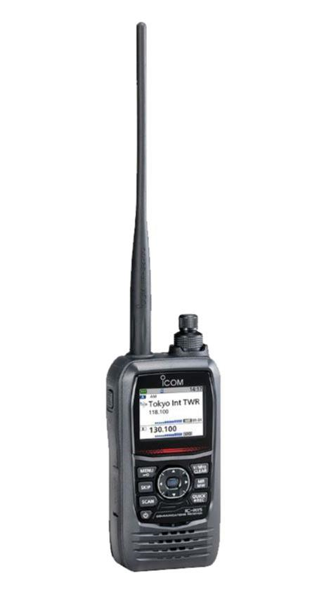
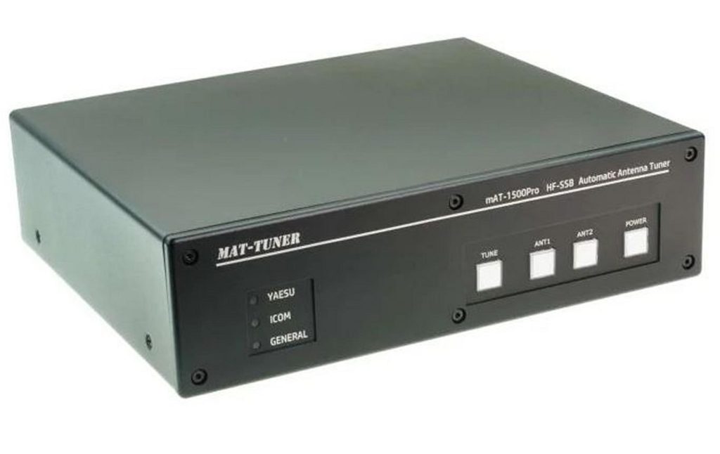
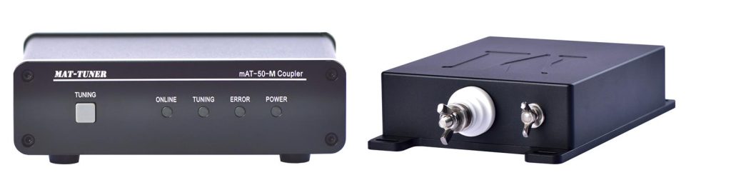
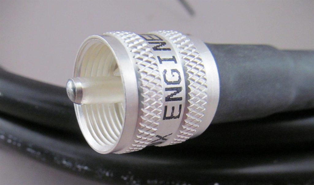
DX Engineering has you covered with a bunch of new products you’ll want to add to your amateur radio must-have list, from premade coax assemblies to a new Icom handheld receiver. DX Engineering’s Michael Murphy, KI8R, highlights a few of the latest offerings in the video below.
Like what you see? Click on the links below for all the details.
As an analog, HDR, discrete component, radical homebrew fundamentalist, obviously I have been concerned about all the hype about SDR. SDR advocates often make it sound as if those of us who build with discrete analog components (crystal filters!) are hopless troglodytes, about to be thrown on the ash heap of radio history. Or something like that. They sort of imply that without the cleansing benefits of SDR, our signals will remain hoplessly dirty.
I find it interesting that Sherwood concluded that the cleanest transmitter he ever owned was a Collins 32S-3! He compared the two tone output of this old rig to that of a modern transceiver. This was in 2019. See above. HDR wins.
Don't get me wrong. I want to clean up the signals from my HDR rigs. But I am encouraged by Sherwood's remarks. I do not think I will have to go SDR in order to have a clean signal. I may just do some two-tone tests on the rigs, make some adjustments, and maybe build a class A Thermatron .1 kW linear.


 Kolkata: The organisation of ham radio operators in Bengal has written to the principal secretary...


 [Marius Taciuc’s] latest endeavor, the B4 Thinker, offers a captivating glimpse into microcontroller architecture through...